TopoQuest Logo
Do you find TopoQuest useful?
Help keep TopoQuest running and adding new maps/features by donating!
Bitcoin:  19c7KJd3qBynnjoSw5npx9KScwjBe4ifkT
Litecoin:  LXs6TkuXGGXo1vDsWCkWVdjQX94eUKd6ui
Home View Maps Find Maps Find Places Resources & Links


Newtonia, Missouri Topographic Map

USGS Map Title: Newtonia, MO
USGS Map MRC: 36094H2
DRG (GeoTIFF) Download: o36094h2.tif


Neighboring USGS Topographic Map Quads:


  Fidelity, MO  
37094A3
 

  Reeds, MO  
37094A2
 

  Sarcoxie, MO  
37094A1
 

  Granby, MO  
36094H3
 

  Newtonia, MO  
36094H2
 

  Pierce City, MO  
36094H1
 

  Neosho East, MO  
36094G3
 

  Stella, MO  
36094G2
 

  Wheaton, MO  
36094G1


Map MRC Location:

N37°
W95°
N37°
W94°
H8 H7 H6 H5 H4 H3 H2 H1
G8 G7 G6 G5 G4 G3 G2 G1
F8 F7 F6 F5 F4 F3 F2 F1
E8 E7 E6 E5 E4 E3 E2 E1
D8 D7 D6 D5 D4 D3 D2 D1
C8 C7 C6 C5 C4 C3 C2 C1
B8 B7 B6 B5 B4 B3 B2 B1
A8 A7 A6 A5 A4 A3 A2 A1
N36°
W95°
N36°
W94°

Newtonia, MO USGS 1:24K Topographic Map Preview:
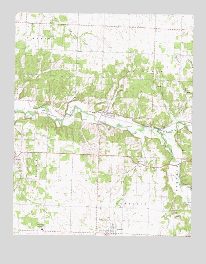
Newtonia, MO USGS Topographic Map
Click on map above to begin viewing in our Map Viewer.

This topographic map contains these locations and features:
Feature Name Type Latitude Longitude GNIS ID View Map
Cedar Bluff School (historical)SchoolN36.8901°W94.1278°2709599View Map
Civil War CemeteryCemeteryN36.8839°W94.1869°715860View Map
Clear CreekStreamN36.9353°W94.1494°715931View Map
Douthit BranchStreamN36.9376°W94.1294°717017View Map
East Newton High SchoolSchoolN36.8784°W94.2299°717327View Map
East Union School (historical)SchoolN36.9925°W94.1795°746339View Map
Green Valley School (historical)SchoolN36.9403°W94.1258°2709600View Map
Mound ChapelChurchN36.8884°W94.1377°722691View Map
Mountain Grove ChurchChurchN36.9167°W94.1638°722990View Map
NewtoniaPopulated PlaceN36.8767°W94.1855°723346View Map
Newtonia BranchStreamN36.9345°W94.1613°723347View Map
Nimmo CemeteryCemeteryN36.9367°W94.1438°723376View Map
Number 40 DamDamN36.8767°W94.2402°762975View Map
ParkPopulated PlaceN36.9792°W94.1969°755535View Map
Pryor BranchStreamN36.9395°W94.1347°724981View Map
RitcheyPopulated PlaceN36.9442°W94.1849°725331View Map
Town of NewtoniaCivilN36.8793°W94.1837°2396814View Map
Town of RitcheyCivilN36.9440°W94.1858°2396880View Map
Township of Van BurenCivilN36.9890°W94.1365°767082View Map
Van Buren ChurchChurchN36.9776°W94.1344°728112View Map
West Union ChurchChurchN36.9942°W94.2374°728635View Map
West Union School (historical)SchoolN36.9940°W94.2369°746338View Map
Wurmington BranchStreamN36.9398°W94.1338°729170View Map

Note: Coordinates in the location and feature list above are referenced to NAD83 datum.


Copyright (C) 2008-2025 Ryan Niemi / Sunset Dynamics ... All Rights Reserved