TopoQuest Logo
Do you find TopoQuest useful?
Help keep TopoQuest running and adding new maps/features by donating!
Bitcoin:  19c7KJd3qBynnjoSw5npx9KScwjBe4ifkT
Litecoin:  LXs6TkuXGGXo1vDsWCkWVdjQX94eUKd6ui
Home View Maps Find Maps Find Places Resources & Links


Pierce City, Missouri Topographic Map

USGS Map Title: Pierce City, MO
USGS Map MRC: 36094H1
DRG (GeoTIFF) Download: o36094h1.tif


Neighboring USGS Topographic Map Quads:


  Reeds, MO  
37094A2
 

  Sarcoxie, MO  
37094A1
 

  Stotts City, MO  
37093A8
 

  Newtonia, MO  
36094H2
 

  Pierce City, MO  
36094H1
 

  Monett, MO  
36093H8
 

  Stella, MO  
36094G2
 

  Wheaton, MO  
36094G1
 

  Purdy, MO  
36093G8


Map MRC Location:

N37°
W95°
N37°
W94°
H8 H7 H6 H5 H4 H3 H2 H1
G8 G7 G6 G5 G4 G3 G2 G1
F8 F7 F6 F5 F4 F3 F2 F1
E8 E7 E6 E5 E4 E3 E2 E1
D8 D7 D6 D5 D4 D3 D2 D1
C8 C7 C6 C5 C4 C3 C2 C1
B8 B7 B6 B5 B4 B3 B2 B1
A8 A7 A6 A5 A4 A3 A2 A1
N36°
W95°
N36°
W94°

Pierce City, MO USGS 1:24K Topographic Map Preview:
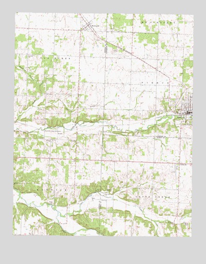
Pierce City, MO USGS Topographic Map
Click on map above to begin viewing in our Map Viewer.

This topographic map contains these locations and features:
Feature Name Type Latitude Longitude GNIS ID View Map
BerwickPopulated PlaceN36.9331°W94.0947°740675View Map
Berwick ChurchChurchN36.9281°W94.0999°714003View Map
Bethel ChurchChurchN36.8951°W94.0602°714044View Map
Capps CreekStreamN36.8881°W94.0935°730260View Map
Cave SpringSpringN36.8998°W94.0652°715530View Map
Center PointPopulated PlaceN36.9178°W94.0819°737884View Map
Chapman School (historical)SchoolN36.9029°W94.0498°732845View Map
City of Pierce CityCivilN36.9464°W94.0033°2396200View Map
Clear Creek ChurchChurchN36.9273°W94.0819°715942View Map
Fairview School (historical)SchoolN36.9615°W94.0799°746341View Map
Hawkins SpringSpringN36.8998°W94.0599°719242View Map
Hudson CreekStreamN36.8831°W94.0263°719953View Map
Hudson School (historical)SchoolN36.8903°W94.0094°732846View Map
Humphreys BranchStreamN36.9584°W94.1077°719992View Map
Hutchison BranchStreamN36.9470°W94.1122°720050View Map
JollyPopulated PlaceN36.8959°W94.0702°740973View Map
Jolly School (historical)SchoolN36.8965°W94.0822°746343View Map
Meane SpringSpringN36.8831°W94.0049°722185View Map
Monett Regional AirportAirportN36.9115°W94.0110°758818View Map
Mount Pleasant School (historical)SchoolN36.9457°W94.0389°746433View Map
Oak Grove School (historical)SchoolN36.9928°W94.0108°746436View Map
Pierce CityPopulated PlaceN36.9459°W94.0002°724319View Map
Pierce City Fire Protection District Station 1BuildingN36.9525°W94.0153°2620660View Map
Pierce City Police DepartmentBuildingN36.9444°W94.0029°2752369View Map
Pierce City Post OfficePost OfficeN36.9445°W94.0020°2782595View Map
Pleasant Hill School (historical)SchoolN36.9751°W94.0394°746435View Map
Pleasant View Church (historical)ChurchN36.9681°W94.0430°746434View Map
Quinn (historical)Populated PlaceN36.9756°W94.0394°740523View Map
Rose Hill School (historical)SchoolN36.9162°W94.0138°732844View Map
Ross School (historical)SchoolN36.9317°W94.0802°746342View Map
South Fork Capps CreekStreamN36.8831°W94.0263°730259View Map
Township of BerwickCivilN36.9061°W94.1047°767071View Map
Township of Capps CreekCivilN36.8874°W94.0154°766251View Map
Van Buren ChurchChurchN36.9765°W94.1155°728111View Map
VanBuren School (historical)SchoolN36.9766°W94.1246°746340View Map
Village of WentworthCivilN36.9932°W94.0755°2400125View Map
WentworthPopulated PlaceN36.9934°W94.0744°728509View Map
Wentworth Post OfficePost OfficeN36.9943°W94.0724°2782639View Map
Wright CemeteryCemeteryN36.8931°W94.0974°729155View Map
YonkervillePopulated PlaceN36.9162°W94.0094°729202View Map

Note: Coordinates in the location and feature list above are referenced to NAD83 datum.


Copyright (C) 2008-2024 Ryan Niemi / Sunset Dynamics ... All Rights Reserved