TopoQuest Logo
Do you find TopoQuest useful?
Help keep TopoQuest running and adding new maps/features by donating!
Bitcoin:  19c7KJd3qBynnjoSw5npx9KScwjBe4ifkT
Litecoin:  LXs6TkuXGGXo1vDsWCkWVdjQX94eUKd6ui
Home View Maps Find Maps Find Places Resources & Links


Sarona, Wisconsin Topographic Map

USGS Map Title: Sarona, WI
USGS Map MRC: 45091F7
DRG (GeoTIFF) Download: o45091f7.tif


Neighboring USGS Topographic Map Quads:


  Spooner, WI  
45091G8
 

  Spooner Lake, WI  
45091G7
 

  Potato Lake, WI  
45091G6
 

  Shell Lake, WI  
45091F8
 

  Sarona, WI  
45091F7
 

  Nobleton, WI  
45091F6
 

  Lower Vermillion Lake, WI  
45091E8
 

  Haugen, WI  
45091E7
 

  Rice Lake North, WI  
45091E6


Map MRC Location:

N46°
W92°
N46°
W91°
H8 H7 H6 H5 H4 H3 H2 H1
G8 G7 G6 G5 G4 G3 G2 G1
F8 F7 F6 F5 F4 F3 F2 F1
E8 E7 E6 E5 E4 E3 E2 E1
D8 D7 D6 D5 D4 D3 D2 D1
C8 C7 C6 C5 C4 C3 C2 C1
B8 B7 B6 B5 B4 B3 B2 B1
A8 A7 A6 A5 A4 A3 A2 A1
N45°
W92°
N45°
W91°

Sarona, WI USGS 1:24K Topographic Map Preview:
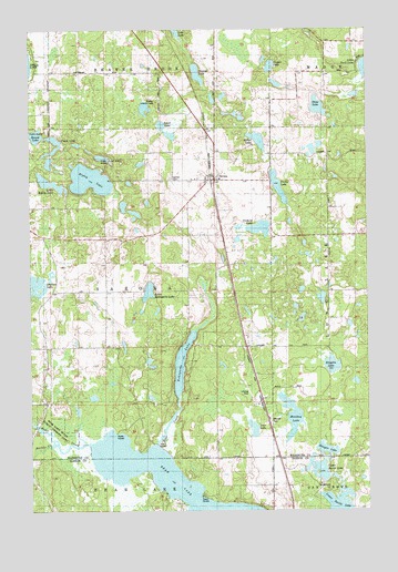
Sarona, WI USGS Topographic Map
Click on map above to begin viewing in our Map Viewer.

This topographic map contains these locations and features:
Feature Name Type Latitude Longitude GNIS ID View Map
American Tower Site 5057TowerN45.7438°W91.8316°2036728View Map
Bear CreekStreamN45.6422°W91.8293°1561349View Map
Bear LakeLakeN45.6303°W91.8221°1561392View Map
Bear Lake State Public Fishery AreaParkN45.6480°W91.8655°1561393View Map
Boyer CreekStreamN45.6425°W91.8532°1562114View Map
Browns LakeLakeN45.7385°W91.8127°1562272View Map
Casper LakeLakeN45.7402°W91.7857°1562776View Map
Chain LakeLakeN45.7181°W91.8670°1562926View Map
Four Seasons Airport (historical)AirportN45.6500°W91.8002°1582193View Map
Haugen LakeLakeN45.6408°W91.7657°1566143View Map
Kekegama LakeLakeN45.6655°W91.8202°1567375View Map
Kingelm LakeLakeN45.6625°W91.7635°1567508View Map
Little Kekegama LakeLakeN45.6819°W91.8313°1568292View Map
Little Ripley LakeLakeN45.7103°W91.8679°1568384View Map
Lost LakeLakeN45.7168°W91.8482°1568668View Map
Lower Devils LakeLakeN45.6263°W91.7611°1568725View Map
Microwave Tower American Tower Site 50574TowerN45.7438°W91.8316°2036722View Map
Miller LakeLakeN45.7212°W91.7905°1569516View Map
Monday LakeLakeN45.6497°W91.7786°1569647View Map
Pavlas LakeLakeN45.7090°W91.7829°1571099View Map
Ripley LakeLakeN45.7110°W91.8527°1572334View Map
Round LakeLakeN45.7224°W91.8727°1572664View Map
SaronaPopulated PlaceN45.7111°W91.8066°1573728View Map
Sarona CemeteryCemeteryN45.7111°W91.8224°1573729View Map
Sarona Post OfficePost OfficeN45.7111°W91.8088°2036730View Map
Sarona Town HallBuildingN45.7111°W91.8068°2036731View Map
Sarona United Methodist ChurchChurchN45.7119°W91.8071°2036729View Map
Shallow LakeLakeN45.6835°W91.8736°1573952View Map
Shell Lake Substation - Barron Electric CoopertLocaleN45.6963°W91.8702°2036727View Map
Shelton Lookout TowerTowerN45.7311°W91.8280°1581340View Map
Sport LakeLakeN45.7228°W91.8243°1574572View Map
Star LakeLakeN45.6463°W91.7927°1574809View Map
Stone LakeLakeN45.7297°W91.7680°1574922View Map
Sucker CreekStreamN45.6361°W91.8702°1575008View Map
Town of SaronaCivilN45.6797°W91.8450°1584101View Map
Upper Devils LakeLakeN45.6353°W91.7677°1575960View Map
Yechout LakeLakeN45.6983°W91.7899°1577081View Map

Note: Coordinates in the location and feature list above are referenced to NAD83 datum.


Copyright (C) 2008-2025 Ryan Niemi / Sunset Dynamics ... All Rights Reserved