TopoQuest Logo
Do you find TopoQuest useful?
Help keep TopoQuest running and adding new maps/features by donating!
Bitcoin:  19c7KJd3qBynnjoSw5npx9KScwjBe4ifkT
Litecoin:  LXs6TkuXGGXo1vDsWCkWVdjQX94eUKd6ui
Home View Maps Find Maps Find Places Resources & Links


Rice Lake North, Wisconsin Topographic Map

USGS Map Title: Rice Lake North, WI
USGS Map MRC: 45091E6
DRG (GeoTIFF) Download: o45091e6.tif


Neighboring USGS Topographic Map Quads:


  Sarona, WI  
45091F7
 

  Nobleton, WI  
45091F6
 

  Birchwood, WI  
45091F5
 

  Haugen, WI  
45091E7
 

  Rice Lake North, WI  
45091E6
 

  Mikana, WI  
45091E5
 

  Barron, WI  
45091D7
 

  Rice Lake South, WI  
45091D6
 

  Strickland, WI  
45091D5


Map MRC Location:

N46°
W92°
N46°
W91°
H8 H7 H6 H5 H4 H3 H2 H1
G8 G7 G6 G5 G4 G3 G2 G1
F8 F7 F6 F5 F4 F3 F2 F1
E8 E7 E6 E5 E4 E3 E2 E1
D8 D7 D6 D5 D4 D3 D2 D1
C8 C7 C6 C5 C4 C3 C2 C1
B8 B7 B6 B5 B4 B3 B2 B1
A8 A7 A6 A5 A4 A3 A2 A1
N45°
W92°
N45°
W91°

Rice Lake North, WI USGS 1:24K Topographic Map Preview:
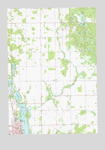
Rice Lake North, WI USGS Topographic Map
Click on map above to begin viewing in our Map Viewer.

This topographic map contains these locations and features:
Feature Name Type Latitude Longitude GNIS ID View Map
American Cellular Phone TowerTowerN45.6205°W91.7460°2036742View Map
Assembly of God ChurchChurchN45.5091°W91.7463°2036759View Map
Barron County FairgroundsParkN45.5136°W91.7366°1837873View Map
Barron County Training School (historical)SchoolN45.5011°W91.7338°1837876View Map
Bear CreekStreamN45.5380°W91.7427°1561363View Map
Bethany Lutheran ChurchChurchN45.5019°W91.7357°1837885View Map
Blue Hills Unitarian UniversalistChurchN45.5013°W91.7399°2036766View Map
BrillPopulated PlaceN45.6027°W91.6721°1562209View Map
Brill Post OfficePost OfficeN45.6044°W91.6729°2036744View Map
Brill RiverStreamN45.5563°W91.6510°1562210View Map
Brill SchoolSchoolN45.6091°W91.6721°1837887View Map
CampiaPopulated PlaceN45.5375°W91.6657°1562695View Map
Century Tel Microwave TowerTowerN45.5011°W91.7371°2036767View Map
Chain LakeLakeN45.6137°W91.6437°1562925View Map
Christ Community ChurchChurchN45.5013°W91.7349°1837892View Map
DobiePopulated PlaceN45.5519°W91.6835°1564013View Map
Evangelical Free ChurchChurchN45.5038°W91.7443°1837919View Map
Fadness SchoolSchoolN45.5366°W91.6404°1564794View Map
Farmers Union Co-op Mill and ElevatorBuildingN45.5038°W91.7391°2036761View Map
First Church of Christ ScientistChurchN45.5069°W91.7341°1837924View Map
Future Farmers of America ParkParkN45.5166°W91.7385°1837930View Map
Goose LakeLakeN45.5985°W91.6503°1565656View Map
Gospel TabernacleChurchN45.5061°W91.7385°1837934View Map
Grace Episcopal ChurchChurchN45.5055°W91.7374°1837936View Map
Grace Lutheran ChurchChurchN45.6097°W91.6721°1837935View Map
Hiawatha ParkParkN45.5186°W91.7252°1837945View Map
Indian Mound ParkParkN45.5130°W91.7318°1837951View Map
Indianhead SpeedwayLocaleN45.5330°W91.7435°1837952View Map
Jefferson Elementary SchoolSchoolN45.5002°W91.7446°1837954View Map
Joy Fellowship ChurchChurchN45.5030°W91.7338°2036762View Map
Kiddie Korner PreschoolSchoolN45.5039°W91.7441°2713434View Map
Lakeview Medical CenterHospitalN45.5142°W91.7334°1837959View Map
Lincoln Elementary SchoolSchoolN45.5058°W91.7366°1837963View Map
Lincoln SchoolSchoolN45.5241°W91.7046°1568123View Map
Marshfield Clinic - Indianhead CenterHospitalN45.5130°W91.7335°2036746View Map
Marshfield Clinic Family CenterHospitalN45.5088°W91.7374°2036732View Map
Nora CemeteryCemeteryN45.5202°W91.7378°1570332View Map
Oak Grove Center SchoolSchoolN45.6100°W91.7041°1570619View Map
Oak Grove Town HallBuildingN45.6097°W91.7038°2036743View Map
Our Lady of Lourdes Catholic CemeteryCemeteryN45.5545°W91.6827°1988537View Map
Our Lady of Lourdes ChurchChurchN45.5538°W91.6827°1988879View Map
Our Lady of Lourdes Community CenterBuildingN45.5538°W91.6843°2036745View Map
Our Saviors ChurchChurchN45.5383°W91.6413°1570946View Map
Our Saviors Lutheran CemeteryCemeteryN45.5371°W91.6403°1988538View Map
Red Cedar Community CenterBuildingN45.5036°W91.7352°2036764View Map
Rice LakePopulated PlaceN45.5061°W91.7382°1572268View Map
Rice LakeLakeN45.5158°W91.7282°1572273View Map
Rice Lake 230ReservoirN45.5072°W91.7247°1791861View Map
Rice Lake City HallBuildingN45.5047°W91.7327°1837995View Map
Rice Lake High SchoolSchoolN45.5003°W91.7490°1837996View Map
Rice Lake High School StadiumLocaleN45.5013°W91.7468°2036772View Map
Rice Lake JailBuildingN45.5008°W91.7366°2036768View Map
Rice Lake Municipal Airport (historical)AirportN45.5558°W91.7191°1837998View Map
Rice Lake Post OfficePost OfficeN45.5033°W91.7325°1837999View Map
Rice Lake Public LibraryBuildingN45.5041°W91.7329°1838000View Map
River of Praise ChurchChurchN45.5013°W91.7338°2036771View Map
Round LakeLakeN45.6196°W91.6472°1572661View Map
Saint Johns Evangelical Lutheran ChurchChurchN45.5083°W91.7341°1838005View Map
Saint Joseph's Catholic SchoolSchoolN45.5050°W91.7376°1838006View Map
Saint Josephs HospitalHospitalN45.5033°W91.7349°1838007View Map
Saint Josephs Roman Catholic ChurchChurchN45.5047°W91.7371°1838008View Map
Stump LakeLakeN45.5383°W91.7370°1574995View Map
Town of Oak GroveCivilN45.5954°W91.7234°1583840View Map
Town of Rice LakeCivilN45.5130°W91.7196°1584020View Map
Tuscobia LakeLakeN45.5441°W91.7471°1575749View Map
United Presbyterian ChurchChurchN45.5016°W91.7357°2036765View Map
Washington Junior High SchoolSchoolN45.5002°W91.7366°1838029View Map
Wesleyan Methodist Church (historical)ChurchN45.5047°W91.7357°1838030View Map

Note: Coordinates in the location and feature list above are referenced to NAD83 datum.


Copyright (C) 2008-2024 Ryan Niemi / Sunset Dynamics ... All Rights Reserved