TopoQuest Logo
Do you find TopoQuest useful?
Help keep TopoQuest running and adding new maps/features by donating!
Bitcoin:  19c7KJd3qBynnjoSw5npx9KScwjBe4ifkT
Litecoin:  LXs6TkuXGGXo1vDsWCkWVdjQX94eUKd6ui
Home View Maps Find Maps Find Places Resources & Links


Montpelier, Louisiana Topographic Map

USGS Map Title: Montpelier, LA
USGS Map MRC: 30090F6
DRG (GeoTIFF) Download: o30090f6.tif


Neighboring USGS Topographic Map Quads:


  Hatchersville, LA  
30090G7
 

  Greensburg, LA  
30090G6
 

  Roseland, LA  
30090G5
 

  Pine Grove, LA  
30090F7
 

  Montpelier, LA  
30090F6
 

  Amite, LA  
30090F5
 

  Satsuma, LA  
30090E7
 

  Holden, LA  
30090E6
 

  Albany, LA  
30090E5


Map MRC Location:

N31°
W91°
N31°
W90°
H8 H7 H6 H5 H4 H3 H2 H1
G8 G7 G6 G5 G4 G3 G2 G1
F8 F7 F6 F5 F4 F3 F2 F1
E8 E7 E6 E5 E4 E3 E2 E1
D8 D7 D6 D5 D4 D3 D2 D1
C8 C7 C6 C5 C4 C3 C2 C1
B8 B7 B6 B5 B4 B3 B2 B1
A8 A7 A6 A5 A4 A3 A2 A1
N30°
W91°
N30°
W90°

Montpelier, LA USGS 1:24K Topographic Map Preview:
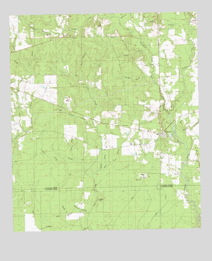
Montpelier, LA USGS Topographic Map
Click on map above to begin viewing in our Map Viewer.

This topographic map contains these locations and features:
Feature Name Type Latitude Longitude GNIS ID View Map
Becky BranchStreamN30.6660°W90.7107°560126View Map
Bedstead BranchStreamN30.6346°W90.7137°532872View Map
Bills BranchStreamN30.6374°W90.7079°533123View Map
Brushy CreekStreamN30.7482°W90.6801°560288View Map
Camp Running WaterLocaleN30.6419°W90.6376°551990View Map
Coffman CreekStreamN30.6860°W90.6973°560450View Map
Crooked BranchStreamN30.6427°W90.6943°534261View Map
Curtis CreekStreamN30.6763°W90.7476°560556View Map
Dales ChapelChurchN30.6638°W90.6265°560577View Map
Davis BranchStreamN30.7166°W90.7359°560589View Map
East Spring BranchStreamN30.6599°W90.6920°560696View Map
Fred BranchStreamN30.6616°W90.6876°560796View Map
George CemeteryCemeteryN30.7432°W90.6915°560826View Map
Goodman BranchStreamN30.7166°W90.7359°560848View Map
Hog BayouStreamN30.6252°W90.7054°560976View Map
JackPopulated PlaceN30.7382°W90.7123°1627338View Map
Jordan BranchStreamN30.7413°W90.7143°1627376View Map
Kale BranchStreamN30.7121°W90.7015°1627383View Map
Killian BranchStreamN30.7227°W90.6557°1627402View Map
Killian BranchStreamN30.6732°W90.6340°1627403View Map
Midway ChurchChurchN30.7371°W90.6826°1627656View Map
Mitchell BranchStreamN30.6357°W90.6995°537165View Map
MontpelierPopulated PlaceN30.6810°W90.6490°1627683View Map
Montpelier Baptist ChurchChurchN30.6797°W90.6498°2602263View Map
Montpelier Fire DepartmentBuildingN30.6801°W90.6539°2332421View Map
Montpelier Police Department - ChiefBuildingN30.6819°W90.6593°2334075View Map
Morgan ChapelChurchN30.6852°W90.6762°1627692View Map
Morgan Chapel African Methodist Episcopal ChurchChurchN30.6853°W90.6764°2602264View Map
Mount Zion Freewill Baptist ChurchChurchN30.6761°W90.6536°2602401View Map
New Hope CemeteryCemeteryN30.7388°W90.7259°1627762View Map
New Hope ChurchChurchN30.7371°W90.7087°1627764View Map
Red Hill BranchStreamN30.7135°W90.6554°1628031View Map
Rocky Hill ChurchChurchN30.7444°W90.6534°1628067View Map
Rocky Hill School (historical)SchoolN30.7457°W90.6526°1629290View Map
Shillings BranchStreamN30.6830°W90.7404°1628223View Map
Shiloh ChurchChurchN30.7094°W90.7026°1628224View Map
Stone BranchStreamN30.7491°W90.6948°1628297View Map
Sweet Gum PondLakeN30.7432°W90.6434°1628317View Map
Twelvemile CreekStreamN30.6919°W90.6443°1628395View Map
Village of MontpelierCivilN30.6822°W90.6545°2407504View Map
Ward FourCivilN30.6966°W90.7379°1628588View Map
West Spring BranchStreamN30.6552°W90.6959°1628485View Map
Williams BranchStreamN30.7469°W90.6768°1628505View Map

Note: Coordinates in the location and feature list above are referenced to NAD83 datum.


Copyright (C) 2008-2025 Ryan Niemi / Sunset Dynamics ... All Rights Reserved