TopoQuest Logo
Do you find TopoQuest useful?
Help keep TopoQuest running and adding new maps/features by donating!
Bitcoin:  19c7KJd3qBynnjoSw5npx9KScwjBe4ifkT
Litecoin:  LXs6TkuXGGXo1vDsWCkWVdjQX94eUKd6ui
Home View Maps Find Maps Find Places Resources & Links


School Hill, Wisconsin Topographic Map

USGS Map Title: School Hill, WI
USGS Map MRC: 43087H8
DRG (GeoTIFF) Download: o43087h8.tif


Neighboring USGS Topographic Map Quads:


  Potter, WI  
44088A1
 

  Valders, WI  
44087A8
 

  Clarks Mills, WI  
44087A7
 

  Kiel, WI  
43088H1
 

  School Hill, WI  
43087H8
 

  Cleveland West, WI  
43087H7
 

  Elkhart Lake, WI  
43088G1
 

  Franklin, WI  
43087G8
 

  Howards Grove, WI  
43087G7


Map MRC Location:

N44°
W88°
N44°
W87°
H8 H7 H6 H5 H4 H3 H2 H1
G8 G7 G6 G5 G4 G3 G2 G1
F8 F7 F6 F5 F4 F3 F2 F1
E8 E7 E6 E5 E4 E3 E2 E1
D8 D7 D6 D5 D4 D3 D2 D1
C8 C7 C6 C5 C4 C3 C2 C1
B8 B7 B6 B5 B4 B3 B2 B1
A8 A7 A6 A5 A4 A3 A2 A1
N43°
W88°
N43°
W87°

School Hill, WI USGS 1:24K Topographic Map Preview:
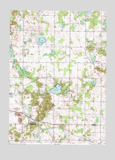
School Hill, WI USGS Topographic Map
Click on map above to begin viewing in our Map Viewer.

This topographic map contains these locations and features:
Feature Name Type Latitude Longitude GNIS ID View Map
AdaPopulated PlaceN43.8769°W87.8956°1560679View Map
Ada Fire DepartmentBuildingN43.8769°W87.8953°2697846View Map
Autumn Creek FarmLocaleN43.9600°W87.9656°2710407View Map
Bethel ChurchChurchN43.8914°W87.9079°1561639View Map
Bethel Church CemeteryCemeteryN43.8964°W87.9024°1561629View Map
Bethlehem ChurchChurchN43.9578°W87.9826°1561655View Map
Cedar LakeLakeN43.9249°W87.9385°1562851View Map
County Line OrchardLocaleN43.8953°W87.8906°2710442View Map
Devin AcresLocaleN43.8861°W87.8892°2706304View Map
Eaton Twin LakesLakeN43.9839°W87.9311°1564401View Map
Fountain Park SchoolSchoolN43.9642°W87.9420°1565179View Map
Golden Bear FarmLocaleN43.9117°W87.9600°2710305View Map
Graf LakeLakeN43.9404°W87.9807°1565702View Map
Greendale DairyLocaleN43.9794°W87.9592°2710408View Map
Harrison SchoolSchoolN43.8764°W87.9918°1566099View Map
Hillside Grove SchoolSchoolN43.9567°W87.9820°1566466View Map
Holy Trinity CemeteryCemeteryN43.9537°W87.8995°1566627View Map
Horseshoe LakeLakeN43.9307°W87.8915°1566727View Map
Karstaedt LakeLakeN43.9364°W87.8982°2761397View Map
Kleinhans Dairy FarmLocaleN43.9800°W87.9336°2710411View Map
Koco RanchLocaleN43.9883°W87.9056°2710304View Map
Lax ChapelChurchN43.9953°W87.9826°1567896View Map
Little Pigeon LakeLakeN43.9816°W87.8751°1577355View Map
Little Sy LakeLakeN43.9612°W87.9460°2761399View Map
Louis CornersPopulated PlaceN43.9353°W87.9520°1568696View Map
Louis Corners DairyLocaleN43.9364°W87.9578°2710412View Map
Maple Corner SchoolSchoolN43.8922°W87.9420°1568961View Map
MillhomePopulated PlaceN43.8950°W87.9623°1569523View Map
Millhome CreekStreamN43.8889°W87.9459°1577284View Map
Millhome Flowage 168ReservoirN43.8950°W87.9634°1792179View Map
Millhome Nursery and GreenhouseBuildingN43.8831°W87.9603°2706308View Map
Millhome WP396 DamDamN43.8950°W87.9634°1792178View Map
Misty River DairyLocaleN43.9014°W87.8828°2631620View Map
Mud LakeLakeN43.9605°W87.9997°1569995View Map
Nenning Mobile Home ParkPopulated PlaceN43.9303°W87.9417°2711546View Map
Peterson LakeLakeN43.9773°W87.9997°2761401View Map
Pigeon River SchoolSchoolN43.9061°W87.9020°1571374View Map
Prueder LakeLakeN43.9354°W87.9786°1577352View Map
Psalm 23 FarmLocaleN43.9508°W87.9808°2710306View Map
Ranger LakeLakeN43.9217°W87.9268°2761403View Map
Robinway Dairy FarmsLocaleN43.9628°W87.9186°2710339View Map
RockvillePopulated PlaceN43.9200°W87.9979°1572490View Map
Rockville DamDamN43.9200°W87.9984°1791956View Map
Rockville Flowage 153ReservoirN43.9200°W87.9984°1791957View Map
S and J FarmsLocaleN43.9100°W87.8803°2710448View Map
Saint John CemeteryCemeteryN43.8775°W87.9062°1573046View Map
Salvatorian SeminarySchoolN43.9989°W87.9256°1573641View Map
Schema FarmLocaleN43.9922°W87.9439°2710414View Map
School HillPopulated PlaceN43.9500°W87.8940°1573801View Map
Schuler Dairy FarmsLocaleN43.9825°W87.9411°2710415View Map
Scout LakeLakeN43.9247°W87.9239°2761404View Map
Shoe LakeLakeN43.9439°W87.9883°1574065View Map
Society of the Divine Savior CemeteryCemeteryN43.9998°W87.9284°1568640View Map
Spindler FarmLocaleN43.8758°W87.9094°2706312View Map
Spring LakeLakeN43.9690°W87.8958°1574664View Map
Sy LakeLakeN43.9584°W87.9441°1575199View Map
Town of SchleswigCivilN43.9367°W87.9794°1584109View Map
Townline DairyLocaleN43.9778°W87.9267°2710416View Map
Ucker CemeteryCemeteryN43.9661°W87.9430°1575843View Map
Union CemeteryCemeteryN43.9354°W87.9618°1575883View Map
Vanderbloemen Bog State Natural AreaParkN43.9897°W87.8998°2057505View Map
West LakeLakeN43.9318°W87.8973°1577354View Map
Wilke LakeLakeN43.9697°W87.9587°1576754View Map
Woodland SchoolSchoolN43.9622°W87.9015°1576994View Map

Note: Coordinates in the location and feature list above are referenced to NAD83 datum.


Copyright (C) 2008-2025 Ryan Niemi / Sunset Dynamics ... All Rights Reserved