TopoQuest Logo
Do you find TopoQuest useful?
Help keep TopoQuest running and adding new maps/features by donating!
Bitcoin:  19c7KJd3qBynnjoSw5npx9KScwjBe4ifkT
Litecoin:  LXs6TkuXGGXo1vDsWCkWVdjQX94eUKd6ui
Home View Maps Find Maps Find Places Resources & Links


Cleveland West, Wisconsin Topographic Map

USGS Map Title: Cleveland West, WI
USGS Map MRC: 43087H7
DRG (GeoTIFF) Download: o43087h7.tif


Neighboring USGS Topographic Map Quads:


  Valders, WI  
44087A8
 

  Clarks Mills, WI  
44087A7
 

  Manitowoc, WI  
44087A6
 

  School Hill, WI  
43087H8
 

  Cleveland West, WI  
43087H7
 

  Cleveland East, WI  
43087H6
 

  Franklin, WI  
43087G8
 

  Howards Grove, WI  
43087G7
 

  Sheboygan North, WI  
43087G6


Map MRC Location:

N44°
W88°
N44°
W87°
H8 H7 H6 H5 H4 H3 H2 H1
G8 G7 G6 G5 G4 G3 G2 G1
F8 F7 F6 F5 F4 F3 F2 F1
E8 E7 E6 E5 E4 E3 E2 E1
D8 D7 D6 D5 D4 D3 D2 D1
C8 C7 C6 C5 C4 C3 C2 C1
B8 B7 B6 B5 B4 B3 B2 B1
A8 A7 A6 A5 A4 A3 A2 A1
N43°
W88°
N43°
W87°

Cleveland West, WI USGS 1:24K Topographic Map Preview:
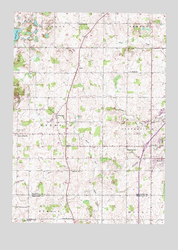
Cleveland West, WI USGS Topographic Map
Click on map above to begin viewing in our Map Viewer.

This topographic map contains these locations and features:
Feature Name Type Latitude Longitude GNIS ID View Map
Bonde AcresLocaleN43.9142°W87.8428°2710417View Map
Brunmeier Dairy FarmLocaleN43.9997°W87.7844°2710419View Map
Circle B Bison RanchLocaleN43.9194°W87.8344°2710420View Map
Cleveland Police DepartmentBuildingN43.9144°W87.7507°2759788View Map
Cleveland Volunteer Fire DepartmentBuildingN43.9145°W87.7545°2697835View Map
Driscoll FarmsLocaleN43.9764°W87.8197°2710424View Map
EdwardsPopulated PlaceN43.8883°W87.8304°2741525View Map
Fitz Pine Dairy FarmLocaleN43.9778°W87.8256°2710421View Map
Green Bay Road SchoolSchoolN43.8769°W87.8248°1565804View Map
Grotegut Dairy FarmLocaleN43.9914°W87.7556°2710341View Map
Harvest Moon DairyLocaleN43.8761°W87.7728°2631614View Map
Hidden Creek FarmLocaleN43.9122°W87.8644°2710422View Map
Interchange 137CrossingN43.9211°W87.7664°2351435View Map
Jaeger FarmsLocaleN43.9425°W87.7644°2710445View Map
La Follette SchoolSchoolN43.9650°W87.7798°1567693View Map
Lakeshore Technical CollegeSchoolN43.9248°W87.7545°1562890View Map
Liberty Bell SchoolSchoolN43.9930°W87.8218°1568009View Map
Libertyland FarmsLocaleN43.9925°W87.8231°2710294View Map
Lindeman LakeLakeN43.9832°W87.8562°2761398View Map
Long View Dairy FarmLocaleN43.8986°W87.8306°2710446View Map
M V FarmLocaleN43.9944°W87.7642°2710425View Map
MeemePopulated PlaceN43.9205°W87.8315°1577723View Map
Meeme Center CemeteryCemeteryN43.9300°W87.8718°1569317View Map
Meeme Leads Charter SchoolSchoolN43.9272°W87.8340°2716594View Map
Meeme RiverStreamN43.8953°W87.8095°1569319View Map
Mineral Springs SchoolSchoolN43.9272°W87.8709°1569551View Map
Mueller Range Line DairyLocaleN43.9222°W87.7992°2710426View Map
North Creek Dairy FarmLocaleN43.9131°W87.7669°2710447View Map
Orth FarmsLocaleN43.8989°W87.7828°2631616View Map
OsmanPopulated PlaceN43.9686°W87.8209°1570878View Map
Pigeon LakeReservoirN43.9828°W87.8740°1571370View Map
Pleasant Hill SchoolSchoolN43.9186°W87.7812°1571606View Map
Rof Lor Dairy FarmLocaleN43.9303°W87.8394°2710423View Map
Saint Johns ChurchChurchN43.8769°W87.8665°1573091View Map
Saint Joseph's Catholic CemeteryCemeteryN43.8846°W87.8630°1573829View Map
Saxon CemeteryCemeteryN43.9172°W87.7802°1573759View Map
Saxon Homestead FarmLocaleN43.9097°W87.7769°2631617View Map
Schwartzwald SchoolSchoolN43.8772°W87.8609°1573830View Map
Siemers Holstein FarmsLocaleN43.9236°W87.8675°2631619View Map
Soaring Eagle DairyLocaleN43.9775°W87.8017°2710340View Map
Spring ValleyPopulated PlaceN43.9389°W87.8395°1574696View Map
Sunny Side Dairy FarmLocaleN43.9922°W87.8439°2710301View Map
Taylor SchoolSchoolN43.9069°W87.8265°1575284View Map
Town of CentervilleCivilN43.9401°W87.7537°1582943View Map
Town of MeemeCivilN43.9354°W87.8619°1583686View Map
Windemere FarmLocaleN43.8925°W87.8667°2710449View Map
WKTT-FM (Cleveland)TowerN43.9864°W87.7648°1582586View Map
Ziegler Dairy FarmsLocaleN43.9192°W87.8081°2710428View Map

Note: Coordinates in the location and feature list above are referenced to NAD83 datum.


Copyright (C) 2008-2024 Ryan Niemi / Sunset Dynamics ... All Rights Reserved