TopoQuest Logo
Do you find TopoQuest useful?
Help keep TopoQuest running and adding new maps/features by donating!
Bitcoin:  19c7KJd3qBynnjoSw5npx9KScwjBe4ifkT
Litecoin:  LXs6TkuXGGXo1vDsWCkWVdjQX94eUKd6ui
Home View Maps Find Maps Find Places Resources & Links


School Section Mountain, Wyoming Topographic Map

USGS Map Title: School Section Mountain, WY
USGS Map MRC: 42105D6
DRG (GeoTIFF) Download: o42105d6.tif


Neighboring USGS Topographic Map Quads:


  Buffalo Peak, WY  
42105E7
 

  Blue Nose Creek, WY  
42105E6
 

  Maneater Creek, WY  
42105E5
 

  Warbonnett Peak, WY  
42105D7
 

  School Section Mountain, WY  
42105D6
 

  Saddleback Mountain, WY  
42105D5
 

  Marshall, WY  
42105C7
 

  Toltec, WY  
42105C6
 

  Windy Peak, WY  
42105C5


Map MRC Location:

N43°
W106°
N43°
W105°
H8 H7 H6 H5 H4 H3 H2 H1
G8 G7 G6 G5 G4 G3 G2 G1
F8 F7 F6 F5 F4 F3 F2 F1
E8 E7 E6 E5 E4 E3 E2 E1
D8 D7 D6 D5 D4 D3 D2 D1
C8 C7 C6 C5 C4 C3 C2 C1
B8 B7 B6 B5 B4 B3 B2 B1
A8 A7 A6 A5 A4 A3 A2 A1
N42°
W106°
N42°
W105°

School Section Mountain, WY USGS 1:24K Topographic Map Preview:
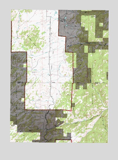
School Section Mountain, WY USGS Topographic Map
Click on map above to begin viewing in our Map Viewer.

This topographic map contains these locations and features:
Feature Name Type Latitude Longitude GNIS ID View Map
Arnold PlaceLocaleN42.4677°W105.6297°1597803View Map
Big Bear CanyonValleyN42.4002°W105.6333°1598132View Map
Chamberlain PassGapN42.4939°W105.6497°1598697View Map
Comb RanchLocaleN42.4411°W105.7228°1598868View Map
Corduroy CreekStreamN42.4014°W105.6919°1598902View Map
Curtis GulchValleyN42.4075°W105.6253°1599089View Map
Downey CreekStreamN42.4966°W105.6797°1599310View Map
Downey ParkFlatN42.4550°W105.6917°1599311View Map
Gould CreekStreamN42.4664°W105.6786°1599991View Map
Hildebrand DitchCanalN42.4961°W105.6914°1600337View Map
Horr Cow CampLocaleN42.4744°W105.6686°1600393View Map
Indian CreekStreamN42.3900°W105.6906°1600493View Map
Latham PassGapN42.4977°W105.6578°1600852View Map
Old Maids DrawValleyN42.3875°W105.7025°1601908View Map
Prill DrawValleyN42.4844°W105.6742°1602306View Map
Prospect GulchValleyN42.3961°W105.6622°1602316View Map
Pyramid MineMineN42.3905°W105.6914°1602332View Map
Reed CreekStreamN42.4655°W105.6781°1602471View Map
Rocky Ford CreekStreamN42.4655°W105.6781°1602611View Map
School Section MountainSummitN42.4694°W105.7236°1602771View Map
Sims RanchLocaleN42.4894°W105.6867°1602934View Map
South Fork La Bonte CreekStreamN42.4022°W105.6339°1604469View Map
Wagonhound DamDamN42.4933°W105.6806°1605867View Map
Wagonhound ReservoirReservoirN42.4924°W105.6805°1605868View Map
West Fork CanyonValleyN42.4652°W105.6753°1604528View Map

Note: Coordinates in the location and feature list above are referenced to NAD83 datum.


Copyright (C) 2008-2024 Ryan Niemi / Sunset Dynamics ... All Rights Reserved