TopoQuest Logo
Do you find TopoQuest useful?
Help keep TopoQuest running and adding new maps/features by donating!
Bitcoin:  19c7KJd3qBynnjoSw5npx9KScwjBe4ifkT
Litecoin:  LXs6TkuXGGXo1vDsWCkWVdjQX94eUKd6ui
Home View Maps Find Maps Find Places Resources & Links


Maneater Creek, Wyoming Topographic Map

USGS Map Title: Maneater Creek, WY
USGS Map MRC: 42105E5
DRG (GeoTIFF) Download: o42105e5.tif


Neighboring USGS Topographic Map Quads:


  Hermit Rock, WY  
42105F6
 

  La Prele Reservoir, WY  
42105F5
 

  Chalk Buttes, WY  
42105F4
 

  Blue Nose Creek, WY  
42105E6
 

  Maneater Creek, WY  
42105E5
 

  Poison Lake, WY  
42105E4
 

  School Section Mountain, WY  
42105D6
 

  Saddleback Mountain, WY  
42105D5
 

  Braae, WY  
42105D4


Map MRC Location:

N43°
W106°
N43°
W105°
H8 H7 H6 H5 H4 H3 H2 H1
G8 G7 G6 G5 G4 G3 G2 G1
F8 F7 F6 F5 F4 F3 F2 F1
E8 E7 E6 E5 E4 E3 E2 E1
D8 D7 D6 D5 D4 D3 D2 D1
C8 C7 C6 C5 C4 C3 C2 C1
B8 B7 B6 B5 B4 B3 B2 B1
A8 A7 A6 A5 A4 A3 A2 A1
N42°
W106°
N42°
W105°

Maneater Creek, WY USGS 1:24K Topographic Map Preview:
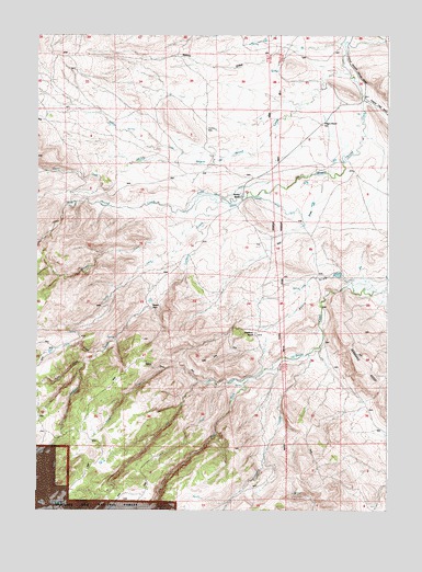
Maneater Creek, WY USGS Topographic Map
Click on map above to begin viewing in our Map Viewer.

This topographic map contains these locations and features:
Feature Name Type Latitude Longitude GNIS ID View Map
Basin DamDamN42.5616°W105.5172°1608068View Map
Basin DrawValleyN42.5600°W105.5130°1597950View Map
Basin ReservoirReservoirN42.5619°W105.5182°1608069View Map
Cherry CreekStreamN42.5847°W105.6019°1598714View Map
Corral CreekStreamN42.5825°W105.5647°1598910View Map
George Nagle DitchCanalN42.5833°W105.5617°1599926View Map
Gooseberry CreekStreamN42.5414°W105.5280°1599982View Map
Hay Press CreekStreamN42.5425°W105.5997°1600253View Map
Kenny DrawValleyN42.6233°W105.5144°1600696View Map
Latham CreekStreamN42.5808°W105.5594°1600851View Map
Magpie CreekStreamN42.5927°W105.5600°1604421View Map
Maneater CreekStreamN42.5730°W105.5722°1601241View Map
Meehl DrawValleyN42.5369°W105.5792°1601346View Map
Middleton RanchLocaleN42.5464°W105.5469°1601435View Map
Mill CreekStreamN42.5333°W105.5558°1601455View Map
Muddy Wagon Hound CreekStreamN42.6150°W105.5139°1601624View Map
Peterson DamDamN42.6033°W105.5205°1606326View Map
Peterson ReservoirReservoirN42.6033°W105.5205°1606327View Map
Raeber RanchLocaleN42.5822°W105.5514°1602353View Map
Red DrawValleyN42.5883°W105.5205°1602442View Map
Rogers PlaceLocaleN42.5533°W105.5842°1602620View Map
Sand CreekStreamN42.5389°W105.6078°1602706View Map
Sled CreekStreamN42.5350°W105.5486°1602972View Map
Stove CreekStreamN42.5341°W105.5667°1603396View Map
Wagon Hound Ditch Number 3CanalN42.5819°W105.5442°1605512View Map
Wagon Hound GorgeValleyN42.5802°W105.6017°1603950View Map
Wagonhound AirportAirportN42.5881°W105.5384°2443895View Map
West Fork La Bonte CreekStreamN42.5358°W105.5486°1604066View Map

Note: Coordinates in the location and feature list above are referenced to NAD83 datum.


Copyright (C) 2008-2025 Ryan Niemi / Sunset Dynamics ... All Rights Reserved