TopoQuest Logo
Do you find TopoQuest useful?
Help keep TopoQuest running and adding new maps/features by donating!
Bitcoin:  19c7KJd3qBynnjoSw5npx9KScwjBe4ifkT
Litecoin:  LXs6TkuXGGXo1vDsWCkWVdjQX94eUKd6ui
Home View Maps Find Maps Find Places Resources & Links


Schultz, West Virginia Topographic Map

USGS Map Title: Schultz, WV
USGS Map MRC: 39081C2
DRG (GeoTIFF) Download: o39081c2.tif


Neighboring USGS Topographic Map Quads:


  Belmont, WV  
39081D3
 

  Raven Rock, WV  
39081D2
 

  Bens Run, WV  
39081D1
 

  Willow Island, WV  
39081C3
 

  Schultz, WV  
39081C2
 

  Ellenboro, WV  
39081C1
 

  Petroleum, WV  
39081B3
 

  Cairo, WV  
39081B2
 

  Harrisville, WV  
39081B1


Map MRC Location:

N40°
W82°
N40°
W81°
H8 H7 H6 H5 H4 H3 H2 H1
G8 G7 G6 G5 G4 G3 G2 G1
F8 F7 F6 F5 F4 F3 F2 F1
E8 E7 E6 E5 E4 E3 E2 E1
D8 D7 D6 D5 D4 D3 D2 D1
C8 C7 C6 C5 C4 C3 C2 C1
B8 B7 B6 B5 B4 B3 B2 B1
A8 A7 A6 A5 A4 A3 A2 A1
N39°
W82°
N39°
W81°

Schultz, WV USGS 1:24K Topographic Map Preview:
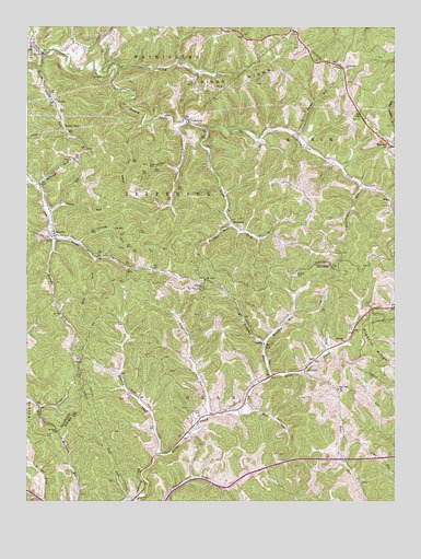
Schultz, WV USGS Topographic Map
Click on map above to begin viewing in our Map Viewer.

This topographic map contains these locations and features:
Feature Name Type Latitude Longitude GNIS ID View Map
Alum Cave RunStreamN39.3501°W81.2107°1534901View Map
Bear Run ChurchChurchN39.2801°W81.1440°1535404View Map
Brushy ForkStreamN39.2626°W81.2046°1536505View Map
Brushy Peak School (historical)SchoolN39.2840°W81.2182°1688929View Map
Buck RunStreamN39.2509°W81.2154°1536570View Map
Bukey RunStreamN39.3270°W81.2437°1536680View Map
Burntcabin RunStreamN39.3337°W81.1365°1536769View Map
CalcuttaPopulated PlaceN39.3506°W81.1946°1536855View Map
Calcutta CemeteryCemeteryN39.3496°W81.1913°2574022View Map
Calcutta School (historical)SchoolN39.3567°W81.1915°1678499View Map
Calcutta United Methodist ChurchChurchN39.3501°W81.1948°1678500View Map
Camp Run School (historical)SchoolN39.2659°W81.1262°1688938View Map
Carney RunStreamN39.3179°W81.2321°1537044View Map
Center Valley School (historical)SchoolN39.3487°W81.1634°1678502View Map
CloverdalePopulated PlaceN39.3651°W81.1432°1678504View Map
Cloverdale CemeteryCemeteryN39.3645°W81.1421°1678505View Map
Cloverdale ChurchChurchN39.3645°W81.1418°1537429View Map
CombsLocaleN39.2929°W81.1698°1537541View Map
District BCivilN39.3405°W81.1815°1928245View Map
Douglas CemeteryCemeteryN39.3095°W81.1579°1538295View Map
Douglas RunStreamN39.2826°W81.1671°1538296View Map
Drum Chapel (historical)ChurchN39.3740°W81.1601°1678511View Map
Earleys RunStreamN39.3331°W81.2454°1538494View Map
GlendalePopulated PlaceN39.2851°W81.1554°1554571View Map
Glendale ChurchChurchN39.2929°W81.1412°1539461View Map
Glenwood School (historical)SchoolN39.3242°W81.1423°1678521View Map
Henry CampLocaleN39.3481°W81.2373°1540153View Map
Henry Camp RunStreamN39.3684°W81.2448°1540154View Map
Henry Camp School (historical)SchoolN39.3487°W81.2376°1678525View Map
Ingram ChurchChurchN39.3065°W81.1909°1540708View Map
Ingram Ridge CemeteryCemeteryN39.3059°W81.1915°1688985View Map
Ingram School (historical)SchoolN39.3006°W81.1884°1688986View Map
Kings RidgeRidgeN39.3581°W81.1782°1541224View Map
Layfields CemeteryCemeteryN39.2731°W81.1904°1541566View Map
Layfields RunStreamN39.2729°W81.1868°1541567View Map
Left Fork French CreekStreamN39.3487°W81.1887°1541659View Map
Lone ValleyPopulated PlaceN39.2806°W81.1726°1689001View Map
Lone Valley School (historical)SchoolN39.2784°W81.1751°1689002View Map
Long RunStreamN39.3640°W81.2190°1542410View Map
MaxwellPopulated PlaceN39.3437°W81.1257°1542885View Map
Meadow RunStreamN39.2909°W81.1687°1543074View Map
Meadow Run School (historical)SchoolN39.3040°W81.1579°1689013View Map
Mount Dewey School (historical)SchoolN39.3704°W81.2254°1678540View Map
Mount Zion ChurchChurchN39.2684°W81.2393°1543838View Map
Nutter Form School (historical)SchoolN39.2559°W81.1912°1689021View Map
PleasantsPopulated PlaceN39.3240°W81.1804°1549877View Map
Pleasants CountyCivilN39.3709°W81.1606°1678557View Map
PoynettePopulated PlaceN39.3340°W81.1359°1678566View Map
Right Fork French CreekStreamN39.3484°W81.1884°1545642View Map
SchultzPopulated PlaceN39.3201°W81.2401°1546504View Map
Schultz RunStreamN39.3487°W81.1984°1546507View Map
Schultz Run School (historical)SchoolN39.3379°W81.1987°1678581View Map
Sharps RunStreamN39.3190°W81.2398°1546627View Map
Spice RunStreamN39.3145°W81.2259°1547140View Map
Spice Run School (historical)SchoolN39.3148°W81.2240°1678587View Map
Star School (historical)SchoolN39.3206°W81.1662°1678588View Map
Turkey RunStreamN39.3459°W81.1576°1548358View Map
WileyPopulated PlaceN39.3304°W81.1254°1555986View Map
Wolf RunStreamN39.2742°W81.1734°1549292View Map
Wrights RunStreamN39.3229°W81.1809°1549431View Map

Note: Coordinates in the location and feature list above are referenced to NAD83 datum.


Copyright (C) 2008-2025 Ryan Niemi / Sunset Dynamics ... All Rights Reserved