TopoQuest Logo
Do you find TopoQuest useful?
Help keep TopoQuest running and adding new maps/features by donating!
Bitcoin:  19c7KJd3qBynnjoSw5npx9KScwjBe4ifkT
Litecoin:  LXs6TkuXGGXo1vDsWCkWVdjQX94eUKd6ui
Home View Maps Find Maps Find Places Resources & Links


Scotch Grove, Iowa Topographic Map

USGS Map Title: Scotch Grove, IA
USGS Map MRC: 42091B1
DRG (GeoTIFF) Download: o42091b1.tif


Neighboring USGS Topographic Map Quads:


  Hopkinton East, IA  
42091C2
 

  Cascade, IA  
42091C1
 

  Fillmore, IA  
42090C8
 

  Monticello, IA  
42091B2
 

  Scotch Grove, IA  
42091B1
 

  Canton, IA  
42090B8
 

  Morley, IA  
42091A2
 

  Wyoming West, IA  
42091A1
 

  Wyoming East, IA  
42090A8


Map MRC Location:

N43°
W92°
N43°
W91°
H8 H7 H6 H5 H4 H3 H2 H1
G8 G7 G6 G5 G4 G3 G2 G1
F8 F7 F6 F5 F4 F3 F2 F1
E8 E7 E6 E5 E4 E3 E2 E1
D8 D7 D6 D5 D4 D3 D2 D1
C8 C7 C6 C5 C4 C3 C2 C1
B8 B7 B6 B5 B4 B3 B2 B1
A8 A7 A6 A5 A4 A3 A2 A1
N42°
W92°
N42°
W91°

Scotch Grove, IA USGS 1:24K Topographic Map Preview:
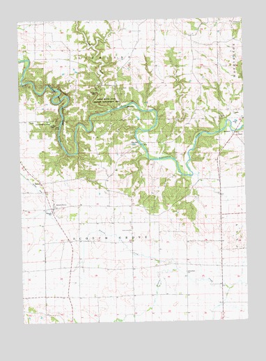
Scotch Grove, IA USGS Topographic Map
Click on map above to begin viewing in our Map Viewer.

This topographic map contains these locations and features:
Feature Name Type Latitude Longitude GNIS ID View Map
Camp Courageous of IowaLocaleN42.2081°W91.1076°455108View Map
Chimney RockSummitN42.2200°W91.0818°2001876View Map
Chimney Rock Indian Bluffs State Game Mgt ArParkN42.2164°W91.0738°455395View Map
Corbett's Mill BridgeBridgeN42.1983°W91.0740°2001895View Map
Dales FordPopulated PlaceN42.2145°W91.0668°464512View Map
Ebys MillPopulated PlaceN42.1997°W91.0590°464529View Map
Fuller's Mills Post Office (historical)Post OfficeN42.1861°W91.0224°2001789View Map
Fullers Mill (historical)LocaleN42.1872°W91.0288°466162View Map
Indian Bluffs State Wildlife Management AreaAreaN42.2167°W91.0768°464374View Map
Johnson (historical)Populated PlaceN42.1492°W91.0329°465531View Map
Johnson Post Office (historical)Post OfficeN42.1492°W91.0329°2001790View Map
Johnson Town CemeteryCemeteryN42.1453°W91.0338°457977View Map
Johnstown CemeteryCemeteryN42.1458°W91.0346°1669635View Map
Jurdan CreekStreamN42.2133°W91.0726°458013View Map
Pictured Rocks County ParkParkN42.2194°W91.1057°460123View Map
Prairie CreekStreamN42.1472°W91.0396°460393View Map
Scotch GrovePopulated PlaceN42.1728°W91.1076°461484View Map
Scotch Grove (historical)LocaleN42.1728°W91.1076°2001791View Map
Scotch Grove CemeteryCemeteryN42.1658°W91.0638°461485View Map
Scotch Grove CemeteryCemeteryN42.1651°W91.0641°461487View Map
Scotch Grove ChurchChurchN42.1625°W91.0649°461486View Map
Scotch Grove Post Office (historical)Post OfficeN42.1728°W91.1076°2001513View Map
SpringholePopulated PlaceN42.2183°W91.0976°464756View Map
Tibbetts CreekStreamN42.2342°W91.1210°462238View Map
Tibetts CreekStreamN42.2342°W91.1213°465396View Map
Township of Scotch GroveCivilN42.1648°W91.0727°468664View Map

Note: Coordinates in the location and feature list above are referenced to NAD83 datum.


Copyright (C) 2008-2025 Ryan Niemi / Sunset Dynamics ... All Rights Reserved