TopoQuest Logo
Do you find TopoQuest useful?
Help keep TopoQuest running and adding new maps/features by donating!
Bitcoin:  19c7KJd3qBynnjoSw5npx9KScwjBe4ifkT
Litecoin:  LXs6TkuXGGXo1vDsWCkWVdjQX94eUKd6ui
Home View Maps Find Maps Find Places Resources & Links


Hopkinton East, Iowa Topographic Map

USGS Map Title: Hopkinton East, IA
USGS Map MRC: 42091C2
DRG (GeoTIFF) Download: o42091c2.tif


Neighboring USGS Topographic Map Quads:


  Earlville, IA  
42091D3
 

  Dyersville West, IA  
42091D2
 

  Dyersville East, IA  
42091D1
 

  Hopkinton West, IA  
42091C3
 

  Hopkinton East, IA  
42091C2
 

  Cascade, IA  
42091C1
 

  Anamosa NE, IA  
42091B3
 

  Monticello, IA  
42091B2
 

  Scotch Grove, IA  
42091B1


Map MRC Location:

N43°
W92°
N43°
W91°
H8 H7 H6 H5 H4 H3 H2 H1
G8 G7 G6 G5 G4 G3 G2 G1
F8 F7 F6 F5 F4 F3 F2 F1
E8 E7 E6 E5 E4 E3 E2 E1
D8 D7 D6 D5 D4 D3 D2 D1
C8 C7 C6 C5 C4 C3 C2 C1
B8 B7 B6 B5 B4 B3 B2 B1
A8 A7 A6 A5 A4 A3 A2 A1
N42°
W92°
N42°
W91°

Hopkinton East, IA USGS 1:24K Topographic Map Preview:
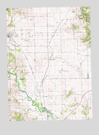
Hopkinton East, IA USGS Topographic Map
Click on map above to begin viewing in our Map Viewer.

This topographic map contains these locations and features:
Feature Name Type Latitude Longitude GNIS ID View Map
Camp De ShawLocaleN42.2611°W91.1349°455116View Map
City of HopkintonCivilN42.3431°W91.2487°2394419View Map
Cline CreekStreamN42.2650°W91.2051°455479View Map
Deer CreekStreamN42.2606°W91.2038°455863View Map
Delaware County Historical MuseumLocaleN42.3375°W91.2418°1999958View Map
East Monticello CemeteryCemeteryN42.2597°W91.1613°2001886View Map
Highway Thirty-Eight SpeedwayLocaleN42.3439°W91.2485°1999953View Map
HopkintonPopulated PlaceN42.3439°W91.2485°457659View Map
Hopkinton (historical)LocaleN42.3453°W91.2493°1999951View Map
Hopkinton Ambulance ServiceBuildingN42.3425°W91.2445°2599798View Map
Hopkinton CemeteryCemeteryN42.3422°W91.2382°2000005View Map
Hopkinton City HallBuildingN42.3433°W91.2476°1999949View Map
Hopkinton City ParkParkN42.3450°W91.2435°464381View Map
Hopkinton Family Medical CenterHospitalN42.3439°W91.2488°1999952View Map
Hopkinton Feed and Grain Incorporated ElevatorLocaleN42.3411°W91.2440°1999948View Map
Hopkinton Fire DepartmentBuildingN42.3425°W91.2445°2577303View Map
Hopkinton Post OfficePost OfficeN42.3439°W91.2485°1999955View Map
Hopkinton Public LibraryBuildingN42.3433°W91.2476°1999950View Map
Johnston Elementary SchoolSchoolN42.3476°W91.2489°1999957View Map
Junction SwitchPopulated PlaceN42.2767°W91.2029°464192View Map
Livingston CemeteryCemeteryN42.3275°W91.2436°458538View Map
Milo Number Seven School (historical)SchoolN42.3375°W91.2418°1999959View Map
Mount Pleasant CemeteryCemeteryN42.3618°W91.1478°2000007View Map
Sacred Heart CemeteryCemeteryN42.2608°W91.1905°460890View Map
Saint Luke Catholic ChurchChurchN42.3439°W91.2485°1999954View Map
Sand SpringsPopulated PlaceN42.3175°W91.1893°461406View Map
Sand Springs CemeteryCemeteryN42.3191°W91.1710°461407View Map
Sand Springs Post Office (historical)Post OfficeN42.3175°W91.1893°1999886View Map
Silver CreekStreamN42.2764°W91.2210°461626View Map
Township of LovellCivilN42.2523°W91.1888°468308View Map
Township of South ForkCivilN42.3394°W91.1984°468728View Map
United Methodist ChurchChurchN42.3467°W91.2460°1999956View Map
Walnut Acres CampgroundLocaleN42.2589°W91.1915°2001731View Map
Wet Creek BridgeBridgeN42.2583°W91.2265°2001896View Map
Willard CemeteryCemeteryN42.3642°W91.2199°2000006View Map

Note: Coordinates in the location and feature list above are referenced to NAD83 datum.


Copyright (C) 2008-2024 Ryan Niemi / Sunset Dynamics ... All Rights Reserved