TopoQuest Logo
Do you find TopoQuest useful?
Help keep TopoQuest running and adding new maps/features by donating!
Bitcoin:  19c7KJd3qBynnjoSw5npx9KScwjBe4ifkT
Litecoin:  LXs6TkuXGGXo1vDsWCkWVdjQX94eUKd6ui
Home View Maps Find Maps Find Places Resources & Links


Scotland, Georgia Topographic Map

USGS Map Title: Scotland, GA
USGS Map MRC: 32082A7
DRG (GeoTIFF) Download: o32082a7.tif


Neighboring USGS Topographic Map Quads:


  McRae NW, GA  
32082B8
 

  Alamo, GA  
32082B7
 

  Glenwood, GA  
32082B6
 

  McRae, GA  
32082A8
 

  Scotland, GA  
32082A7
 

  Jordan, GA  
32082A6
 

  Workmore, GA  
31082H8
 

  Jacksonville NE, GA  
31082H7
 

  Lumber City, GA  
31082H6


Map MRC Location:

N33°
W83°
N33°
W82°
H8 H7 H6 H5 H4 H3 H2 H1
G8 G7 G6 G5 G4 G3 G2 G1
F8 F7 F6 F5 F4 F3 F2 F1
E8 E7 E6 E5 E4 E3 E2 E1
D8 D7 D6 D5 D4 D3 D2 D1
C8 C7 C6 C5 C4 C3 C2 C1
B8 B7 B6 B5 B4 B3 B2 B1
A8 A7 A6 A5 A4 A3 A2 A1
N32°
W83°
N32°
W82°

Scotland, GA USGS 1:24K Topographic Map Preview:
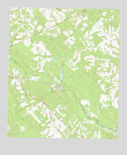
Scotland, GA USGS Topographic Map
Click on map above to begin viewing in our Map Viewer.

This topographic map contains these locations and features:
Feature Name Type Latitude Longitude GNIS ID View Map
Alamo DivisionCivilN32.1182°W82.7972°1936071View Map
AvantsPopulated PlaceN32.1102°W82.8593°331068View Map
Bay Springs ChurchChurchN32.0924°W82.8485°354492View Map
Browning CemeteryCemeteryN32.0068°W82.8085°311882View Map
Browning CemeteryCemeteryN32.0099°W82.8060°311883View Map
City of ScotlandCivilN32.0472°W82.8181°2405431View Map
Cleggs LakeReservoirN32.0608°W82.8148°341494View Map
Cleggs Lake DamDamN32.0585°W82.8149°341493View Map
Clements CemeteryCemeteryN32.0304°W82.7685°312732View Map
Davis ChapelChurchN32.0107°W82.7507°313345View Map
ErickPopulated PlaceN32.1232°W82.8315°331667View Map
Erick ChurchChurchN32.1249°W82.8315°351272View Map
Flanders LakeReservoirN32.0755°W82.8233°341059View Map
Flanders Lake DamDamN32.0718°W82.8215°341058View Map
Hinson CemeteryCemeteryN32.1229°W82.8224°315456View Map
Little CreekStreamN32.0496°W82.8082°317004View Map
McDuffie CemeteryCemeteryN32.0554°W82.8632°317902View Map
McRae Correctional InstitutionBuildingN32.0508°W82.8724°2735753View Map
McRae-Helena DivisionCivilN32.0243°W82.8734°1936387View Map
Mill CreekStreamN32.0566°W82.8151°318223View Map
Purvis CemeteryCemeteryN32.0877°W82.7604°321235View Map
ScotlandPopulated PlaceN32.0488°W82.8171°356523View Map
Scotland Fire DepartmentBuildingN32.0502°W82.8173°2604932View Map
Stenson LakeReservoirN32.0100°W82.8160°340351View Map
Stenson Lake DamDamN32.0085°W82.8165°340350View Map
Stuart ChapelChurchN32.1246°W82.8213°323700View Map
Talmadge LakeReservoirN32.0182°W82.8359°335980View Map
Talmadge Lake DamDamN32.0168°W82.8349°335979View Map
Telfair Memorial GardensCemeteryN32.0568°W82.8679°323974View Map
TownsPopulated PlaceN32.0043°W82.7546°333253View Map
Union ChurchChurchN32.0980°W82.7657°324517View Map
WDAX-AM (Mcrae)TowerN32.0571°W82.8654°352494View Map
WDAX-FM (McRae)TowerN32.0571°W82.8654°352734View Map
Wilcox CreekStreamN32.0746°W82.8707°325264View Map
Williams CemeteryCemeteryN32.1110°W82.8643°325330View Map

Note: Coordinates in the location and feature list above are referenced to NAD83 datum.


Copyright (C) 2008-2025 Ryan Niemi / Sunset Dynamics ... All Rights Reserved