TopoQuest Logo
Do you find TopoQuest useful?
Help keep TopoQuest running and adding new maps/features by donating!
Bitcoin:  19c7KJd3qBynnjoSw5npx9KScwjBe4ifkT
Litecoin:  LXs6TkuXGGXo1vDsWCkWVdjQX94eUKd6ui
Home View Maps Find Maps Find Places Resources & Links


Jordan, Georgia Topographic Map

USGS Map Title: Jordan, GA
USGS Map MRC: 32082A6
DRG (GeoTIFF) Download: o32082a6.tif


Neighboring USGS Topographic Map Quads:


  Alamo, GA  
32082B7
 

  Glenwood, GA  
32082B6
 

  Mount Vernon, GA  
32082B5
 

  Scotland, GA  
32082A7
 

  Jordan, GA  
32082A6
 

  Uvalda, GA  
32082A5
 

  Jacksonville NE, GA  
31082H7
 

  Lumber City, GA  
31082H6
 

  Hazlehurst North, GA  
31082H5


Map MRC Location:

N33°
W83°
N33°
W82°
H8 H7 H6 H5 H4 H3 H2 H1
G8 G7 G6 G5 G4 G3 G2 G1
F8 F7 F6 F5 F4 F3 F2 F1
E8 E7 E6 E5 E4 E3 E2 E1
D8 D7 D6 D5 D4 D3 D2 D1
C8 C7 C6 C5 C4 C3 C2 C1
B8 B7 B6 B5 B4 B3 B2 B1
A8 A7 A6 A5 A4 A3 A2 A1
N32°
W83°
N32°
W82°

Jordan, GA USGS 1:24K Topographic Map Preview:
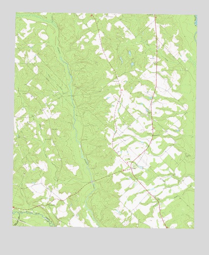
Jordan, GA USGS Topographic Map
Click on map above to begin viewing in our Map Viewer.

This topographic map contains these locations and features:
Feature Name Type Latitude Longitude GNIS ID View Map
Adams CemeteryCemeteryN32.0680°W82.6576°310392View Map
Benton CemeteryCemeteryN32.0857°W82.6782°311101View Map
Browning CemeteryCemeteryN32.1238°W82.6874°311884View Map
Browning ChurchChurchN32.0777°W82.7404°311886View Map
Camp CreekStreamN32.0785°W82.7112°312211View Map
Clark CemeteryCemeteryN32.0991°W82.6535°312684View Map
Eddards CreekStreamN32.0268°W82.6965°313848View Map
Free Run ChurchChurchN32.0555°W82.6549°314364View Map
Glenwood DivisionCivilN32.1162°W82.6685°1936288View Map
Hope ChurchChurchN32.0968°W82.6529°315629View Map
Horne Mission ChurchChurchN32.0513°W82.7235°315674View Map
JordanPopulated PlaceN32.0349°W82.6687°332120View Map
Little CreekStreamN32.1193°W82.7249°317029View Map
Livingston CemeteryCemeteryN32.0427°W82.6312°317261View Map
Lotts CreekStreamN32.0977°W82.6262°317423View Map
Pleasant Hill ChurchChurchN32.0571°W82.7243°320879View Map
Sardis ChurchChurchN32.0443°W82.6785°322538View Map
Shiloh ChurchChurchN32.0182°W82.6515°322866View Map
Smith PondReservoirN32.1022°W82.6708°341632View Map
Smith Pond DamDamN32.1035°W82.6715°341631View Map
Spencer and Baker CemeteryCemeteryN32.0105°W82.6699°351274View Map
Spring HillPopulated PlaceN32.0132°W82.7254°326527View Map
Spring Hill Baptist ChurchChurchN32.0132°W82.7249°351275View Map
Spring Hill Methodist ChurchChurchN32.0113°W82.7274°351276View Map
Springhill Volunteer Fire DepartmentBuildingN32.0140°W82.7246°2604772View Map
Starlight CemeteryCemeteryN32.1246°W82.6546°323527View Map
Stewart PondReservoirN32.0358°W82.6623°341057View Map
Stewart Pond DamDamN32.0352°W82.6599°341056View Map
Wheeler CountyCivilN32.1171°W82.7246°351278View Map

Note: Coordinates in the location and feature list above are referenced to NAD83 datum.


Copyright (C) 2008-2025 Ryan Niemi / Sunset Dynamics ... All Rights Reserved