TopoQuest Logo
Do you find TopoQuest useful?
Help keep TopoQuest running and adding new maps/features by donating!
Bitcoin:  19c7KJd3qBynnjoSw5npx9KScwjBe4ifkT
Litecoin:  LXs6TkuXGGXo1vDsWCkWVdjQX94eUKd6ui
Home View Maps Find Maps Find Places Resources & Links


McRae NW, Georgia Topographic Map

USGS Map Title: McRae NW, GA
USGS Map MRC: 32082B8
DRG (GeoTIFF) Download: o32082b8.tif


Neighboring USGS Topographic Map Quads:


  Cadwell, GA  
32083C1
 

  Five Points, GA  
32082C8
 

  Lowery, GA  
32082C7
 

  Jay Bird Springs, GA  
32083B1
 

  McRae NW, GA  
32082B8
 

  Alamo, GA  
32082B7
 

  Milan, GA  
32083A1
 

  McRae, GA  
32082A8
 

  Scotland, GA  
32082A7


Map MRC Location:

N33°
W83°
N33°
W82°
H8 H7 H6 H5 H4 H3 H2 H1
G8 G7 G6 G5 G4 G3 G2 G1
F8 F7 F6 F5 F4 F3 F2 F1
E8 E7 E6 E5 E4 E3 E2 E1
D8 D7 D6 D5 D4 D3 D2 D1
C8 C7 C6 C5 C4 C3 C2 C1
B8 B7 B6 B5 B4 B3 B2 B1
A8 A7 A6 A5 A4 A3 A2 A1
N32°
W83°
N32°
W82°

McRae NW, GA USGS 1:24K Topographic Map Preview:
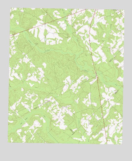
McRae NW, GA USGS Topographic Map
Click on map above to begin viewing in our Map Viewer.

This topographic map contains these locations and features:
Feature Name Type Latitude Longitude GNIS ID View Map
Antioch CemeteryCemeteryN32.2207°W82.8960°310554View Map
Big BranchStreamN32.1321°W82.9104°311312View Map
Burch CemeteryCemeteryN32.2068°W82.9143°312039View Map
Cedar Grove SchoolSchoolN32.2477°W82.8818°346505View Map
Doctor Alfred Tennyson Coleman Memorial BridgeBridgeN32.1902°W82.9046°346527View Map
Harrelson CemeteryCemeteryN32.1388°W82.8968°315174View Map
Lime Sink CreekStreamN32.2063°W82.9254°316870View Map
Little Joiner CreekStreamN32.1755°W82.9979°317104View Map
Long BranchStreamN32.2443°W82.9382°317327View Map
Mount Olivet ChurchChurchN32.1441°W82.9113°318786View Map
New Bethel ChurchChurchN32.1585°W82.9365°319276View Map
New Hope CemeteryCemeteryN32.2243°W82.9349°319353View Map
New Hope Church (historical)ChurchN32.2246°W82.9363°346592View Map
Sigurd (historical)Populated PlaceN32.1471°W82.9901°348146View Map
Whitewater CreekStreamN32.1841°W82.8851°325227View Map
Whitewater School (historical)SchoolN32.2143°W82.8899°346648View Map

Note: Coordinates in the location and feature list above are referenced to NAD83 datum.


Copyright (C) 2008-2024 Ryan Niemi / Sunset Dynamics ... All Rights Reserved