TopoQuest Logo
Do you find TopoQuest useful?
Help keep TopoQuest running and adding new maps/features by donating!
Bitcoin:  19c7KJd3qBynnjoSw5npx9KScwjBe4ifkT
Litecoin:  LXs6TkuXGGXo1vDsWCkWVdjQX94eUKd6ui
Home View Maps Find Maps Find Places Resources & Links


Scottsville, Kentucky Topographic Map

USGS Map Title: Scottsville, KY
USGS Map MRC: 36086G2
DRG (GeoTIFF) Download: o36086g2.tif


Neighboring USGS Topographic Map Quads:


  Polkville, KY  
36086H3
 

  Meador, KY  
36086H2
 

  Lucas, KY  
36086H1
 

  Allen Springs, KY  
36086G3
 

  Scottsville, KY  
36086G2
 

  Austin, KY  
36086G1
 

  Adolphus, KY  
36086F3
 

  Petroleum, KY  
36086F2
 

  Holland, KY  
36086F1


Map MRC Location:

N37°
W87°
N37°
W86°
H8 H7 H6 H5 H4 H3 H2 H1
G8 G7 G6 G5 G4 G3 G2 G1
F8 F7 F6 F5 F4 F3 F2 F1
E8 E7 E6 E5 E4 E3 E2 E1
D8 D7 D6 D5 D4 D3 D2 D1
C8 C7 C6 C5 C4 C3 C2 C1
B8 B7 B6 B5 B4 B3 B2 B1
A8 A7 A6 A5 A4 A3 A2 A1
N36°
W87°
N36°
W86°

Scottsville, KY USGS 1:24K Topographic Map Preview:
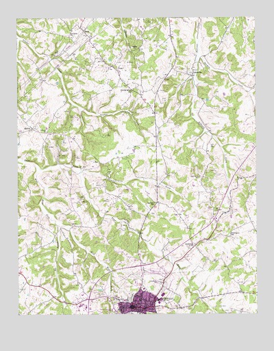
Scottsville, KY USGS Topographic Map
Click on map above to begin viewing in our Map Viewer.

This topographic map contains these locations and features:
Feature Name Type Latitude Longitude GNIS ID View Map
Allen CountyCivilN36.7513°W86.1904°516848View Map
Bethlehem Missionary Baptist ChurchChurchN36.7792°W86.1577°487013View Map
Big BranchStreamN36.7873°W86.2294°487129View Map
Chestnut Point SchoolSchoolN36.7517°W86.1355°489462View Map
Clifton General Baptist ChurchChurchN36.8619°W86.1874°489672View Map
Crescent Hill CemeteryCemeteryN36.7631°W86.1758°490324View Map
GainesvillePopulated PlaceN36.8506°W86.1583°492651View Map
Greenville ChurchChurchN36.8670°W86.2208°493345View Map
HalifaxPopulated PlaceN36.8284°W86.2422°508161View Map
Halifax Volunteer Fire DepartmentBuildingN36.8300°W86.2440°2637363View Map
Harrison SchoolSchoolN36.7967°W86.1783°493819View Map
Jacksonian Hotel Historical MarkerParkN36.7531°W86.1908°2744126View Map
Liberty Baptist ChurchChurchN36.8271°W86.2349°496364View Map
North Prong Bays ForkStreamN36.8106°W86.2169°501360View Map
ScottsvillePopulated PlaceN36.7534°W86.1905°503118View Map
Scottsville Fire Department Station 1BuildingN36.7541°W86.1917°2636476View Map
SettlePopulated PlaceN36.8695°W86.2144°509032View Map
Settle DivisionCivilN36.8512°W86.1694°1937248View Map
Sinking Spring SchoolSchoolN36.8448°W86.1883°503575View Map
Solomon CreekStreamN36.8589°W86.1550°503871View Map
Tabor CemeteryCemeteryN36.8331°W86.2203°504902View Map
The Medical CenterHospitalN36.7615°W86.2149°2660405View Map
Washington SchoolSchoolN36.7837°W86.1386°506249View Map
West Bays ForkStreamN36.8123°W86.2403°506405View Map
YessePopulated PlaceN36.8531°W86.1972°509420View Map

Note: Coordinates in the location and feature list above are referenced to NAD83 datum.


Copyright (C) 2008-2025 Ryan Niemi / Sunset Dynamics ... All Rights Reserved