TopoQuest Logo
Do you find TopoQuest useful?
Help keep TopoQuest running and adding new maps/features by donating!
Bitcoin:  19c7KJd3qBynnjoSw5npx9KScwjBe4ifkT
Litecoin:  LXs6TkuXGGXo1vDsWCkWVdjQX94eUKd6ui
Home View Maps Find Maps Find Places Resources & Links


Petroleum, Kentucky Topographic Map

USGS Map Title: Petroleum, KY
USGS Map MRC: 36086F2
DRG (GeoTIFF) Download: o36086f2.tif


Neighboring USGS Topographic Map Quads:


  Allen Springs, KY  
36086G3
 

  Scottsville, KY  
36086G2
 

  Austin, KY  
36086G1
 

  Adolphus, KY  
36086F3
 

  Petroleum, KY  
36086F2
 

  Holland, KY  
36086F1
 

  Turners Station, TN  
36086E3
 

  Westmoreland, TN  
36086E2
 

  Lafayette, TN  
36086E1


Map MRC Location:

N37°
W87°
N37°
W86°
H8 H7 H6 H5 H4 H3 H2 H1
G8 G7 G6 G5 G4 G3 G2 G1
F8 F7 F6 F5 F4 F3 F2 F1
E8 E7 E6 E5 E4 E3 E2 E1
D8 D7 D6 D5 D4 D3 D2 D1
C8 C7 C6 C5 C4 C3 C2 C1
B8 B7 B6 B5 B4 B3 B2 B1
A8 A7 A6 A5 A4 A3 A2 A1
N36°
W87°
N36°
W86°

Petroleum, KY USGS 1:24K Topographic Map Preview:
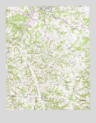
Petroleum, KY USGS Topographic Map
Click on map above to begin viewing in our Map Viewer.

This topographic map contains these locations and features:
Feature Name Type Latitude Longitude GNIS ID View Map
Allen County Ambulance ServiceBuildingN36.7482°W86.1978°2719110View Map
Allen County Sheriff's OfficeBuildingN36.7484°W86.1921°2767502View Map
BarefootPopulated PlaceN36.6359°W86.1922°1314625View Map
Carters Tabernacle Church of GodChurchN36.6580°W86.2298°489005View Map
Casey BranchStreamN36.6975°W86.2305°489040View Map
Cider Press HollowValleyN36.6320°W86.1830°1280560View Map
City of ScottsvilleCivilN36.7493°W86.1966°2405434View Map
Concord United Methodist ChurchChurchN36.6774°W86.2160°489922View Map
Doddy ChurchChurchN36.6903°W86.1403°490954View Map
Doddy SchoolSchoolN36.6687°W86.1325°490955View Map
Dover Missionary Baptist ChurchChurchN36.7118°W86.1873°491068View Map
Dry BranchStreamN36.6373°W86.1972°1282892View Map
Finns RiverStreamN36.6723°W86.2489°492088View Map
Flag Lick CreekStreamN36.6917°W86.1855°492161View Map
Florida CreekStreamN36.6495°W86.2030°492267View Map
Forest SpringsPopulated PlaceN36.6589°W86.1611°508022View Map
Forest Springs Post Office (historical)Post OfficeN36.6589°W86.1611°1926480View Map
Garrett CreekStreamN36.6703°W86.2494°492724View Map
Hickory Hill ChurchChurchN36.7448°W86.2472°494134View Map
Jacks Hollowk BranchStreamN36.7400°W86.1880°495094View Map
Little Trammel CreekStreamN36.7024°W86.2471°496881View Map
Macedonia Baptist ChurchChurchN36.6433°W86.2186°497407View Map
Maple Grove ChurchChurchN36.6545°W86.1730°497506View Map
Maple Grove General Baptist ChurchChurchN36.6546°W86.1734°2647157View Map
Mount Carmel ChurchChurchN36.6992°W86.1550°498699View Map
Mount Pleasant United Methodist ChurchChurchN36.7095°W86.2285°498830View Map
Mount Union (historical)Populated PlaceN36.6491°W86.1447°2742849View Map
Mount Union SchoolSchoolN36.6478°W86.1422°498879View Map
Mount Union United Methodist ChurchChurchN36.6499°W86.1488°498873View Map
Nancy CemeteryCemeteryN36.6706°W86.1850°499161View Map
Old Carter CemeteryCemeteryN36.6314°W86.2411°1296287View Map
PetroleumPopulated PlaceN36.6953°W86.2483°500484View Map
Pleasant Field SchoolSchoolN36.7245°W86.1503°500800View Map
Pleasant Grove ChurchChurchN36.6814°W86.1511°500807View Map
Pleasant Hill ChurchChurchN36.7220°W86.1430°500848View Map
RodemerPopulated PlaceN36.7192°W86.2294°508962View Map
Rough CreekStreamN36.6892°W86.2213°502379View Map
Rough Creek ChurchChurchN36.6864°W86.1905°502380View Map
Scottsville DivisionCivilN36.7469°W86.1598°1937245View Map
Scottsville Fire Department Station 2BuildingN36.7364°W86.2219°2636698View Map
Scottsville Police DepartmentBuildingN36.7487°W86.1921°2767628View Map
Shady Grove SchoolSchoolN36.7014°W86.2011°503221View Map
Snake CreekStreamN36.6800°W86.2155°503838View Map
South Allen Fire DepartmentBuildingN36.6470°W86.1486°2636983View Map
Steenbergen SpringSpringN36.7495°W86.1394°504314View Map
Union Chapel SchoolSchoolN36.6770°W86.1814°505772View Map
Union Chapel United Methodist ChurchChurchN36.6789°W86.1881°505767View Map
Union Chapel United Methodist ChurchChurchN36.6773°W86.1829°2647152View Map
Wagoner HollowValleyN36.6549°W86.2435°506102View Map
Walnut GrovePopulated PlaceN36.6579°W86.2235°2742852View Map
Watkins BranchStreamN36.7306°W86.2428°506273View Map
White Plains (historical)Populated PlaceN36.7392°W86.2167°2742853View Map
White Plains SchoolSchoolN36.7384°W86.2139°506636View Map
WLCK-AM (Scottsville)TowerN36.7400°W86.1722°517897View Map
Wolf CemeteryCemeteryN36.6628°W86.2461°506991View Map
WVLE-FM (Scottsville)TowerN36.7403°W86.1753°518020View Map

Note: Coordinates in the location and feature list above are referenced to NAD83 datum.


Copyright (C) 2008-2024 Ryan Niemi / Sunset Dynamics ... All Rights Reserved