TopoQuest Logo
Do you find TopoQuest useful?
Help keep TopoQuest running and adding new maps/features by donating!
Bitcoin:  19c7KJd3qBynnjoSw5npx9KScwjBe4ifkT
Litecoin:  LXs6TkuXGGXo1vDsWCkWVdjQX94eUKd6ui
Home View Maps Find Maps Find Places Resources & Links


Scranton, Kentucky Topographic Map

USGS Map Title: Scranton, KY
USGS Map MRC: 37083H5
DRG (GeoTIFF) Download: o37083h5.tif


Neighboring USGS Topographic Map Quads:


  Olympia, KY  
38083A6
 

  Salt Lick, KY  
38083A5
 

  Bangor, KY  
38083A4
 

  Frenchburg, KY  
37083H6
 

  Scranton, KY  
37083H5
 

  Ezel, KY  
37083H4
 

  Slade, KY  
37083G6
 

  Pomeroyton, KY  
37083G5
 

  Hazel Green, KY  
37083G4


Map MRC Location:

N38°
W84°
N38°
W83°
H8 H7 H6 H5 H4 H3 H2 H1
G8 G7 G6 G5 G4 G3 G2 G1
F8 F7 F6 F5 F4 F3 F2 F1
E8 E7 E6 E5 E4 E3 E2 E1
D8 D7 D6 D5 D4 D3 D2 D1
C8 C7 C6 C5 C4 C3 C2 C1
B8 B7 B6 B5 B4 B3 B2 B1
A8 A7 A6 A5 A4 A3 A2 A1
N37°
W84°
N37°
W83°

Scranton, KY USGS 1:24K Topographic Map Preview:
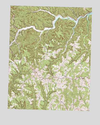
Scranton, KY USGS Topographic Map
Click on map above to begin viewing in our Map Viewer.

This topographic map contains these locations and features:
Feature Name Type Latitude Longitude GNIS ID View Map
Auger Hole BranchStreamN37.8959°W83.5602°510323View Map
Barker CemeteryCemeteryN37.9245°W83.5730°510402View Map
Bashford CemeteryCemeteryN37.9787°W83.5591°510426View Map
Becky Jane HollowValleyN37.9149°W83.6094°510495View Map
Bethel ChurchChurchN37.9715°W83.5819°510571View Map
Betty Gap RidgeRidgeN37.9440°W83.5299°510583View Map
Betty Gap SchoolSchoolN37.9451°W83.5341°510584View Map
Big Oak HollowValleyN37.9569°W83.5372°510682View Map
Blythes BranchStreamN37.9517°W83.6246°510814View Map
Board Cut BranchStreamN37.9884°W83.5177°510816View Map
Botts (historical)Populated PlaceN37.9178°W83.5374°2400752View Map
Botts Christian ChurchChurchN37.9158°W83.5364°2400753View Map
Botts Elementary SchoolSchoolN37.9170°W83.5374°516722View Map
Botts Fire DepartmentBuildingN37.9152°W83.5394°2636971View Map
Botts ForkStreamN37.9490°W83.5063°510862View Map
Brewer HollowValleyN37.9736°W83.5291°510904View Map
Brier BranchStreamN37.9715°W83.5696°510919View Map
Brushy ForkStreamN37.9929°W83.5027°510979View Map
Byrd CemeteryCemeteryN37.9034°W83.5160°511116View Map
Carter BranchStreamN37.9911°W83.5092°2785226View Map
City of FrenchburgCivilN37.9540°W83.6227°2403664View Map
Clifton CreekStreamN37.9687°W83.5766°516723View Map
Clifton SchoolSchoolN37.9717°W83.5735°511405View Map
Cold Cave SchoolSchoolN37.9923°W83.5019°511454View Map
Corner RidgeRidgeN37.8820°W83.5935°511549View Map
Craig HillSummitN37.9857°W83.6201°2416633View Map
Cubilo HollowValleyN37.9074°W83.6162°511671View Map
DennistonPopulated PlaceN37.9159°W83.5380°511788View Map
Denniston CemeteryCemeteryN37.9067°W83.5535°511789View Map
Denniston Post OfficePost OfficeN37.9158°W83.5360°2400768View Map
Dock HollowValleyN37.9488°W83.5859°511842View Map
Donathan RockSummitN37.9531°W83.6182°511863View Map
Egelston CemeteryCemeteryN37.8976°W83.6046°512015View Map
Fletcher RidgeRidgeN37.8904°W83.5752°512205View Map
Frenchburg DivisionCivilN37.9529°W83.5390°1937013View Map
Green Gose BranchStreamN37.8759°W83.6005°512434View Map
Hackney BranchStreamN37.9698°W83.6107°512496View Map
Halfway BranchStreamN37.9726°W83.5977°512512View Map
Hill Top (historical)Populated PlaceN37.9861°W83.6192°2400783View Map
Hill Top Church of GodChurchN37.9856°W83.6185°512710View Map
Hog BranchStreamN37.9723°W83.5657°512721View Map
Holland BranchStreamN37.9929°W83.5669°512744View Map
Ingram CemeteryCemeteryN37.9876°W83.5532°512920View Map
Jim BranchStreamN37.9901°W83.5594°513009View Map
Josie BranchStreamN37.8915°W83.5852°513082View Map
Kendrick HollowValleyN37.9531°W83.5386°513118View Map
Kendrick RidgeRidgeN37.9654°W83.5549°513119View Map
Kendrick Ridge ChurchChurchN37.9448°W83.5674°516724View Map
Kendrick Ridge SchoolSchoolN37.9448°W83.5666°513120View Map
Kinster BranchStreamN37.9931°W83.5019°513158View Map
Landsaw BranchStreamN37.8881°W83.5663°513200View Map
Laurel Grove (historical)Populated PlaceN37.9206°W83.5850°2400787View Map
Laurel Springs Baptist ChurchChurchN37.9201°W83.5852°516725View Map
Lawson BranchStreamN37.9365°W83.5891°513271View Map
Long BranchStreamN37.9631°W83.5777°513598View Map
Lovelace CemeteryCemeteryN37.9120°W83.5719°513650View Map
MaribaPopulated PlaceN37.9162°W83.5785°513788View Map
Mariba Church of GodChurchN37.9201°W83.5852°513789View Map
Mariba ForkStreamN37.8881°W83.5663°513790View Map
Mariba Post Office (historical)Post OfficeN37.9167°W83.5801°2416642View Map
McCausey Post Office (historical)Post OfficeN37.9330°W83.6171°2400789View Map
McCausey Railroad Station (historical)LocaleN37.9327°W83.6176°2400790View Map
McCausey Ridge (historical)Populated PlaceN37.9297°W83.6168°2400791View Map
McCausey Ridge CemeteryCemeteryN37.9304°W83.6205°513849View Map
McCausey Ridge Lookout TowerTowerN37.9354°W83.6132°517239View Map
McCausey Ridge SchoolSchoolN37.9292°W83.6166°513850View Map
Menifee CountyCivilN37.9414°W83.5989°516929View Map
Menifee County Ambulance ServiceBuildingN37.9451°W83.5980°2719156View Map
Meyers ForkStreamN37.9829°W83.5207°513915View Map
Morgan HollowValleyN37.9008°W83.6229°514060View Map
Myers Fork SchoolSchoolN37.9706°W83.5269°513916View Map
Owens BranchStreamN37.9540°W83.6207°514391View Map
Ponder BranchStreamN37.9626°W83.6144°514704View Map
Powers CemeteryCemeteryN37.9229°W83.5382°514756View Map
RatliffPopulated PlaceN37.9962°W83.5749°514840View Map
Ratliff CreekStreamN37.9845°W83.5527°514842View Map
Ratliff School (historical)SchoolN37.9961°W83.5753°2416647View Map
Richardson BranchStreamN37.9948°W83.5782°514912View Map
ScrantonPopulated PlaceN37.9873°W83.5216°515303View Map
Scranton Post Office (historical)Post OfficeN37.9909°W83.5260°2400807View Map
Simpkins HollowValleyN37.9497°W83.5832°515428View Map
Slab Camp BranchStreamN37.9873°W83.5202°515462View Map
Station CemeteryCemeteryN37.9856°W83.5446°515671View Map
Suiters BranchStreamN37.9659°W83.6132°515803View Map
Tarr RidgeRidgeN37.9081°W83.5991°515869View Map
Tarr Ridge ChurchChurchN37.8998°W83.6030°516728View Map
Tarr Ridge SchoolSchoolN37.9006°W83.6024°515870View Map
Taylor HollowValleyN37.9631°W83.5316°515881View Map
Thomas BranchStreamN37.9856°W83.5369°515925View Map
Tolan CreekStreamN37.9570°W83.6171°515963View Map
Trace BranchStreamN37.9704°W83.6074°516006View Map
Trimble Bend (historical)Populated PlaceN37.8862°W83.5439°2417210View Map
Trimble Bend SchoolSchoolN37.8859°W83.5446°516021View Map
United States Weather StationBuildingN37.8904°W83.5785°516766View Map
Wagers HollowValleyN37.9760°W83.5279°516195View Map
Welch CemeteryCemeteryN37.9398°W83.5146°516259View Map
Welch ChurchChurchN37.9403°W83.5147°2094829View Map
Welch ForkStreamN37.9440°W83.5038°516260View Map
WellingtonPopulated PlaceN37.9145°W83.5119°516267View Map
Wellington Post OfficePost OfficeN37.9141°W83.5121°2400817View Map
Wells SchoolSchoolN37.9059°W83.5069°516269View Map
West Denniston (historical)Populated PlaceN37.9264°W83.5632°2400818View Map
Wynn BranchStreamN37.9401°W83.5841°516495View Map

Note: Coordinates in the location and feature list above are referenced to NAD83 datum.


Copyright (C) 2008-2024 Ryan Niemi / Sunset Dynamics ... All Rights Reserved