TopoQuest Logo
Do you find TopoQuest useful?
Help keep TopoQuest running and adding new maps/features by donating!
Bitcoin:  19c7KJd3qBynnjoSw5npx9KScwjBe4ifkT
Litecoin:  LXs6TkuXGGXo1vDsWCkWVdjQX94eUKd6ui
Home View Maps Find Maps Find Places Resources & Links


Bison, Oklahoma Topographic Map

USGS Map Title: Bison, OK
USGS Map MRC: 36097B8
DRG (GeoTIFF) Download: o36097b8.tif


Neighboring USGS Topographic Map Quads:


  Drummond, OK  
36098C1
 

  Waukomis, OK  
36097C8
 

  Enid SE, OK  
36097C7
 

  Barr, OK  
36098B1
 

  Bison, OK  
36097B8
 

  Steinerts Lake, OK  
36097B7
 

  Lacey, OK  
36098A1
 

  Hennessey, OK  
36097A8
 

  Union, OK  
36097A7


Map MRC Location:

N37°
W98°
N37°
W97°
H8 H7 H6 H5 H4 H3 H2 H1
G8 G7 G6 G5 G4 G3 G2 G1
F8 F7 F6 F5 F4 F3 F2 F1
E8 E7 E6 E5 E4 E3 E2 E1
D8 D7 D6 D5 D4 D3 D2 D1
C8 C7 C6 C5 C4 C3 C2 C1
B8 B7 B6 B5 B4 B3 B2 B1
A8 A7 A6 A5 A4 A3 A2 A1
N36°
W98°
N36°
W97°

Bison, OK USGS 1:24K Topographic Map Preview:
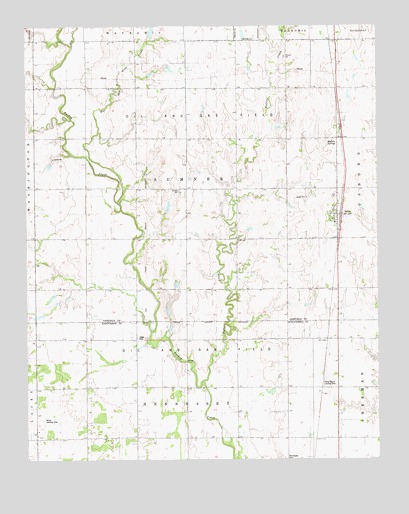
Bison, OK USGS Topographic Map
Click on map above to begin viewing in our Map Viewer.

This topographic map contains these locations and features:
Feature Name Type Latitude Longitude GNIS ID View Map
BisonPopulated PlaceN36.1964°W97.8901°1090170View Map
Bison Census Designated PlaceCensusN36.1959°W97.8979°2629907View Map
Buffalo CreekStreamN36.1478°W97.9373°1090645View Map
Buffalo SpringsSpringN36.2160°W97.8928°1738117View Map
Buffalo Springs Stage Station (historical)Populated PlaceN36.1911°W97.9117°2438093View Map
Dry CreekStreamN36.2445°W97.9834°1092237View Map
Hell and Gone CreekStreamN36.1995°W97.9673°1093655View Map
Hope CemeteryCemeteryN36.1600°W97.9609°1093912View Map
Miller Landing Strip (historical)AirportN36.1364°W97.9942°1738118View Map
Oknoname 04701 DamDamN36.1667°W97.9370°1754326View Map
Oknoname 04701 ReservoirReservoirN36.1667°W97.9370°1754327View Map
Pribyl Ranch Landing StripAirportN36.1473°W97.8948°1747123View Map
Township of SumnerCivilN36.2028°W97.9420°1825597View Map

Note: Coordinates in the location and feature list above are referenced to NAD83 datum.


Copyright (C) 2008-2025 Ryan Niemi / Sunset Dynamics ... All Rights Reserved