TopoQuest Logo
Do you find TopoQuest useful?
Help keep TopoQuest running and adding new maps/features by donating!
Bitcoin:  19c7KJd3qBynnjoSw5npx9KScwjBe4ifkT
Litecoin:  LXs6TkuXGGXo1vDsWCkWVdjQX94eUKd6ui
Home View Maps Find Maps Find Places Resources & Links


Lacey, Oklahoma Topographic Map

USGS Map Title: Lacey, OK
USGS Map MRC: 36098A1
DRG (GeoTIFF) Download: o36098a1.tif


Neighboring USGS Topographic Map Quads:


  Ames, OK  
36098B2
 

  Barr, OK  
36098B1
 

  Bison, OK  
36097B8
 

  Parvin, OK  
36098A2
 

  Lacey, OK  
36098A1
 

  Hennessey, OK  
36097A8
 

  Loyal NW, OK  
35098H2
 

  Loyal, OK  
35098H1
 

  Dover, OK  
35097H8


Map MRC Location:

N37°
W99°
N37°
W98°
H8 H7 H6 H5 H4 H3 H2 H1
G8 G7 G6 G5 G4 G3 G2 G1
F8 F7 F6 F5 F4 F3 F2 F1
E8 E7 E6 E5 E4 E3 E2 E1
D8 D7 D6 D5 D4 D3 D2 D1
C8 C7 C6 C5 C4 C3 C2 C1
B8 B7 B6 B5 B4 B3 B2 B1
A8 A7 A6 A5 A4 A3 A2 A1
N36°
W99°
N36°
W98°

Lacey, OK USGS 1:24K Topographic Map Preview:
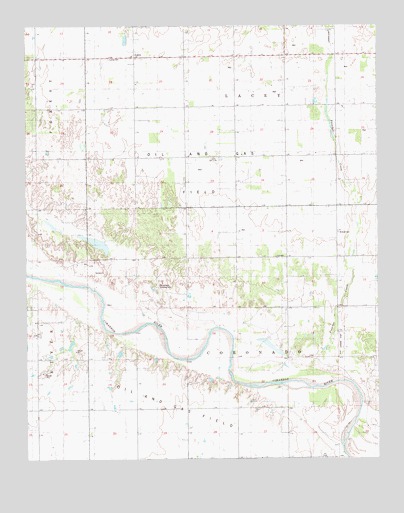
Lacey, OK USGS Topographic Map
Click on map above to begin viewing in our Map Viewer.

This topographic map contains these locations and features:
Feature Name Type Latitude Longitude GNIS ID View Map
Bollenbach Landing Strip (historical)AirportN36.0475°W98.0448°1777565View Map
Huff Landing Strip (historical)AirportN36.0328°W98.0131°1777564View Map
LaceyPopulated PlaceN36.1161°W98.0862°1100558View Map
Lacey CemeteryCemeteryN36.1154°W98.0955°1777566View Map
Mound Ridge SchoolSchoolN36.0584°W98.0153°1095550View Map
Preacher CreekStreamN36.0264°W98.0248°1096919View Map
Township of CoronadoCivilN36.0306°W98.0476°1825565View Map
Township of LaceyCivilN36.1084°W98.0476°1825557View Map
Wilhite CemeteryCemeteryN36.0653°W98.0144°1099811View Map

Note: Coordinates in the location and feature list above are referenced to NAD83 datum.


Copyright (C) 2008-2025 Ryan Niemi / Sunset Dynamics ... All Rights Reserved