TopoQuest Logo
Do you find TopoQuest useful?
Help keep TopoQuest running and adding new maps/features by donating!
Bitcoin:  19c7KJd3qBynnjoSw5npx9KScwjBe4ifkT
Litecoin:  LXs6TkuXGGXo1vDsWCkWVdjQX94eUKd6ui
Home View Maps Find Maps Find Places Resources & Links


Hennessey, Oklahoma Topographic Map

USGS Map Title: Hennessey, OK
USGS Map MRC: 36097A8
DRG (GeoTIFF) Download: o36097a8.tif


Neighboring USGS Topographic Map Quads:


  Barr, OK  
36098B1
 

  Bison, OK  
36097B8
 

  Steinerts Lake, OK  
36097B7
 

  Lacey, OK  
36098A1
 

  Hennessey, OK  
36097A8
 

  Union, OK  
36097A7
 

  Loyal, OK  
35098H1
 

  Dover, OK  
35097H8
 

  Kingfisher NE, OK  
35097H7


Map MRC Location:

N37°
W98°
N37°
W97°
H8 H7 H6 H5 H4 H3 H2 H1
G8 G7 G6 G5 G4 G3 G2 G1
F8 F7 F6 F5 F4 F3 F2 F1
E8 E7 E6 E5 E4 E3 E2 E1
D8 D7 D6 D5 D4 D3 D2 D1
C8 C7 C6 C5 C4 C3 C2 C1
B8 B7 B6 B5 B4 B3 B2 B1
A8 A7 A6 A5 A4 A3 A2 A1
N36°
W98°
N36°
W97°

Hennessey, OK USGS 1:24K Topographic Map Preview:
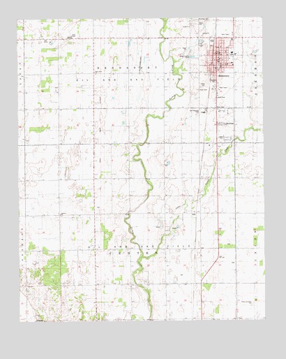
Hennessey, OK USGS Topographic Map
Click on map above to begin viewing in our Map Viewer.

This topographic map contains these locations and features:
Feature Name Type Latitude Longitude GNIS ID View Map
Assembly of God ChurchChurchN36.1056°W97.9014°1798316View Map
Bullfoot ParkParkN36.0995°W97.9009°1777521View Map
Calvary CemeteryCemeteryN36.1227°W97.9086°1777519View Map
Catholic ChurchChurchN36.1109°W97.8978°1798317View Map
Catholic Parish HallChurchN36.1114°W97.8978°1798318View Map
Church of ChristChurchN36.0592°W97.9617°1091364View Map
Church of the Good NewsChurchN36.1098°W97.8992°1798319View Map
Enix Boys AirportAirportN36.1035°W97.9374°1102499View Map
Evans and Burns CemeteryCemeteryN36.0076°W97.8814°1777522View Map
Harmony CemeteryCemeteryN36.0447°W97.9799°2705445View Map
Harmony ChurchChurchN36.0445°W97.9787°1093552View Map
HennesseyPopulated PlaceN36.1092°W97.8987°1093669View Map
Hennessey CemeteryCemeteryN36.1243°W97.9086°1738119View Map
Hennessey DivisionCivilN36.0635°W97.8805°1937729View Map
Hennessey High SchoolSchoolN36.1099°W97.8911°1793702View Map
Hennessey Lower Elementary SchoolSchoolN36.1114°W97.8910°1793704View Map
Hennessey Police DepartmentBuildingN36.1071°W97.8984°2757631View Map
Hennessey Upper Elementary SchoolSchoolN36.1109°W97.8908°1793703View Map
Hennessey Volunteer Fire DepartmentBuildingN36.1051°W97.8986°2658321View Map
JacksPopulated PlaceN36.0445°W97.9095°1100532View Map
Life Emergency Medical Services of HennesseyBuildingN36.1096°W97.8984°2658310View Map
Little Turkey CreekStreamN36.0273°W97.9378°1094854View Map
Maple Grove CemeteryCemeteryN36.1036°W97.9612°2705461View Map
Maple Grove ChurchChurchN36.1028°W97.9614°1095127View Map
Methodist ChurchChurchN36.1084°W97.8981°1798320View Map
Town of HennesseyCivilN36.1056°W97.8989°2412746View Map
Township of CenterCivilN36.0278°W97.9448°1825566View Map

Note: Coordinates in the location and feature list above are referenced to NAD83 datum.


Copyright (C) 2008-2025 Ryan Niemi / Sunset Dynamics ... All Rights Reserved