TopoQuest Logo
Do you find TopoQuest useful?
Help keep TopoQuest running and adding new maps/features by donating!
Bitcoin:  19c7KJd3qBynnjoSw5npx9KScwjBe4ifkT
Litecoin:  LXs6TkuXGGXo1vDsWCkWVdjQX94eUKd6ui
Home View Maps Find Maps Find Places Resources & Links


Seaboard, Alabama Topographic Map

USGS Map Title: Seaboard, AL
USGS Map MRC: 31088C2
DRG (GeoTIFF) Download: o31088c2.tif


Neighboring USGS Topographic Map Quads:


  Chatom, AL  
31088D3
 

  Rutan, AL  
31088D2
 

  Wagarville, AL  
31088D1
 

  Vinegar Bend, AL  
31088C3
 

  Seaboard, AL  
31088C2
 

  McIntosh, AL  
31088C1
 

  Deer Park, AL  
31088B3
 

  Sims Chapel, AL  
31088B2
 

  Calvert, AL  
31088B1


Map MRC Location:

N32°
W89°
N32°
W88°
H8 H7 H6 H5 H4 H3 H2 H1
G8 G7 G6 G5 G4 G3 G2 G1
F8 F7 F6 F5 F4 F3 F2 F1
E8 E7 E6 E5 E4 E3 E2 E1
D8 D7 D6 D5 D4 D3 D2 D1
C8 C7 C6 C5 C4 C3 C2 C1
B8 B7 B6 B5 B4 B3 B2 B1
A8 A7 A6 A5 A4 A3 A2 A1
N31°
W89°
N31°
W88°

Seaboard, AL USGS 1:24K Topographic Map Preview:
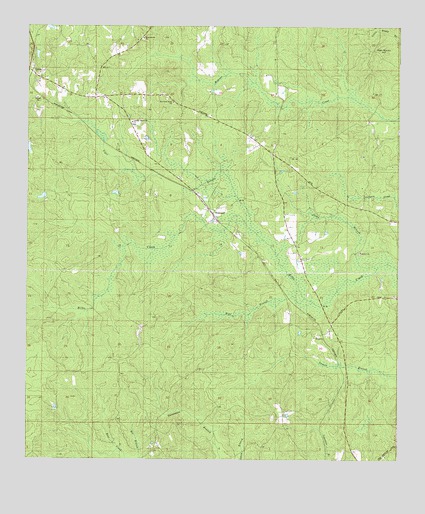
Seaboard, AL USGS Topographic Map
Click on map above to begin viewing in our Map Viewer.

This topographic map contains these locations and features:
Feature Name Type Latitude Longitude GNIS ID View Map
Bee BranchStreamN31.2504°W88.2147°113792View Map
Bethel CemeteryCemeteryN31.3096°W88.1383°157546View Map
Bethel United Methodist ChurchChurchN31.3099°W88.1378°114036View Map
Chalker Memorial CemeteryCemeteryN31.3471°W88.2150°157552View Map
Chalker Memorial United Methodist ChurchChurchN31.3474°W88.2150°138874View Map
Hawthorn Road ChurchChurchN31.3529°W88.2011°138918View Map
High Rocky HillSummitN31.3679°W88.1336°120067View Map
Howard Town Baptist ChurchChurchN31.3716°W88.2117°138926View Map
Howard Town CemeteryCemeteryN31.3716°W88.2111°157620View Map
Jacks BranchStreamN31.3057°W88.1378°151872View Map
Little CreekStreamN31.2571°W88.1500°693758View Map
Old Methodist CemeteryCemeteryN31.3516°W88.2475°157596View Map
Richardson School (historical)SchoolN31.3191°W88.1625°138806View Map
SeaboardPopulated PlaceN31.3213°W88.1886°150016View Map
TibbiePopulated PlaceN31.3621°W88.2486°127959View Map
Tibbie Census Designated PlaceCensusN31.3628°W88.2470°2628606View Map
Tibbie Post OfficePost OfficeN31.3622°W88.2487°166974View Map
Tibbie Volunteer Fire DepartmentBuildingN31.3548°W88.2276°2691264View Map
Tiger BranchStreamN31.3216°W88.1786°127974View Map
ToptonPopulated PlaceN31.2863°W88.1500°157164View Map
UniformPopulated PlaceN31.3493°W88.2345°157186View Map
Violet Hill School (historical)SchoolN31.2899°W88.1608°138843View Map
Wolf BranchStreamN31.2993°W88.1600°129150View Map

Note: Coordinates in the location and feature list above are referenced to NAD83 datum.


Copyright (C) 2008-2025 Ryan Niemi / Sunset Dynamics ... All Rights Reserved