TopoQuest Logo
Do you find TopoQuest useful?
Help keep TopoQuest running and adding new maps/features by donating!
Bitcoin:  19c7KJd3qBynnjoSw5npx9KScwjBe4ifkT
Litecoin:  LXs6TkuXGGXo1vDsWCkWVdjQX94eUKd6ui
Home View Maps Find Maps Find Places Resources & Links


Sebastopol, Mississippi Topographic Map

USGS Map Title: Sebastopol, MS
USGS Map MRC: 32089E3
DRG (GeoTIFF) Download: o32089e3.tif


Neighboring USGS Topographic Map Quads:


  McAfee, MS  
32089F4
 

  Madden, MS  
32089F3
 

  McDonald, MS  
32089F2
 

  Walnut Grove, MS  
32089E4
 

  Sebastopol, MS  
32089E3
 

  Union West, MS  
32089E2
 

  Harperville, MS  
32089D4
 

  Conehatta, MS  
32089D3
 

  Decatur NW, MS  
32089D2


Map MRC Location:

N33°
W90°
N33°
W89°
H8 H7 H6 H5 H4 H3 H2 H1
G8 G7 G6 G5 G4 G3 G2 G1
F8 F7 F6 F5 F4 F3 F2 F1
E8 E7 E6 E5 E4 E3 E2 E1
D8 D7 D6 D5 D4 D3 D2 D1
C8 C7 C6 C5 C4 C3 C2 C1
B8 B7 B6 B5 B4 B3 B2 B1
A8 A7 A6 A5 A4 A3 A2 A1
N32°
W90°
N32°
W89°

Sebastopol, MS USGS 1:24K Topographic Map Preview:
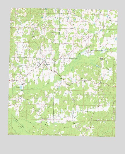
Sebastopol, MS USGS Topographic Map
Click on map above to begin viewing in our Map Viewer.

This topographic map contains these locations and features:
Feature Name Type Latitude Longitude GNIS ID View Map
Bethelehem Church (historical)ChurchN32.5051°W89.2917°689449View Map
Bogue FaliahStreamN32.5138°W89.3640°667388View Map
Chestnut Ridge School (historical)SchoolN32.5174°W89.2565°689461View Map
Crossroad ChurchChurchN32.5671°W89.3634°668974View Map
Dollars Store (historical)LocaleN32.5587°W89.3126°689473View Map
Don Landrum Lake DamDamN32.5601°W89.2617°681503View Map
Gilmers ChurchChurchN32.5560°W89.2906°670399View Map
Green Acre Farm Sewage Pond DamDamN32.5451°W89.3601°681485View Map
Greenfield (historical)Populated PlaceN32.5218°W89.2992°689483View Map
HaysPopulated PlaceN32.5374°W89.3612°691927View Map
High HillPopulated PlaceN32.6243°W89.3178°707111View Map
High Hill CemeteryCemeteryN32.6240°W89.3181°707112View Map
High Hill ChurchChurchN32.6249°W89.3173°671191View Map
Hurricane CreekStreamN32.5435°W89.3576°671611View Map
KitchenerPopulated PlaceN32.5821°W89.2851°691987View Map
Little Sipsey CreekStreamN32.5843°W89.2712°672687View Map
Milldale CemeteryCemeteryN32.6057°W89.3009°673637View Map
Moores Mill (historical)LocaleN32.5549°W89.3159°690951View Map
Pine Grove ChurchChurchN32.6015°W89.3262°675840View Map
Pinter CreekStreamN32.5726°W89.3009°675923View Map
Pleasant Valley ChurchChurchN32.6137°W89.2515°676141View Map
ProspectPopulated PlaceN32.5524°W89.2690°692160View Map
Prospect ChurchChurchN32.5521°W89.2687°689530View Map
R C Camp Lake DamDamN32.5951°W89.2501°681524View Map
Race CreekStreamN32.5999°W89.2648°676450View Map
Reids ChapelChurchN32.5546°W89.2870°676599View Map
Rocky Hill ChurchChurchN32.5962°W89.3095°676795View Map
SalemPopulated PlaceN32.5974°W89.3490°692204View Map
Salem CemeteryCemeteryN32.5976°W89.3487°707154View Map
Salem School (historical)SchoolN32.5974°W89.3409°707156View Map
SebastopolPopulated PlaceN32.5729°W89.3351°677487View Map
Sebastopol Attendance CenterSchoolN32.5701°W89.3387°707300View Map
Sebastopol Baptist ChurchChurchN32.5724°W89.3348°685105View Map
Sebastopol Post OfficePost OfficeN32.5661°W89.3432°2768787View Map
Simmons CreekStreamN32.5604°W89.3170°677819View Map
Steam Mill ChurchChurchN32.6204°W89.3076°678253View Map
Stribbings Store (historical)LocaleN32.6190°W89.2990°685061View Map
Sulphur SpringSpringN32.5385°W89.2945°689572View Map
Sulphur Springs ChurchChurchN32.5165°W89.3303°678394View Map
Tom BranchStreamN32.5810°W89.2684°678803View Map
Town of SebastopolCivilN32.5679°W89.3340°2407305View Map
Vance Mill (historical)LocaleN32.5335°W89.2573°689553View Map
Vanzant CreekStreamN32.5151°W89.3390°679188View Map
White Plains ChurchChurchN32.5499°W89.3053°679607View Map
White Plains ChurchChurchN32.5551°W89.2820°679608View Map

Note: Coordinates in the location and feature list above are referenced to NAD83 datum.


Copyright (C) 2008-2024 Ryan Niemi / Sunset Dynamics ... All Rights Reserved