TopoQuest Logo
Do you find TopoQuest useful?
Help keep TopoQuest running and adding new maps/features by donating!
Bitcoin:  19c7KJd3qBynnjoSw5npx9KScwjBe4ifkT
Litecoin:  LXs6TkuXGGXo1vDsWCkWVdjQX94eUKd6ui
Home View Maps Find Maps Find Places Resources & Links


Conehatta, Mississippi Topographic Map

USGS Map Title: Conehatta, MS
USGS Map MRC: 32089D3
DRG (GeoTIFF) Download: o32089d3.tif


Neighboring USGS Topographic Map Quads:


  Walnut Grove, MS  
32089E4
 

  Sebastopol, MS  
32089E3
 

  Union West, MS  
32089E2
 

  Harperville, MS  
32089D4
 

  Conehatta, MS  
32089D3
 

  Decatur NW, MS  
32089D2
 

  Forest, MS  
32089C4
 

  Lake, MS  
32089C3
 

  Newton, MS  
32089C2


Map MRC Location:

N33°
W90°
N33°
W89°
H8 H7 H6 H5 H4 H3 H2 H1
G8 G7 G6 G5 G4 G3 G2 G1
F8 F7 F6 F5 F4 F3 F2 F1
E8 E7 E6 E5 E4 E3 E2 E1
D8 D7 D6 D5 D4 D3 D2 D1
C8 C7 C6 C5 C4 C3 C2 C1
B8 B7 B6 B5 B4 B3 B2 B1
A8 A7 A6 A5 A4 A3 A2 A1
N32°
W90°
N32°
W89°

Conehatta, MS USGS 1:24K Topographic Map Preview:
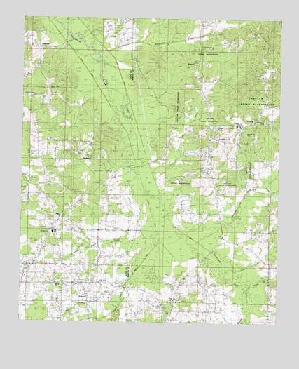
Conehatta, MS USGS Topographic Map
Click on map above to begin viewing in our Map Viewer.

This topographic map contains these locations and features:
Feature Name Type Latitude Longitude GNIS ID View Map
Amis CemeteryCemeteryN32.4965°W89.3342°685094View Map
B Hollingsworth Catfish Pond DamDamN32.3951°W89.3467°681299View Map
Big LakeLakeN32.4609°W89.3260°685095View Map
Bollybusha CreekStreamN32.4860°W89.3370°667413View Map
Box CreekStreamN32.4365°W89.3123°667486View Map
Brusha SchoolSchoolN32.4429°W89.3437°667673View Map
Caney CreekStreamN32.4324°W89.2581°668040View Map
Carson PondReservoirN32.4562°W89.2841°689455View Map
Charles McEdwards Catfish Pond DamDamN32.4901°W89.3301°681435View Map
Chestnut Springs SchoolSchoolN32.4832°W89.2898°668381View Map
Choctaw Church (historical)ChurchN32.4549°W89.2701°689462View Map
Community PondReservoirN32.4578°W89.2572°689464View Map
ConehattaPopulated PlaceN32.4513°W89.2853°668759View Map
Conehatta Census Designated PlaceCensusN32.4601°W89.2785°2402793View Map
Conehatta CreekStreamN32.4115°W89.2948°668760View Map
Conehatta High SchoolSchoolN32.4504°W89.2842°689465View Map
Conehatta Missionary Baptist ChurchChurchN32.4501°W89.2806°710458View Map
Conehatta Post OfficePost OfficeN32.4508°W89.2838°2768753View Map
Conehatta SchoolSchoolN32.4568°W89.2695°689466View Map
County Line School (historical)SchoolN32.4996°W89.3217°689468View Map
Crooked Wood CreekStreamN32.4363°W89.3201°693013View Map
Crosby Mill (historical)LocaleN32.4190°W89.3098°689469View Map
D Graham Lake DamDamN32.4535°W89.2701°681388View Map
Dennis BranchStreamN32.4660°W89.3228°689471View Map
Dorsey BranchStreamN32.3896°W89.2687°693100View Map
E J Pearson Lake DamDamN32.4451°W89.2751°681373View Map
Futchs CemeteryCemeteryN32.4082°W89.3678°685098View Map
Gibbstown - Lawrence Volunteer Fire DepartmentBuildingN32.3795°W89.2845°2667889View Map
Goodhope ChurchChurchN32.3863°W89.3434°670495View Map
Goodhope SchoolSchoolN32.3904°W89.3601°670498View Map
HazelPopulated PlaceN32.3813°W89.3015°671044View Map
Hazel ChurchChurchN32.3832°W89.2981°689488View Map
Hensley BranchStreamN32.4196°W89.3048°671120View Map
James May Lake DamDamN32.4251°W89.3667°681348View Map
Lake SchoolSchoolN32.4124°W89.3590°685100View Map
Lake Volunteer Fire DepartmentBuildingN32.4322°W89.3686°2667973View Map
Lay CemeteryCemeteryN32.4338°W89.3706°685101View Map
Macedonia ChurchChurchN32.4557°W89.2709°689502View Map
Mount Calvary ChurchChurchN32.4426°W89.3409°685103View Map
Mount Olive SchoolSchoolN32.4118°W89.3640°674172View Map
Mount Zion ChurchChurchN32.4818°W89.2920°689509View Map
Mount Zion SchoolSchoolN32.4807°W89.2931°674412View Map
Pearsons Catfish Pond DamDamN32.4418°W89.2684°681367View Map
Pearsons Catfish Pond DamDamN32.4435°W89.2684°681370View Map
Pearsons Mill (historical)LocaleN32.4885°W89.2703°689519View Map
PiketownPopulated PlaceN32.4876°W89.3662°685104View Map
Pleasant Hill CemeteryCemeteryN32.4526°W89.2664°689526View Map
Pleasant Ridge ChurchChurchN32.4713°W89.3651°676109View Map
Saint Catherine ChurchChurchN32.4576°W89.2620°689534View Map
Salem ChurchChurchN32.4190°W89.3581°677278View Map
Sellers CreekStreamN32.3976°W89.2753°677509View Map
Sharon ChurchChurchN32.3910°W89.3573°685106View Map
Sharon ChurchChurchN32.3843°W89.3001°689538View Map
Summers CemeteryCemeteryN32.4682°W89.3739°685108View Map
Warrior CanalCanalN32.3988°W89.3167°689558View Map
Warrior CreekStreamN32.4054°W89.2923°695097View Map
Wolf BranchStreamN32.3776°W89.3317°679805View Map

Note: Coordinates in the location and feature list above are referenced to NAD83 datum.


Copyright (C) 2008-2025 Ryan Niemi / Sunset Dynamics ... All Rights Reserved