TopoQuest Logo
Do you find TopoQuest useful?
Help keep TopoQuest running and adding new maps/features by donating!
Bitcoin:  19c7KJd3qBynnjoSw5npx9KScwjBe4ifkT
Litecoin:  LXs6TkuXGGXo1vDsWCkWVdjQX94eUKd6ui
Home View Maps Find Maps Find Places Resources & Links


Seven Valleys, Pennsylvania Topographic Map

USGS Map Title: Seven Valleys, PA
USGS Map MRC: 39076G7
DRG (GeoTIFF) Download: o39076g7.tif


Neighboring USGS Topographic Map Quads:


  Abbottstown, PA  
39076H8
 

  West York, PA  
39076H7
 

  York, PA  
39076H6
 

  Hanover, PA  
39076G8
 

  Seven Valleys, PA  
39076G7
 

  Glen Rock, PA  
39076G6
 

  Manchester, MD  
39076F8
 

  Lineboro, MD  
39076F7
 

  New Freedom, PA  
39076F6


Map MRC Location:

N40°
W77°
N40°
W76°
H8 H7 H6 H5 H4 H3 H2 H1
G8 G7 G6 G5 G4 G3 G2 G1
F8 F7 F6 F5 F4 F3 F2 F1
E8 E7 E6 E5 E4 E3 E2 E1
D8 D7 D6 D5 D4 D3 D2 D1
C8 C7 C6 C5 C4 C3 C2 C1
B8 B7 B6 B5 B4 B3 B2 B1
A8 A7 A6 A5 A4 A3 A2 A1
N39°
W77°
N39°
W76°

Seven Valleys, PA USGS 1:24K Topographic Map Preview:
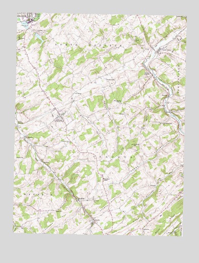
Seven Valleys, PA USGS Topographic Map
Click on map above to begin viewing in our Map Viewer.

This topographic map contains these locations and features:
Feature Name Type Latitude Longitude GNIS ID View Map
B and B Airport (historical)AirportN39.8626°W76.8319°1193762View Map
Beard SchoolSchoolN39.8604°W76.8022°1211176View Map
Berkheimer SchoolSchoolN39.8532°W76.8689°1211177View Map
BonnairPopulated PlaceN39.7526°W76.7555°1169976View Map
Borough of JeffersonCivilN39.8157°W76.8411°1215750View Map
Borough of Seven ValleysCivilN39.8545°W76.7667°1215760View Map
Bortner SchoolSchoolN39.7754°W76.7847°1211187View Map
Bowmans StoreLocaleN39.7815°W76.8089°1170072View Map
Brodbeck SchoolSchoolN39.7762°W76.8080°1211186View Map
BrodbecksPopulated PlaceN39.7707°W76.8278°1203157View Map
Brush ValleyValleyN39.8352°W76.8113°1170465View Map
Buffalo ValleyValleyN39.8232°W76.8302°1170625View Map
Bunch CreekStreamN39.8718°W76.8728°1192218View Map
Cherry RunStreamN39.8243°W76.7644°1171655View Map
Chestnut Grove ChurchChurchN39.8026°W76.8336°1171711View Map
Codorus Creek DamDamN39.8684°W76.8664°1194390View Map
Codorus Post OfficePost OfficeN39.8165°W76.8411°1214697View Map
Cold SpringPopulated PlaceN39.8298°W76.8325°1203305View Map
Community Fire Company of Seven ValleysBuildingN39.8545°W76.7718°2100023View Map
Diehl SchoolSchoolN39.8509°W76.7866°1211175View Map
Fair SchoolSchoolN39.7659°W76.7680°1211188View Map
Fishel CreekStreamN39.8634°W76.7594°1192464View Map
Friendship Hose Company 1 Station 4BuildingN39.8733°W76.8652°2100035View Map
GlatfeltersPopulated PlaceN39.8745°W76.7505°1192520View Map
GlenvillePopulated PlaceN39.7570°W76.8153°1175734View Map
Glenville Post OfficePost OfficeN39.7591°W76.8160°2772719View Map
Hanover JunctionPopulated PlaceN39.8423°W76.7755°1176479View Map
Hanover Road DamDamN39.8675°W76.8681°1194389View Map
Hunter Glen FarmLocaleN39.8097°W76.8072°2519185View Map
Huntrick HillSummitN39.8018°W76.7869°1177632View Map
JeffersonPopulated PlaceN39.8173°W76.8416°1178010View Map
Jefferson Volunteer Fire Company Station 47BuildingN39.8192°W76.8428°2653127View Map
Kinney SchoolSchoolN39.7959°W76.8261°1211185View Map
Krebs SchoolSchoolN39.7984°W76.7700°1211184View Map
Krebs ValleyValleyN39.8086°W76.7530°1178678View Map
Lake LehmanReservoirN39.8610°W76.8581°1194388View Map
Lake Lehman DamDamN39.8632°W76.8609°1194387View Map
LaruePopulated PlaceN39.8204°W76.7602°1178902View Map
LehmanPopulated PlaceN39.8645°W76.8583°1179163View Map
Meadow Valley Breeder FarmsLocaleN39.8117°W76.8197°2519183View Map
Miller SchoolSchoolN39.7632°W76.8433°1181232View Map
NeimanPopulated PlaceN39.8190°W76.7939°1182233View Map
Orion Horse FarmLocaleN39.8467°W76.8603°2650579View Map
PentlandPopulated PlaceN39.7909°W76.8539°1204381View Map
Pet CemeteryCemeteryN39.8579°W76.7805°1183617View Map
PiercevillePopulated PlaceN39.7543°W76.7797°1204389View Map
Prospect Hill SchoolSchoolN39.8273°W76.8516°1211180View Map
RockvillePopulated PlaceN39.7787°W76.7750°1204531View Map
Rocky RidgeRidgeN39.7529°W76.7653°1185363View Map
Saint Francis SchoolSchoolN39.8615°W76.8733°1185950View Map
Saint Jacobs ChurchChurchN39.7704°W76.8155°1185999View Map
Saints Peter and Paul ChurchChurchN39.8143°W76.7661°1186791View Map
Saubel HillSummitN39.7676°W76.8041°1186998View Map
Saubel SchoolSchoolN39.8048°W76.8514°1211181View Map
SeitzvillePopulated PlaceN39.8301°W76.7619°1204608View Map
Senft School Number OneSchoolN39.8687°W76.8419°1211179View Map
Senft School Number TwoSchoolN39.8529°W76.8386°1211178View Map
Seven ValleysPopulated PlaceN39.8557°W76.7686°1187268View Map
Seven Valleys Fire Company Station 62BuildingN39.8550°W76.7718°2100070View Map
Seven Valleys Post OfficePost OfficeN39.8561°W76.7683°2756702View Map
ShaffersLocaleN39.8243°W76.7933°1212592View Map
Sheaffer SchoolSchoolN39.8243°W76.7964°1211183View Map
SinsheimPopulated PlaceN39.8048°W76.8661°1204657View Map
Smyser StationLocaleN39.8498°W76.7677°1211182View Map
Snyder SchoolSchoolN39.7932°W76.8730°1187960View Map
Spring GrovePopulated PlaceN39.8745°W76.8658°1188229View Map
Spring Grove Area Ambulance ClubBuildingN39.8733°W76.8652°2722324View Map
Spring Grove DamDamN39.8684°W76.8664°1194391View Map
Stauffer SchoolSchoolN39.8484°W76.8219°1211174View Map
Sterner SchoolSchoolN39.8051°W76.8080°1211173View Map
StrickhousersPopulated PlaceN39.8387°W76.8086°1204759View Map
Township of CodorusCivilN39.7838°W76.7938°1217282View Map
Township of ManheimCivilN39.7594°W76.8613°1217297View Map
Township of North CodorusCivilN39.8646°W76.8189°1217300View Map
Tri Community Ambulance ServiceBuildingN39.8562°W76.7739°2722211View Map
Valley JunctionPopulated PlaceN39.8115°W76.8728°1204863View Map
Zeigler ChurchChurchN39.8618°W76.7866°1191940View Map
Zion Shaeffer Union ChurchChurchN39.8251°W76.7966°1192017View Map

Note: Coordinates in the location and feature list above are referenced to NAD83 datum.


Copyright (C) 2008-2025 Ryan Niemi / Sunset Dynamics ... All Rights Reserved