TopoQuest Logo
Do you find TopoQuest useful?
Help keep TopoQuest running and adding new maps/features by donating!
Bitcoin:  19c7KJd3qBynnjoSw5npx9KScwjBe4ifkT
Litecoin:  LXs6TkuXGGXo1vDsWCkWVdjQX94eUKd6ui
Home View Maps Find Maps Find Places Resources & Links


Sexton Mountain, Oregon Topographic Map

USGS Map Title: Sexton Mountain, OR
USGS Map MRC: 42123E3
DRG (GeoTIFF) Download: o42123e3.tif


Neighboring USGS Topographic Map Quads:


  Glendale, OR  
42123F4
 

  Golden, OR  
42123F3
 

  King Mountain, OR  
42123F2
 

  Merlin, OR  
42123E4
 

  Sexton Mountain, OR  
42123E3
 

  Wimer, OR  
42123E2
 

  Wilderville, OR  
42123D4
 

  Grants Pass, OR  
42123D3
 

  Rogue River, OR  
42123D2


Map MRC Location:

N43°
W124°
N43°
W123°
H8 H7 H6 H5 H4 H3 H2 H1
G8 G7 G6 G5 G4 G3 G2 G1
F8 F7 F6 F5 F4 F3 F2 F1
E8 E7 E6 E5 E4 E3 E2 E1
D8 D7 D6 D5 D4 D3 D2 D1
C8 C7 C6 C5 C4 C3 C2 C1
B8 B7 B6 B5 B4 B3 B2 B1
A8 A7 A6 A5 A4 A3 A2 A1
N42°
W124°
N42°
W123°

Sexton Mountain, OR USGS 1:24K Topographic Map Preview:
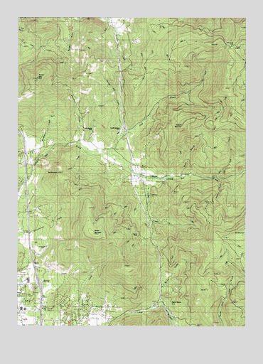
Sexton Mountain, OR USGS Topographic Map
Click on map above to begin viewing in our Map Viewer.

This topographic map contains these locations and features:
Feature Name Type Latitude Longitude GNIS ID View Map
Baby MineMineN42.5340°W123.3092°1117120View Map
Breakdown CreekStreamN42.5696°W123.3601°1118051View Map
Burgess GulchValleyN42.6237°W123.3467°1118323View Map
Cherry CreekStreamN42.5712°W123.3387°1118847View Map
Corliss CreekStreamN42.5651°W123.2914°1132849View Map
Corn CreekStreamN42.5429°W123.3039°1132878View Map
Cove CreekStreamN42.5618°W123.3120°1119406View Map
Daisy MineMineN42.6129°W123.2539°1119670View Map
Dunlap CreekStreamN42.5004°W123.2873°1155068View Map
Fall CreekStreamN42.5607°W123.2681°1120589View Map
Fleming Middle SchoolSchoolN42.5069°W123.3739°2440333View Map
Fleming Middle School Sewage Treatment PlantLocaleN42.5171°W123.3733°2660674View Map
Forest QueenLocaleN42.5101°W123.2892°1120884View Map
Gopher MineMineN42.5362°W123.3103°1121255View Map
Grants Pass DivisionCivilN42.5122°W123.3249°1938021View Map
Hammersley Post Office (historical)Post OfficeN42.6129°W123.2592°1164393View Map
Hammersly MineMineN42.6140°W123.2592°1121543View Map
Horse CreekStreamN42.5765°W123.3201°1121990View Map
Jack CreekStreamN42.5698°W123.3251°1122319View Map
Kettering (historical)LocaleN42.5610°W123.2845°1132877View Map
King GulchValleyN42.5207°W123.3498°1132876View Map
Lucky QueenLocaleN42.5785°W123.3203°1123609View Map
Lucky Queen MineMineN42.5801°W123.3356°1123610View Map
Lucky Queen Post Office (historical)Post OfficeN42.5785°W123.3203°1165569View Map
Manzanita Elementary SchoolSchoolN42.5065°W123.3720°2440334View Map
Manzanita Safety Rest AreaLocaleN42.5176°W123.3634°1134913View Map
Morris CreekStreamN42.5087°W123.2970°1124371View Map
Mountain Post Office (historical)Post OfficeN42.5748°W123.3359°1165675View Map
North Valley High SchoolSchoolN42.5181°W123.3704°2440343View Map
Oak MineMineN42.5526°W123.3026°1134914View Map
Orofino GulchValleyN42.5585°W123.2648°1125045View Map
Orofino MineMineN42.5498°W123.2712°1125046View Map
Red MountainSummitN42.5620°W123.3540°1136677View Map
Roberts MountainSummitN42.5812°W123.2855°1136693View Map
Rural / Metro Fire Department Station 2BuildingN42.5012°W123.3738°2577122View Map
Sexton MountainSummitN42.6001°W123.3658°1126770View Map
Shorthorn GulchValleyN42.5965°W123.3590°1126924View Map
Twelve O'Clock MineMineN42.5590°W123.2956°1128330View Map
Walker MountainSummitN42.5376°W123.3339°1128595View Map
Water BranchStreamN42.5601°W123.2876°1128711View Map
Winona (historical)LocaleN42.5604°W123.2970°1129237View Map
Winona Post Office (historical)Post OfficeN42.5604°W123.2970°1166202View Map

Note: Coordinates in the location and feature list above are referenced to NAD83 datum.


Copyright (C) 2008-2024 Ryan Niemi / Sunset Dynamics ... All Rights Reserved