TopoQuest Logo
Do you find TopoQuest useful?
Help keep TopoQuest running and adding new maps/features by donating!
Bitcoin:  19c7KJd3qBynnjoSw5npx9KScwjBe4ifkT
Litecoin:  LXs6TkuXGGXo1vDsWCkWVdjQX94eUKd6ui
Home View Maps Find Maps Find Places Resources & Links


Wimer, Oregon Topographic Map

USGS Map Title: Wimer, OR
USGS Map MRC: 42123E2
DRG (GeoTIFF) Download: o42123e2.tif


Neighboring USGS Topographic Map Quads:


  Golden, OR  
42123F3
 

  King Mountain, OR  
42123F2
 

  Skeleton Mountain, OR  
42123F1
 

  Sexton Mountain, OR  
42123E3
 

  Wimer, OR  
42123E2
 

  McConville Peak, OR  
42123E1
 

  Grants Pass, OR  
42123D3
 

  Rogue River, OR  
42123D2
 

  Gold Hill, OR  
42123D1


Map MRC Location:

N43°
W124°
N43°
W123°
H8 H7 H6 H5 H4 H3 H2 H1
G8 G7 G6 G5 G4 G3 G2 G1
F8 F7 F6 F5 F4 F3 F2 F1
E8 E7 E6 E5 E4 E3 E2 E1
D8 D7 D6 D5 D4 D3 D2 D1
C8 C7 C6 C5 C4 C3 C2 C1
B8 B7 B6 B5 B4 B3 B2 B1
A8 A7 A6 A5 A4 A3 A2 A1
N42°
W124°
N42°
W123°

Wimer, OR USGS 1:24K Topographic Map Preview:
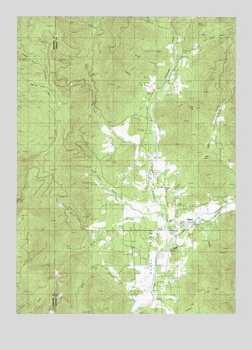
Wimer, OR USGS Topographic Map
Click on map above to begin viewing in our Map Viewer.

This topographic map contains these locations and features:
Feature Name Type Latitude Longitude GNIS ID View Map
A K GulchValleyN42.6123°W123.1637°1132705View Map
Badcock ReservoirReservoirN42.5411°W123.1526°1135414View Map
Bear BranchStreamN42.5098°W123.1726°1117342View Map
Brass Nail GulchValleyN42.5951°W123.2339°1118043View Map
Brown GulchValleyN42.5415°W123.1803°1132701View Map
Brushy GulchValleyN42.5904°W123.1764°1118163View Map
Bummer GulchValleyN42.6029°W123.2342°1118306View Map
China GapGapN42.5857°W123.1503°1118910View Map
Coker GapGapN42.5665°W123.1451°1135410View Map
Collins GulchValleyN42.6026°W123.1623°1132704View Map
Ditch CreekStreamN42.5662°W123.1751°1119959View Map
Dixie GulchValleyN42.5721°W123.1914°1119969View Map
Elk MountainSummitN42.5408°W123.2477°1120459View Map
Evans GulchValleyN42.6026°W123.1553°1132706View Map
Evans ValleyValleyN42.5037°W123.1795°1120540View Map
Evans Valley Elementary SchoolSchoolN42.5389°W123.1633°1120541View Map
Evans Valley Fire District 6BuildingN42.5390°W123.1519°2576627View Map
French GulchValleyN42.6235°W123.1651°1132707View Map
Fry GulchValleyN42.6082°W123.1584°1121018View Map
Greens GulchValleyN42.5365°W123.1442°1121412View Map
Harris GulchValleyN42.6201°W123.1642°1121623View Map
Jackson ReservoirReservoirN42.6047°W123.1730°1135411View Map
Ladies CreekStreamN42.5860°W123.1734°1132703View Map
North Fork Queens BranchStreamN42.5329°W123.2031°1132700View Map
Penny Ante MineMineN42.5998°W123.2123°1162485View Map
Pleasant CreekStreamN42.5323°W123.1614°1125468View Map
Pleasant Creek Guard StationLocaleN42.5637°W123.1737°1125469View Map
Pleasant ValleyValleyN42.5446°W123.1684°1125479View Map
Potter CreekStreamN42.5193°W123.1567°1132708View Map
Queens BranchStreamN42.5423°W123.1664°1125746View Map
Red DitchCanalN42.5182°W123.1712°1125876View Map
Rocky GulchValleyN42.5873°W123.2081°1132702View Map
Saddle CreekStreamN42.5290°W123.1609°1132709View Map
Springbrook AirportAirportN42.5532°W123.2022°1131720View Map
Standard Basin ReservoirReservoirN42.5787°W123.1998°1135413View Map
Vroman DitchCanalN42.5304°W123.1567°1135415View Map
Williams and Whalen DitchCanalN42.5498°W123.1259°1135409View Map
WimerPopulated PlaceN42.5387°W123.1489°1129208View Map
Wimer Census Designated PlaceCensusN42.5446°W123.1480°2611786View Map
Wimer Post Office (historical)Post OfficeN42.5387°W123.1489°1166193View Map
Zwan ReservoirReservoirN42.5771°W123.1664°1135412View Map

Note: Coordinates in the location and feature list above are referenced to NAD83 datum.


Copyright (C) 2008-2025 Ryan Niemi / Sunset Dynamics ... All Rights Reserved