TopoQuest Logo
Do you find TopoQuest useful?
Help keep TopoQuest running and adding new maps/features by donating!
Bitcoin:  19c7KJd3qBynnjoSw5npx9KScwjBe4ifkT
Litecoin:  LXs6TkuXGGXo1vDsWCkWVdjQX94eUKd6ui
Home View Maps Find Maps Find Places Resources & Links


Golden, Oregon Topographic Map

USGS Map Title: Golden, OR
USGS Map MRC: 42123F3
DRG (GeoTIFF) Download: o42123f3.tif


Neighboring USGS Topographic Map Quads:


  McCullough Creek, OR  
42123G4
 

  Quines Creek, OR  
42123G3
 

  Starvout Creek, OR  
42123G2
 

  Glendale, OR  
42123F4
 

  Golden, OR  
42123F3
 

  King Mountain, OR  
42123F2
 

  Merlin, OR  
42123E4
 

  Sexton Mountain, OR  
42123E3
 

  Wimer, OR  
42123E2


Map MRC Location:

N43°
W124°
N43°
W123°
H8 H7 H6 H5 H4 H3 H2 H1
G8 G7 G6 G5 G4 G3 G2 G1
F8 F7 F6 F5 F4 F3 F2 F1
E8 E7 E6 E5 E4 E3 E2 E1
D8 D7 D6 D5 D4 D3 D2 D1
C8 C7 C6 C5 C4 C3 C2 C1
B8 B7 B6 B5 B4 B3 B2 B1
A8 A7 A6 A5 A4 A3 A2 A1
N42°
W124°
N42°
W123°

Golden, OR USGS 1:24K Topographic Map Preview:
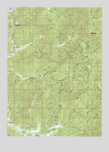
Golden, OR USGS Topographic Map
Click on map above to begin viewing in our Map Viewer.

This topographic map contains these locations and features:
Feature Name Type Latitude Longitude GNIS ID View Map
Anaconda MineMineN42.6804°W123.3153°1116920View Map
Bear GulchValleyN42.6748°W123.3178°1117379View Map
Bear GulchValleyN42.7096°W123.3081°1117381View Map
Benjamin GulchValleyN42.6301°W123.3331°1117521View Map
Benson GulchValleyN42.6832°W123.3026°1132868View Map
Big Slide LodeMineN42.7110°W123.2706°1117667View Map
Big SpringSpringN42.6937°W123.3720°1162731View Map
Black CanyonValleyN42.6568°W123.3090°1162719View Map
Blue Channel PlacerMineN42.6826°W123.3417°1117836View Map
Board Tree CreekStreamN42.7151°W123.3409°1117881View Map
Brown GulchValleyN42.6860°W123.3262°1132869View Map
Browning SpringSpringN42.6373°W123.3053°1132873View Map
BuckhornSummitN42.7290°W123.3213°1118229View Map
Bummer GulchValleyN42.7168°W123.2798°1118307View Map
China GulchValleyN42.7143°W123.3190°1118912View Map
Colby GulchValleyN42.6812°W123.3534°1119093View Map
Columbia PlacerMineN42.6446°W123.3156°1119171View Map
Cougar MineMineN42.6921°W123.2767°1119380View Map
Cougar SpringSpringN42.6943°W123.2762°1162716View Map
Coyote MineMineN42.6854°W123.2959°1119472View Map
Dorothea MineMineN42.6846°W123.2856°1120036View Map
Eastman GulchValleyN42.6479°W123.2581°1120364View Map
Fandora MineMineN42.6846°W123.2778°1120619View Map
Florene MineMineN42.6854°W123.2903°1120846View Map
Foley GulchValleyN42.6848°W123.3392°1120860View Map
Gold Cup PlacerMineN42.6468°W123.2589°1121204View Map
GoldenPopulated PlaceN42.6823°W123.3315°1136323View Map
Golden Post Office (historical)Post OfficeN42.6823°W123.3315°1165324View Map
Golden Ring MineMineN42.7032°W123.2634°1121221View Map
Grandpa GulchValleyN42.7137°W123.3081°1132866View Map
Greenback (historical)Populated PlaceN42.6526°W123.3120°1134142View Map
Greenback MineMineN42.6537°W123.3070°1121408View Map
Greenback Post Office (historical)Post OfficeN42.6526°W123.3120°1165345View Map
Hole in the GroundValleyN42.7098°W123.3037°1121910View Map
Horseshoe LodeMineN42.6787°W123.3048°1122045View Map
Jackpot MineMineN42.6901°W123.3251°1122347View Map
Jim Blaine MineMineN42.6426°W123.3106°1122424View Map
Kennedy GulchValleyN42.6832°W123.3648°1122684View Map
King Mountain Truck TrailTrailN42.6698°W123.2720°1122751View Map
Lehman ReservoirReservoirN42.7165°W123.2678°1162715View Map
Levens GulchValleyN42.7140°W123.3153°1123051View Map
MacAbee MineMineN42.6823°W123.3167°1123656View Map
Martha MineMineN42.6698°W123.3067°1123802View Map
McCourtney CreekStreamN42.6290°W123.2776°1132874View Map
Miller GulchValleyN42.6768°W123.3237°1124200View Map
Morning MineMineN42.6915°W123.3237°1124365View Map
Mountain SpringSpringN42.7123°W123.3720°1132864View Map
Oro Grande MineMineN42.6676°W123.2920°1134141View Map
Panning GulchValleyN42.6812°W123.2828°1125153View Map
Payne PlacerMineN42.6843°W123.3509°1125250View Map
PlacerPopulated PlaceN42.6321°W123.3153°1125461View Map
Placer CemeteryCemeteryN42.6359°W123.3150°1156899View Map
Placer Post Office (historical)Post OfficeN42.6321°W123.3153°1165795View Map
Poe SpringSpringN42.7218°W123.3734°1162729View Map
Post GulchValleyN42.6857°W123.2973°1125593View Map
Post MountainSummitN42.6943°W123.2811°1125597View Map
Quartz Mill GulchValleyN42.6357°W123.2948°1125735View Map
Reed MineMineN42.6751°W123.3028°1125924View Map
Robinson GulchValleyN42.6815°W123.3284°1126121View Map
Saint Paul MountainSummitN42.6624°W123.2809°1126489View Map
Saint Peter MountainSummitN42.6672°W123.2979°1136724View Map
Scholey GulchValleyN42.6776°W123.3051°1126650View Map
Schoolhouse GulchValleyN42.6304°W123.3512°1132871View Map
Secesh GulchValleyN42.7151°W123.2720°1132867View Map
Secesh ReservoirReservoirN42.7035°W123.2732°1134143View Map
Shanks CreekStreamN42.6268°W123.3465°1126794View Map
Shot MineMineN42.6643°W123.3037°1126926View Map
Silent Friend MineMineN42.6993°W123.2781°1126954View Map
Slagle CreekStreamN42.6332°W123.3317°1132872View Map
Sluter MineMineN42.7171°W123.2631°1127096View Map
Sourdough GulchValleyN42.7126°W123.3567°1127222View Map
SpeakerPopulated PlaceN42.7165°W123.2940°1136771View Map
Speaker PlacerMineN42.7118°W123.3103°1127375View Map
Speaker Post Office (historical)Post OfficeN42.7165°W123.2940°1165968View Map
Spotted Fawn MineMineN42.6885°W123.2728°1127401View Map
Stage Coach Forest State ParkParkN42.7304°W123.3692°1638877View Map
Stage Road GulchValleyN42.7098°W123.3640°1127517View Map
Stage Road PassGapN42.7304°W123.3692°1127518View Map
Star MineMineN42.6301°W123.3128°1127536View Map
Still CreekStreamN42.6290°W123.3609°1132875View Map
Stites (historical)LocaleN42.6985°W123.3734°1132865View Map
Strong DamDamN42.7132°W123.3595°1131394View Map
Strong ReservoirReservoirN42.7140°W123.3580°1162717View Map
Sunset MineMineN42.7073°W123.2615°1127752View Map
Tennessee GulchValleyN42.7390°W123.2634°1127933View Map
Tom East CreekStreamN42.6298°W123.3198°1128143View Map
Victor MineMineN42.6873°W123.3248°1128534View Map
Whiskey Bottle CreekStreamN42.6512°W123.3123°1132870View Map
Yellowhorn MineMineN42.6398°W123.3101°1129376View Map

Note: Coordinates in the location and feature list above are referenced to NAD83 datum.


Copyright (C) 2008-2025 Ryan Niemi / Sunset Dynamics ... All Rights Reserved