TopoQuest Logo
Do you find TopoQuest useful?
Help keep TopoQuest running and adding new maps/features by donating!
Bitcoin:  19c7KJd3qBynnjoSw5npx9KScwjBe4ifkT
Litecoin:  LXs6TkuXGGXo1vDsWCkWVdjQX94eUKd6ui
Home View Maps Find Maps Find Places Resources & Links


Sharon, Vermont Topographic Map

USGS Map Title: Sharon, VT
USGS Map MRC: 43072G4
DRG (GeoTIFF) Download: o43072g4.tif


Neighboring USGS Topographic Map Quads:


  Randolph Center, VT  
43072H5
 

  Chelsea, VT  
43072H4
 

  Vershire, VT  
43072H3
 

  South Royalton, VT  
43072G5
 

  Sharon, VT  
43072G4
 

  South Strafford, VT  
43072G3
 

  Woodstock North, VT  
43072F5
 

  Quechee, VT  
43072F4
 

  Hanover, NH  
43072F3


Map MRC Location:

N44°
W73°
N44°
W72°
H8 H7 H6 H5 H4 H3 H2 H1
G8 G7 G6 G5 G4 G3 G2 G1
F8 F7 F6 F5 F4 F3 F2 F1
E8 E7 E6 E5 E4 E3 E2 E1
D8 D7 D6 D5 D4 D3 D2 D1
C8 C7 C6 C5 C4 C3 C2 C1
B8 B7 B6 B5 B4 B3 B2 B1
A8 A7 A6 A5 A4 A3 A2 A1
N43°
W73°
N43°
W72°

Sharon, VT USGS 1:24K Topographic Map Preview:
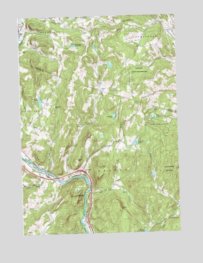
Sharon, VT USGS Topographic Map
Click on map above to begin viewing in our Map Viewer.

This topographic map contains these locations and features:
Feature Name Type Latitude Longitude GNIS ID View Map
Baxter MountainSummitN43.7926°W72.4551°1456299View Map
Belnap Pond DamDamN43.8584°W72.4562°1766562View Map
Billings HillSummitN43.7726°W72.4634°1456423View Map
Broad BrookStreamN43.7870°W72.4840°1456576View Map
Broad Brook CemeteryCemeteryN43.7857°W72.4826°1922281View Map
Button CemeteryCemeteryN43.8554°W72.4966°1456703View Map
C C C PondReservoirN43.8168°W72.3935°1766537View Map
C C C Pond DamDamN43.8167°W72.3879°1766536View Map
Charles Downer State ForestForestN43.8098°W72.3904°1922304View Map
Clover Hill Wildlife Management AreaParkN43.8598°W72.4037°1921365View Map
Crescent LakeReservoirN43.8022°W72.4087°1457058View Map
Crescent Lake DamDamN43.8017°W72.4082°1766411View Map
Dairy Hill SchoolSchoolN43.8251°W72.4798°1457090View Map
Day SchoolSchoolN43.8028°W72.4198°1457126View Map
Dewey CemeteryCemeteryN43.8245°W72.4769°1922328View Map
Downer 4-H CampLocaleN43.8159°W72.4137°1922332View Map
Elmers BrookStreamN43.7795°W72.4684°1802684View Map
Farnham BranchStreamN43.8734°W72.4970°1457411View Map
Fay BrookStreamN43.7820°W72.4607°1457414View Map
Grant BrookStreamN43.8028°W72.4440°865177View Map
High Pole BranchStreamN43.7740°W72.4482°1457816View Map
Howe Covered BridgeBridgeN43.8651°W72.4984°1921437View Map
Howe Hill SchoolSchoolN43.7520°W72.4837°1457918View Map
Interchange 2CrossingN43.7862°W72.4529°1922416View Map
Joseph Smith MonumentParkN43.8237°W72.4723°1458042View Map
Kibling HillSummitN43.8717°W72.4243°1458082View Map
McIntosh PondReservoirN43.8234°W72.4914°1766502View Map
McIntosh Pond DamDamN43.8234°W72.4912°1766501View Map
Morrill Memorial and Harris LibraryBuildingN43.8673°W72.3770°1921489View Map
Mount Pleasant CemeteryCemeteryN43.8725°W72.4647°1921492View Map
Ordway CemeteryCemeteryN43.8657°W72.4471°1921658View Map
Quation BrookStreamN43.7837°W72.4504°1459124View Map
Quimby MountainSummitN43.7626°W72.4245°1459129View Map
Robinson CemeteryCemeteryN43.8322°W72.4332°1921536View Map
Robinson SchoolSchoolN43.8328°W72.4290°1459225View Map
School Number 3SchoolN43.8723°W72.4640°1459411View Map
SharonPopulated PlaceN43.7845°W72.4543°1459459View Map
Sharon Academy High SchoolSchoolN43.7894°W72.4832°2427587View Map
Sharon Academy Middle SchoolSchoolN43.7856°W72.4537°2427576View Map
Sharon Broad Brook SchoolSchoolN43.7837°W72.4834°1459460View Map
Sharon Congregational ChurchChurchN43.7851°W72.4532°1922588View Map
Sharon Elementary SchoolSchoolN43.7850°W72.4562°1922589View Map
Sharon Post OfficePost OfficeN43.7840°W72.4557°1922590View Map
Sharon Volunteer Fire DepartmentBuildingN43.7811°W72.4687°2121294View Map
Standing PondLakeN43.8174°W72.4256°1459664View Map
StraffordPopulated PlaceN43.8665°W72.3779°1459751View Map
Strafford CemeteryCemeteryN43.8677°W72.3793°1921567View Map
Strafford Fire StationBuildingN43.8671°W72.3773°2121338View Map
Strafford Meeting HouseBuildingN43.8667°W72.3784°1921568View Map
Strafford Post OfficePost OfficeN43.8650°W72.3772°1921570View Map
Strafford Village Historic DistrictParkN43.8656°W72.3779°1921572View Map
Town of SharonCivilN43.7830°W72.4363°1462204View Map
Tunbridge Trout PondLakeN43.8582°W72.4563°1459965View Map
Tyler MountainSummitN43.7887°W72.4368°1459979View Map
Village - Pine Hill CemeteryCemeteryN43.7818°W72.4635°1922687View Map
White River Wildlife Management AreaParkN43.7684°W72.4482°1922729View Map
Whitewater BrookStreamN43.7870°W72.4807°1460231View Map

Note: Coordinates in the location and feature list above are referenced to NAD83 datum.


Copyright (C) 2008-2024 Ryan Niemi / Sunset Dynamics ... All Rights Reserved