TopoQuest Logo
Do you find TopoQuest useful?
Help keep TopoQuest running and adding new maps/features by donating!
Bitcoin:  19c7KJd3qBynnjoSw5npx9KScwjBe4ifkT
Litecoin:  LXs6TkuXGGXo1vDsWCkWVdjQX94eUKd6ui
Home View Maps Find Maps Find Places Resources & Links


Chelsea, Vermont Topographic Map

USGS Map Title: Chelsea, VT
USGS Map MRC: 43072H4
DRG (GeoTIFF) Download: o43072h4.tif


Neighboring USGS Topographic Map Quads:


  Brookfield, VT  
44072A5
 

  Washington, VT  
44072A4
 

  West Topsham, VT  
44072A3
 

  Randolph Center, VT  
43072H5
 

  Chelsea, VT  
43072H4
 

  Vershire, VT  
43072H3
 

  South Royalton, VT  
43072G5
 

  Sharon, VT  
43072G4
 

  South Strafford, VT  
43072G3


Map MRC Location:

N44°
W73°
N44°
W72°
H8 H7 H6 H5 H4 H3 H2 H1
G8 G7 G6 G5 G4 G3 G2 G1
F8 F7 F6 F5 F4 F3 F2 F1
E8 E7 E6 E5 E4 E3 E2 E1
D8 D7 D6 D5 D4 D3 D2 D1
C8 C7 C6 C5 C4 C3 C2 C1
B8 B7 B6 B5 B4 B3 B2 B1
A8 A7 A6 A5 A4 A3 A2 A1
N43°
W73°
N43°
W72°

Chelsea, VT USGS 1:24K Topographic Map Preview:
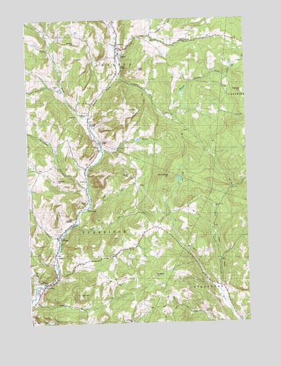
Chelsea, VT USGS Topographic Map
Click on map above to begin viewing in our Map Viewer.

This topographic map contains these locations and features:
Feature Name Type Latitude Longitude GNIS ID View Map
Alden Speare Memorial LibraryBuildingN43.9970°W72.4509°1921311View Map
Beacon HillSummitN43.9912°W72.4701°1458423View Map
Beaver Meadow BrookStreamN43.9612°W72.4165°1456348View Map
Bicknell BrookStreamN43.9456°W72.4565°1456407View Map
Blaisdell - Laird - Laird CemeteryCemeteryN43.9543°W72.4082°1921323View Map
Boardman CemeteryCemeteryN43.9520°W72.4270°1921327View Map
Brocklebank HillSummitN43.9348°W72.4187°1456579View Map
Brookhaven Learning CenterSchoolN43.9935°W72.4474°2427353View Map
Buzzell CemeteryCemeteryN43.9228°W72.3912°1921350View Map
ChelseaPopulated PlaceN43.9898°W72.4476°1456865View Map
Chelsea Census Designated PlaceCensusN43.9871°W72.4522°2745367View Map
Chelsea Historic DistrictParkN43.9881°W72.4482°1921357View Map
Chelsea Municipal ForestForestN43.9498°W72.3951°1921358View Map
Chelsea Post OfficePost OfficeN43.9895°W72.4474°1921359View Map
Chelsea Public LibraryBuildingN43.9873°W72.4465°1921360View Map
Chelsea Public SchoolSchoolN43.9871°W72.4465°2427395View Map
Chelsea Volunteer Fire DepartmentBuildingN43.9916°W72.4468°2121332View Map
Congregational Church of ChelseaChurchN43.9881°W72.4459°1921366View Map
Corwin CemeteryCemeteryN43.9921°W72.4159°1921375View Map
Cram BrookStreamN43.9595°W72.4643°1456089View Map
Curtis HillSummitN43.9353°W72.4418°1457073View Map
Dickerman BrookStreamN43.9309°W72.4659°1457171View Map
Drews CemeteryCemeteryN43.8851°W72.4534°1921384View Map
Durkee CemeteryCemeteryN43.9245°W72.4668°1921385View Map
East HillSummitN43.8870°W72.4715°1457286View Map
First Branch AmbulanceBuildingN43.9915°W72.4470°2578118View Map
Flint Covered BridgeBridgeN43.9492°W72.4590°1921414View Map
Hart HollowValleyN43.9995°W72.4484°1457744View Map
Highland CemeteryCemeteryN43.9848°W72.4459°1921435View Map
Holt HillSummitN43.9626°W72.4359°1457875View Map
Hunt CemeteryCemeteryN43.9469°W72.4596°1921439View Map
Jail BrookStreamN43.9881°W72.4495°1457988View Map
Jenkins BrookStreamN43.9759°W72.4495°1457998View Map
Kelsey Mountain CemeteryCemeteryN43.8926°W72.4551°1921451View Map
Keyser DamDamN43.9517°W72.4345°1766473View Map
Keyser PondReservoirN43.9502°W72.4363°1766474View Map
Kibling Hill Wildlife Management AreaParkN43.8876°W72.4129°1921454View Map
Larkin Covered BridgeBridgeN43.9228°W72.4654°1921462View Map
Lincoln CemeteryCemeteryN43.9720°W72.4833°1921467View Map
Mill Covered BridgeBridgeN43.8917°W72.4912°1921483View Map
Monarch Hill CemeteryCemeteryN43.9053°W72.4419°1921486View Map
Mount Pleasant CemeteryCemeteryN43.8760°W72.4414°1921491View Map
Moxley Covered BridgeBridgeN43.9567°W72.4637°1921495View Map
Norris-Davis CemeteryCemeteryN43.9709°W72.3848°1921477View Map
North TunbridgePopulated PlaceN43.9148°W72.4784°1458766View Map
Noyes CemeteryCemeteryN43.9556°W72.4387°1921479View Map
Old Chelsea CemeteryCemeteryN43.9925°W72.4486°1921500View Map
Old City BrookStreamN43.8762°W72.3815°1458822View Map
Old Meeting House CemeteryCemeteryN43.9041°W72.4955°1921503View Map
Orange County CourthouseBuildingN43.9890°W72.4468°1921505View Map
Orange County Sheriff's OfficeBuildingN43.9883°W72.4456°2752771View Map
School Number 1SchoolN43.9620°W72.4679°1459404View Map
Smith CemeteryCemeteryN43.9345°W72.4393°1921546View Map
Spear CemeteryCemeteryN43.9742°W72.3933°1921561View Map
Spring Road CemeteryCemeteryN43.8963°W72.4981°1921565View Map
Spring Road CemeteryCemeteryN43.8967°W72.4970°1921566View Map
Strafford Municipal ForestForestN43.9203°W72.3904°1921569View Map
Strafford Road CemeteryCemeteryN43.9034°W72.4844°1921571View Map
Taylor Valley CemeteryCemeteryN43.9337°W72.3765°1921574View Map
Town of ChelseaCivilN43.9940°W72.4571°1462069View Map
Town of TunbridgeCivilN43.9019°W72.4852°1462231View Map
TunbridgePopulated PlaceN43.8909°W72.4912°1459963View Map
Tunbridge Central SchoolSchoolN43.9169°W72.4748°1921591View Map
Tunbridge Post OfficePost OfficeN43.8897°W72.4920°1921592View Map
Tunbridge Village CemeteryCemeteryN43.8869°W72.4937°1921594View Map
Tunbridge Volunteer Fire DepartmentBuildingN43.8999°W72.4872°2121326View Map
Wallace CemeteryCemeteryN43.9750°W72.4029°1921609View Map
Wellspring SchoolSchoolN43.9881°W72.4474°2427349View Map
Whitney HillSummitN43.9340°W72.4840°1460240View Map
Whitney Hill CemeteryCemeteryN43.9381°W72.4929°1921644View Map
Williams HillSummitN43.8881°W72.4226°1460270View Map
Wills CemeteryCemeteryN43.9937°W72.4768°1921650View Map

Note: Coordinates in the location and feature list above are referenced to NAD83 datum.


Copyright (C) 2008-2024 Ryan Niemi / Sunset Dynamics ... All Rights Reserved