TopoQuest Logo
Do you find TopoQuest useful?
Help keep TopoQuest running and adding new maps/features by donating!
Bitcoin:  19c7KJd3qBynnjoSw5npx9KScwjBe4ifkT
Litecoin:  LXs6TkuXGGXo1vDsWCkWVdjQX94eUKd6ui
Home View Maps Find Maps Find Places Resources & Links


Sheep Mountain, Idaho Topographic Map

USGS Map Title: Sheep Mountain, ID
USGS Map MRC: 46115G5
DRG (GeoTIFF) Download: o46115g5.tif


Neighboring USGS Topographic Map Quads:


  Buzzard Roost, ID  
46115H6
 

  Mallard Peak, ID  
46115H5
 

  Pole Mountain, ID  
46115H4
 

  Thompson Point, ID  
46115G6
 

  Sheep Mountain, ID  
46115G5
 

  The Nub, ID  
46115G4
 

  Browns Rock, ID  
46115F6
 

  Clarke Mountain, ID  
46115F5
 

  Pot Mountain, ID  
46115F4


Map MRC Location:

N47°
W116°
N47°
W115°
H8 H7 H6 H5 H4 H3 H2 H1
G8 G7 G6 G5 G4 G3 G2 G1
F8 F7 F6 F5 F4 F3 F2 F1
E8 E7 E6 E5 E4 E3 E2 E1
D8 D7 D6 D5 D4 D3 D2 D1
C8 C7 C6 C5 C4 C3 C2 C1
B8 B7 B6 B5 B4 B3 B2 B1
A8 A7 A6 A5 A4 A3 A2 A1
N46°
W116°
N46°
W115°

Sheep Mountain, ID USGS 1:24K Topographic Map Preview:
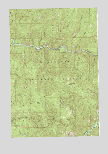
Sheep Mountain, ID USGS Topographic Map
Click on map above to begin viewing in our Map Viewer.

This topographic map contains these locations and features:
Feature Name Type Latitude Longitude GNIS ID View Map
Aquarius CampgroundLocaleN46.8410°W115.6171°376688View Map
Beaver CreekStreamN46.8427°W115.6218°377244View Map
Broom CreekStreamN46.8349°W115.5868°378257View Map
Canyon Ranger StationLocaleN46.8363°W115.5863°378888View Map
Canyon Work CenterLocaleN46.8360°W115.5843°395571View Map
Dog CreekStreamN46.8657°W115.6176°380691View Map
Eagle CreekStreamN46.7549°W115.5160°380977View Map
Eagle PointSummitN46.8007°W115.5379°380995View Map
Ermine CreekStreamN46.7621°W115.5040°381492View Map
Fern CreekStreamN46.8627°W115.6232°381665View Map
Fern RidgeRidgeN46.8719°W115.6001°381670View Map
Fish CreekStreamN46.8324°W115.5313°381742View Map
Flat CreekStreamN46.7532°W115.5196°381830View Map
Governor CreekStreamN46.7524°W115.5213°382476View Map
Grasshopper CreekStreamN46.8363°W115.5846°382573View Map
June CreekStreamN46.8241°W115.5465°384062View Map
Len CreekStreamN46.8082°W115.6138°384578View Map
Leuty CreekStreamN46.8382°W115.6035°384585View Map
Lost Pete CreekStreamN46.8357°W115.5663°386178View Map
Lower Twin CreekStreamN46.8316°W115.5363°386251View Map
Owl CreekStreamN46.8277°W115.5038°388053View Map
Preceptor PointCapeN46.8585°W115.5629°400048View Map
Raft CreekStreamN46.8382°W115.5768°389021View Map
Sheep CreekStreamN46.8380°W115.5738°390193View Map
Sheep MountainSummitN46.7835°W115.5901°390244View Map
Sheep Mountain RangeRangeN46.7916°W115.5646°400080View Map
Sheep Mountain SaddleGapN46.7616°W115.6201°390247View Map
Sneak CreekStreamN46.8330°W115.5454°390733View Map
Star CreekStreamN46.8394°W115.5929°391350View Map
Swanson SaddleGapN46.7694°W115.6079°391740View Map
Upper Twin CreekStreamN46.8321°W115.5363°392661View Map
West SisterSummitN46.8735°W115.5640°393242View Map

Note: Coordinates in the location and feature list above are referenced to NAD83 datum.


Copyright (C) 2008-2025 Ryan Niemi / Sunset Dynamics ... All Rights Reserved