TopoQuest Logo
Do you find TopoQuest useful?
Help keep TopoQuest running and adding new maps/features by donating!
Bitcoin:  19c7KJd3qBynnjoSw5npx9KScwjBe4ifkT
Litecoin:  LXs6TkuXGGXo1vDsWCkWVdjQX94eUKd6ui
Home View Maps Find Maps Find Places Resources & Links


Clarke Mountain, Idaho Topographic Map

USGS Map Title: Clarke Mountain, ID
USGS Map MRC: 46115F5
DRG (GeoTIFF) Download: o46115f5.tif


Neighboring USGS Topographic Map Quads:


  Thompson Point, ID  
46115G6
 

  Sheep Mountain, ID  
46115G5
 

  The Nub, ID  
46115G4
 

  Browns Rock, ID  
46115F6
 

  Clarke Mountain, ID  
46115F5
 

  Pot Mountain, ID  
46115F4
 

  French Mountain, ID  
46115E6
 

  Larch Butte, ID  
46115E5
 

  Lean-to Point, ID  
46115E4


Map MRC Location:

N47°
W116°
N47°
W115°
H8 H7 H6 H5 H4 H3 H2 H1
G8 G7 G6 G5 G4 G3 G2 G1
F8 F7 F6 F5 F4 F3 F2 F1
E8 E7 E6 E5 E4 E3 E2 E1
D8 D7 D6 D5 D4 D3 D2 D1
C8 C7 C6 C5 C4 C3 C2 C1
B8 B7 B6 B5 B4 B3 B2 B1
A8 A7 A6 A5 A4 A3 A2 A1
N46°
W116°
N46°
W115°

Clarke Mountain, ID USGS 1:24K Topographic Map Preview:
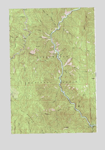
Clarke Mountain, ID USGS Topographic Map
Click on map above to begin viewing in our Map Viewer.

This topographic map contains these locations and features:
Feature Name Type Latitude Longitude GNIS ID View Map
Bungalow Ranger StationLocaleN46.6307°W115.5063°378503View Map
Burro CreekStreamN46.7205°W115.5649°378571View Map
Castle RockCapeN46.6519°W115.5279°379011View Map
Cave CreekStreamN46.6919°W115.5493°379060View Map
Cave PointSummitN46.7099°W115.5343°379064View Map
Chateau CreekStreamN46.6932°W115.5424°379208View Map
Chateau RockPillarN46.6788°W115.5024°379209View Map
Clark Mountain LookoutLocaleN46.6305°W115.5451°399439View Map
Clarke MountainSummitN46.6302°W115.5449°399830View Map
Dead Mule CreekStreamN46.7221°W115.5651°380306View Map
Dead Mule TrailTrailN46.7319°W115.5782°380308View Map
Deadhorse CreekStreamN46.7241°W115.5643°380317View Map
Deep CreekStreamN46.7402°W115.5446°380374View Map
Elk MountainSummitN46.6452°W115.6068°396454View Map
Hornby CreekStreamN46.7049°W115.6057°399067View Map
Little Washington CreekStreamN46.7288°W115.5549°384985View Map
Morgans GulchValleyN46.6507°W115.5332°387220View Map
Orogrande CreekStreamN46.6310°W115.5071°388001View Map
Pack CreekStreamN46.6477°W115.5285°388083View Map
Sheep Mountain Work CenterLocaleN46.7485°W115.6043°390248View Map
Shin PointSummitN46.7119°W115.5874°397158View Map
Shin Point TrailTrailN46.7063°W115.5768°390321View Map
Siwash CreekStreamN46.6707°W115.5510°390487View Map
Snoden CreekStreamN46.6988°W115.5535°390736View Map
Spray CreekStreamN46.6877°W115.5485°391145View Map
Station CreekStreamN46.6480°W115.5285°391376View Map
Swanson CreekStreamN46.7410°W115.5643°391738View Map
Tumble CreekStreamN46.7052°W115.6124°392445View Map
Washington CreekStreamN46.7071°W115.5576°392919View Map
Washington Creek CampgroundLocaleN46.7044°W115.5560°399619View Map

Note: Coordinates in the location and feature list above are referenced to NAD83 datum.


Copyright (C) 2008-2025 Ryan Niemi / Sunset Dynamics ... All Rights Reserved