TopoQuest Logo
Do you find TopoQuest useful?
Help keep TopoQuest running and adding new maps/features by donating!
Bitcoin:  19c7KJd3qBynnjoSw5npx9KScwjBe4ifkT
Litecoin:  LXs6TkuXGGXo1vDsWCkWVdjQX94eUKd6ui
Home View Maps Find Maps Find Places Resources & Links


Sheepeater Mountain, Idaho Topographic Map

USGS Map Title: Sheepeater Mountain, ID
USGS Map MRC: 45115D3
DRG (GeoTIFF) Download: o45115d3.tif


Neighboring USGS Topographic Map Quads:


  Dixie, ID  
45115E4
 

  Whitewater Ranch, ID  
45115E3
 

  Hida Point, ID  
45115E2
 

  Fivemile Bar, ID  
45115D4
 

  Sheepeater Mountain, ID  
45115D3
 

  Meadow of Doubt, ID  
45115D2
 

  Chicken Peak, ID  
45115C4
 

  Mosquito Peak, ID  
45115C3
 

  Lodgepole Creek, ID  
45115C2


Map MRC Location:

N46°
W116°
N46°
W115°
H8 H7 H6 H5 H4 H3 H2 H1
G8 G7 G6 G5 G4 G3 G2 G1
F8 F7 F6 F5 F4 F3 F2 F1
E8 E7 E6 E5 E4 E3 E2 E1
D8 D7 D6 D5 D4 D3 D2 D1
C8 C7 C6 C5 C4 C3 C2 C1
B8 B7 B6 B5 B4 B3 B2 B1
A8 A7 A6 A5 A4 A3 A2 A1
N45°
W116°
N45°
W115°

Sheepeater Mountain, ID USGS 1:24K Topographic Map Preview:
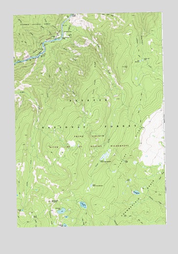
Sheepeater Mountain, ID USGS Topographic Map
Click on map above to begin viewing in our Map Viewer.

This topographic map contains these locations and features:
Feature Name Type Latitude Longitude GNIS ID View Map
Burnt KnobSummitN45.4682°W115.2829°378559View Map
Cambell Ferry Airstrip (historical)AirportN45.4869°W115.3301°399467View Map
Campbells FerryLocaleN45.4891°W115.3323°378832View Map
Cutthroat LakeLakeN45.3757°W115.3350°380199View Map
Fall CreekStreamN45.4771°W115.3526°381542View Map
Fall Creek BarBarN45.4755°W115.3535°381559View Map
Fish LakeLakeN45.3880°W115.3194°381762View Map
Flossie LakeLakeN45.3943°W115.2749°381876View Map
Frog LakeLakeN45.4129°W115.2845°382102View Map
Frog PondLakeN45.4015°W115.2800°382108View Map
Groundhog BarBarN45.4796°W115.3504°382706View Map
Grouse CreekStreamN45.4849°W115.3407°382719View Map
Highline RidgeRidgeN45.4155°W115.2812°383189View Map
Jim Moore PlacePopulated PlaceN45.4863°W115.3393°397821View Map
Lemhi LakeLakeN45.3855°W115.3699°384567View Map
Lower Trout Creek MeadowsFlatN45.4163°W115.3018°386249View Map
Moore CreekStreamN45.4849°W115.3382°387149View Map
Reed CreekStreamN45.4719°W115.3743°389262View Map
Ruff CreekStreamN45.4838°W115.3451°389717View Map
Shake CabinLocaleN45.4724°W115.2662°390133View Map
Sheepeater LakeLakeN45.3843°W115.3378°390266View Map
Sheepeater MountainSummitN45.3899°W115.3471°398120View Map
Sleepy HollowGapN45.3841°W115.3632°390592View Map
Slide CreekStreamN45.4874°W115.3346°390610View Map
Spring CreekStreamN45.4813°W115.3504°391186View Map
Three Blaze TrailTrailN45.3888°W115.2987°392074View Map
Trout CreekStreamN45.4957°W115.3310°392410View Map
Trout Creek RidgeRidgeN45.4505°W115.3104°392425View Map
Upper Trout Creek MeadowsFlatN45.3999°W115.3126°392660View Map
Wet MeadowsFlatN45.4713°W115.2671°393267View Map
Widow BarBarN45.4824°W115.3496°393409View Map

Note: Coordinates in the location and feature list above are referenced to NAD83 datum.


Copyright (C) 2008-2024 Ryan Niemi / Sunset Dynamics ... All Rights Reserved