TopoQuest Logo
Do you find TopoQuest useful?
Help keep TopoQuest running and adding new maps/features by donating!
Bitcoin:  19c7KJd3qBynnjoSw5npx9KScwjBe4ifkT
Litecoin:  LXs6TkuXGGXo1vDsWCkWVdjQX94eUKd6ui
Home View Maps Find Maps Find Places Resources & Links


Fivemile Bar, Idaho Topographic Map

USGS Map Title: Fivemile Bar, ID
USGS Map MRC: 45115D4
DRG (GeoTIFF) Download: o45115d4.tif


Neighboring USGS Topographic Map Quads:


  Silver Spur Ridge, ID  
45115E5
 

  Dixie, ID  
45115E4
 

  Whitewater Ranch, ID  
45115E3
 

  Mackay Bar, ID  
45115D5
 

  Fivemile Bar, ID  
45115D4
 

  Sheepeater Mountain, ID  
45115D3
 

  Burgdorf Summit, ID  
45115C5
 

  Chicken Peak, ID  
45115C4
 

  Mosquito Peak, ID  
45115C3


Map MRC Location:

N46°
W116°
N46°
W115°
H8 H7 H6 H5 H4 H3 H2 H1
G8 G7 G6 G5 G4 G3 G2 G1
F8 F7 F6 F5 F4 F3 F2 F1
E8 E7 E6 E5 E4 E3 E2 E1
D8 D7 D6 D5 D4 D3 D2 D1
C8 C7 C6 C5 C4 C3 C2 C1
B8 B7 B6 B5 B4 B3 B2 B1
A8 A7 A6 A5 A4 A3 A2 A1
N45°
W116°
N45°
W115°

Fivemile Bar, ID USGS 1:24K Topographic Map Preview:
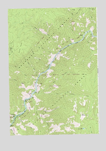
Fivemile Bar, ID USGS Topographic Map
Click on map above to begin viewing in our Map Viewer.

This topographic map contains these locations and features:
Feature Name Type Latitude Longitude GNIS ID View Map
Abrams HeightSummitN45.4269°W115.4796°376460View Map
Bear CreekStreamN45.4163°W115.4615°377089View Map
Big Blowout CreekStreamN45.4588°W115.4260°377436View Map
Blue Bird BarBarN45.4007°W115.4779°377886View Map
Blue Ridge CabinLocaleN45.4977°W115.4057°377944View Map
Boise BarBarN45.4410°W115.4437°378000View Map
Boise CreekStreamN45.4416°W115.4432°378004View Map
Fivemile BarBarN45.4121°W115.4687°381800View Map
Fivemile CreekStreamN45.4121°W115.4693°381808View Map
Gaines BarBarN45.4749°W115.3918°382144View Map
Grizzly GulchValleyN45.4005°W115.4626°382698View Map
Haney BarBarN45.4085°W115.4779°382864View Map
Henry Moore SpringSpringN45.3951°W115.4922°383105View Map
Jackson BarBarN45.3960°W115.4860°399162View Map
Jersey CreekStreamN45.4180°W115.4643°383899View Map
Lemhi BarBarN45.4757°W115.3857°384565View Map
Lemhi CreekStreamN45.4730°W115.3826°384566View Map
Lemhi PointSummitN45.4341°W115.3976°399952View Map
Little Fivemile CreekStreamN45.4174°W115.4637°384833View Map
Little Sheepeater LakeLakeN45.3804°W115.3970°384946View Map
Little Sheepeater PointSummitN45.3938°W115.3996°384947View Map
Ludwig BarBarN45.3924°W115.4898°386277View Map
Ludwig RapidsRapidsN45.3932°W115.4921°386279View Map
Mackay Bar BridgeBridgeN45.3852°W115.4993°386333View Map
Mackay Bar CampgroundLocaleN45.3924°W115.4940°400328View Map
Mammoth MineMineN45.4624°W115.4982°386419View Map
Mammoth MountainSummitN45.4644°W115.4804°396846View Map
No Man CreekStreamN45.4335°W115.4579°387591View Map
Paine CreekStreamN45.4544°W115.4326°388125View Map
Painter BarBarN45.4174°W115.4654°388128View Map
Painter MineMineN45.4232°W115.4615°388130View Map
Painter PointCliffN45.4255°W115.4532°388131View Map
Rabbit CreekStreamN45.4919°W115.4085°389001View Map
Rhett CreekStreamN45.4719°W115.3946°389327View Map
Rhett Creek CampgroundLocaleN45.4727°W115.3946°389328View Map
Rocky BarBarN45.3905°W115.4946°389537View Map
Tepee CreekStreamN45.4296°W115.4601°393915View Map
Tepee GulchStreamN45.4296°W115.4604°400466View Map
Threemile CreekStreamN45.3941°W115.4879°392102View Map
Wilson Bar USFS AirportAirportN45.3971°W115.4846°2443814View Map
Wolfe PlaceLocaleN45.4769°W115.3896°400485View Map

Note: Coordinates in the location and feature list above are referenced to NAD83 datum.


Copyright (C) 2008-2025 Ryan Niemi / Sunset Dynamics ... All Rights Reserved