TopoQuest Logo
Do you find TopoQuest useful?
Help keep TopoQuest running and adding new maps/features by donating!
Bitcoin:  19c7KJd3qBynnjoSw5npx9KScwjBe4ifkT
Litecoin:  LXs6TkuXGGXo1vDsWCkWVdjQX94eUKd6ui
Home View Maps Find Maps Find Places Resources & Links


Whitewater Ranch, Idaho Topographic Map

USGS Map Title: Whitewater Ranch, ID
USGS Map MRC: 45115E3
DRG (GeoTIFF) Download: o45115e3.tif


Neighboring USGS Topographic Map Quads:


  Moose Butte, ID  
45115F4
 

  Trapper Creek, ID  
45115F3
 

  Boston Mountain, ID  
45115F2
 

  Dixie, ID  
45115E4
 

  Whitewater Ranch, ID  
45115E3
 

  Hida Point, ID  
45115E2
 

  Fivemile Bar, ID  
45115D4
 

  Sheepeater Mountain, ID  
45115D3
 

  Meadow of Doubt, ID  
45115D2


Map MRC Location:

N46°
W116°
N46°
W115°
H8 H7 H6 H5 H4 H3 H2 H1
G8 G7 G6 G5 G4 G3 G2 G1
F8 F7 F6 F5 F4 F3 F2 F1
E8 E7 E6 E5 E4 E3 E2 E1
D8 D7 D6 D5 D4 D3 D2 D1
C8 C7 C6 C5 C4 C3 C2 C1
B8 B7 B6 B5 B4 B3 B2 B1
A8 A7 A6 A5 A4 A3 A2 A1
N45°
W116°
N45°
W115°

Whitewater Ranch, ID USGS 1:24K Topographic Map Preview:
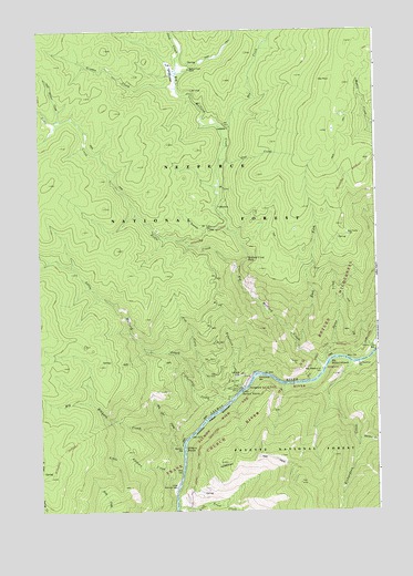
Whitewater Ranch, ID USGS Topographic Map
Click on map above to begin viewing in our Map Viewer.

This topographic map contains these locations and features:
Feature Name Type Latitude Longitude GNIS ID View Map
Bat CreekStreamN45.5996°W115.3065°377028View Map
Bat PointSummitN45.5716°W115.2618°377029View Map
Big Elkhorn CreekStreamN45.5149°W115.3229°377516View Map
Big Mallard CreekStreamN45.5369°W115.2721°377564View Map
Big Mallard Creek BarBarN45.5360°W115.2729°377565View Map
Big Mallard Creek CampgroundLocaleN45.5369°W115.2707°394728View Map
Big Mallard RapidsRapidsN45.5382°W115.2698°371514View Map
Camp CreekStreamN45.5391°W115.2704°378769View Map
Churchill CreekStreamN45.5280°W115.3107°379338View Map
Cow CreekStreamN45.5360°W115.3193°379943View Map
Cup CreekStreamN45.5913°W115.3126°380165View Map
Dry Can CreekStreamN45.5171°W115.3282°380781View Map
East Fork Big Mallard CreekStreamN45.5424°W115.2815°381055View Map
Elkhorn BarBarN45.5157°W115.3276°381405View Map
Elkhorn RapidsRapidsN45.5163°W115.3265°381421View Map
Grouse CreekStreamN45.6102°W115.3298°382720View Map
Growler RapidsRapidsN45.5002°W115.3304°382762View Map
Harlan CreekStreamN45.5182°W115.2579°382913View Map
Jack CreekStreamN45.6138°W115.3226°383803View Map
Kenmitzer BarBarN45.5349°W115.2968°384162View Map
Little Elkhorn BarBarN45.5055°W115.3301°384824View Map
Little Elkhorn CreekStreamN45.5057°W115.3301°384825View Map
Little Mallard CreekStreamN45.5291°W115.3040°384889View Map
Little Mallard RapidsRapidsN45.5335°W115.3012°384891View Map
Little Trout CreekStreamN45.5013°W115.3301°384980View Map
Mallard Creek FallsFallsN45.5656°W115.2981°386408View Map
Mallard Creek RanchLocaleN45.6149°W115.3254°386409View Map
Mallard Creek Ranch AirportAirportN45.6132°W115.3248°2717106View Map
Mallard Creek TrailheadLocaleN45.5791°W115.3082°394726View Map
Noble CreekStreamN45.5624°W115.3021°387600View Map
Richardson BarBarN45.5382°W115.2571°389345View Map
Richardson CreekStreamN45.5380°W115.2612°389349View Map
Robertson CreekStreamN45.5319°W115.3043°389441View Map
Summit CreekStreamN45.5732°W115.3101°391617View Map
Vitta PointSummitN45.5563°W115.3068°400488View Map
Whitewater CampgroundLocaleN45.5324°W115.3001°394727View Map
Whitewater RanchLocaleN45.5319°W115.3062°393392View Map
Yellow Pine BarBarN45.5438°W115.2518°393749View Map

Note: Coordinates in the location and feature list above are referenced to NAD83 datum.


Copyright (C) 2008-2024 Ryan Niemi / Sunset Dynamics ... All Rights Reserved