TopoQuest Logo
Do you find TopoQuest useful?
Help keep TopoQuest running and adding new maps/features by donating!
Bitcoin:  19c7KJd3qBynnjoSw5npx9KScwjBe4ifkT
Litecoin:  LXs6TkuXGGXo1vDsWCkWVdjQX94eUKd6ui
Home View Maps Find Maps Find Places Resources & Links


Shell, South Carolina Topographic Map

USGS Map Title: Shell, SC
USGS Map MRC: 33078H8
DRG (GeoTIFF) Download: o33078h8.tif


Neighboring USGS Topographic Map Quads:


  Bayboro, SC  
34079A1
 

  Loris, SC  
34078A8
 

  Goretown, SC  
34078A7
 

  Adrian, SC  
33079H1
 

  Shell, SC  
33078H8
 

  Hammond, SC  
33078H7
 

  Conway, SC  
33079G1
 

  Nixonville, SC  
33078G8
 

  Hand, SC  
33078G7


Map MRC Location:

N34°
W79°
N34°
W78°
H8 H7 H6 H5 H4 H3 H2 H1
G8 G7 G6 G5 G4 G3 G2 G1
F8 F7 F6 F5 F4 F3 F2 F1
E8 E7 E6 E5 E4 E3 E2 E1
D8 D7 D6 D5 D4 D3 D2 D1
C8 C7 C6 C5 C4 C3 C2 C1
B8 B7 B6 B5 B4 B3 B2 B1
A8 A7 A6 A5 A4 A3 A2 A1
N33°
W79°
N33°
W78°

Shell, SC USGS 1:24K Topographic Map Preview:
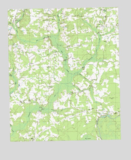
Shell, SC USGS Topographic Map
Click on map above to begin viewing in our Map Viewer.

This topographic map contains these locations and features:
Feature Name Type Latitude Longitude GNIS ID View Map
Alligator SwampStreamN33.9379°W78.9220°1220184View Map
Anderson CemeteryCemeteryN33.9835°W78.9878°1243593View Map
Bayboro BranchStreamN33.9871°W78.9998°1220379View Map
Bethlehem ChurchChurchN33.9038°W78.9031°1246828View Map
Beulah ChurchChurchN33.9679°W78.8895°1246852View Map
Beulah School (historical)SchoolN33.9682°W78.8886°1243612View Map
Bug SwampStreamN33.9743°W78.9528°1221093View Map
Camp SwampStreamN33.9254°W78.9298°1247126View Map
Cherry Hill CemeteryCemeteryN33.9910°W78.8906°1243646View Map
Chestnut CemeteryCemeteryN33.9202°W78.9270°1221555View Map
Daisy School (historical)SchoolN33.9996°W78.8925°1243686View Map
Durant ChurchChurchN33.8863°W78.9609°1247578View Map
Eldorado School Number 1SchoolN33.9249°W78.9045°1222256View Map
Eldorado School Number 2SchoolN33.9593°W78.9306°1222257View Map
Fox BranchStreamN33.9552°W78.9392°1222529View Map
Fox Branch CemeteryCemeteryN33.9577°W78.9464°1243729View Map
Good Hope ChurchChurchN33.9493°W78.9756°1245767View Map
Good Hope SchoolSchoolN33.9371°W78.9664°1222754View Map
Hamilton CemeteryCemeteryN33.9629°W78.9864°1243758View Map
Hellhole SwampStreamN33.9827°W78.9903°1223116View Map
Hickory GrovePopulated PlaceN33.8766°W78.9734°1243764View Map
Hickory Grove Church (historical)ChurchN33.8771°W78.9723°1243766View Map
Hickory Grove SchoolSchoolN33.8777°W78.9725°1223137View Map
Horry CountyCivilN33.9045°W78.9762°1248005View Map
Horry County Fire Department MapleBuildingN33.9258°W78.9876°2368144View Map
Horry County Fire Department ShellBuildingN33.9019°W78.9175°2368197View Map
Horry County Fire Department Station 19BuildingN33.9913°W78.8908°2368326View Map
Horsepen BranchStreamN33.9932°W78.9475°1223336View Map
Horsepen CreekStreamN33.9046°W78.9495°1223342View Map
HowellsPopulated PlaceN33.9766°W78.9981°1246086View Map
Huckleberry BranchStreamN33.9893°W78.9464°1223368View Map
Jacks BayStreamN33.9813°W78.8995°1223485View Map
Kingston Elementary SchoolSchoolN33.9084°W78.9362°1251818View Map
Maple SwampStreamN33.8871°W78.9961°1224304View Map
Mishoe PondReservoirN33.9835°W78.9964°1240158View Map
Mishoe Pond Dam D-3620DamN33.9835°W78.9964°1240157View Map
Mount Calvary ChurchChurchN33.9010°W78.8803°1224690View Map
Mount Calvary School (historical)SchoolN33.9007°W78.8797°1243830View Map
New Home ChurchChurchN33.9443°W78.9173°1249811View Map
New Home Church CemeteryCemeteryN33.9629°W78.9320°1243855View Map
Opening PondLakeN33.9612°W78.9670°1225235View Map
Poplar SwampStreamN33.9371°W78.9945°1225632View Map
Rice Patch BayBayN33.9121°W78.8817°1225855View Map
ShellPopulated PlaceN33.9024°W78.9134°1226554View Map
Stevens CemeteryCemeteryN33.9952°W78.9370°1243973View Map
Tyler PondsLakeN33.9949°W78.9189°1227273View Map
White Oak SchoolSchoolN33.9852°W78.9525°1227551View Map
White Oak SwampStreamN33.9410°W78.9345°1251415View Map
WKZQ-FM (Myrtle Beach)TowerN33.9374°W78.9645°1252523View Map

Note: Coordinates in the location and feature list above are referenced to NAD83 datum.


Copyright (C) 2008-2024 Ryan Niemi / Sunset Dynamics ... All Rights Reserved