TopoQuest Logo
Do you find TopoQuest useful?
Help keep TopoQuest running and adding new maps/features by donating!
Bitcoin:  19c7KJd3qBynnjoSw5npx9KScwjBe4ifkT
Litecoin:  LXs6TkuXGGXo1vDsWCkWVdjQX94eUKd6ui
Home View Maps Find Maps Find Places Resources & Links


Loris, South Carolina Topographic Map

USGS Map Title: Loris, SC
USGS Map MRC: 34078A8
DRG (GeoTIFF) Download: o34078a8.tif


Neighboring USGS Topographic Map Quads:


  Duford, SC  
34079B1
 

  Tabor City West, NC  
34078B8
 

  Tabor City East, NC  
34078B7
 

  Bayboro, SC  
34079A1
 

  Loris, SC  
34078A8
 

  Goretown, SC  
34078A7
 

  Adrian, SC  
33079H1
 

  Shell, SC  
33078H8
 

  Hammond, SC  
33078H7


Map MRC Location:

N35°
W79°
N35°
W78°
H8 H7 H6 H5 H4 H3 H2 H1
G8 G7 G6 G5 G4 G3 G2 G1
F8 F7 F6 F5 F4 F3 F2 F1
E8 E7 E6 E5 E4 E3 E2 E1
D8 D7 D6 D5 D4 D3 D2 D1
C8 C7 C6 C5 C4 C3 C2 C1
B8 B7 B6 B5 B4 B3 B2 B1
A8 A7 A6 A5 A4 A3 A2 A1
N34°
W79°
N34°
W78°

Loris, SC USGS 1:24K Topographic Map Preview:
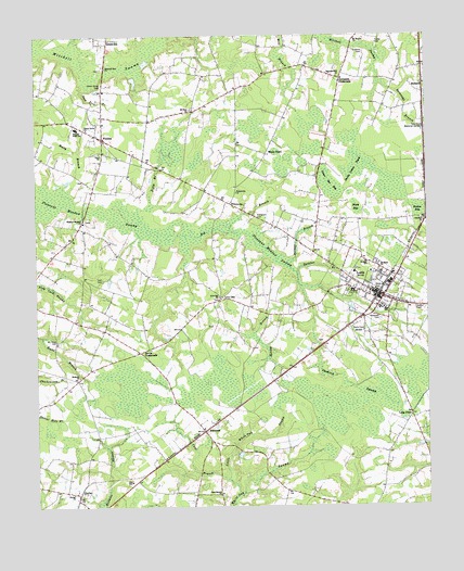
Loris, SC USGS Topographic Map
Click on map above to begin viewing in our Map Viewer.

This topographic map contains these locations and features:
Feature Name Type Latitude Longitude GNIS ID View Map
AllsbrookPopulated PlaceN34.0202°W78.9464°1244873View Map
Allsbrook PondReservoirN34.0035°W78.9764°1240160View Map
Allsbrook Pond Dam D-3619DamN34.0035°W78.9764°1240159View Map
Allsbrook School (historical)SchoolN34.0163°W78.9442°1243592View Map
Benton BaySwampN34.0788°W78.8775°1220505View Map
Berean Assembly of God ChurchChurchN34.0567°W78.8934°2490243View Map
Bethany ChurchChurchN34.0346°W78.9864°1220530View Map
Big BranchStreamN34.0735°W78.9384°1220673View Map
Cane BranchStreamN34.0071°W78.9386°1221306View Map
Cane Branch ChurchChurchN34.0032°W78.9420°1247140View Map
Cherry Hill Baptist ChurchChurchN34.0243°W78.8805°1247271View Map
City of LorisCivilN34.0575°W78.8877°2404958View Map
Clio SchoolSchoolN34.0071°W78.9703°1221642View Map
Cushion SwampSwampN34.0313°W78.9000°1221882View Map
Devils Cotton PatchSwampN34.0899°W78.8967°1222002View Map
Dogwood Hill ChurchChurchN34.1141°W78.9031°1222059View Map
Durham School (historical)SchoolN34.1127°W78.9784°1243698View Map
Fifth BranchStreamN34.0782°W78.9664°1222388View Map
FinkleaPopulated PlaceN34.0982°W78.9784°1247741View Map
Finklea Career CenterSchoolN34.1005°W78.9866°2486477View Map
Finklea High SchoolSchoolN34.1010°W78.9864°1247742View Map
Finklea School (historical)SchoolN34.0929°W78.9786°1243711View Map
Fowler CemeteryCemeteryN34.1232°W78.8903°1222525View Map
Fox BaySwampN34.0668°W78.8847°1243728View Map
Gaskins BranchStreamN34.0624°W78.9167°1222657View Map
GlennPopulated PlaceN34.0752°W78.8753°1243740View Map
Graham CemeteryCemeteryN34.1207°W78.8945°1222799View Map
Green Sea BaySwampN34.0854°W78.9059°1222883View Map
GurleyPopulated PlaceN34.0027°W78.9873°1245870View Map
Gurley ChurchChurchN34.0035°W78.9886°1222960View Map
Harrelson CemeteryCemeteryN34.0774°W78.9292°1223052View Map
Hickory Hill School (historical)SchoolN34.0679°W78.9925°1243767View Map
Hickory Hill School Number 2 (historical)SchoolN34.0343°W78.9859°1243768View Map
Holmes BranchStreamN34.0646°W78.9203°1223247View Map
Holt CemeteryCemeteryN34.0604°W78.9786°1223256View Map
Horry County Fire Department LorisBuildingN34.0584°W78.8932°2368080View Map
Horry County Fire Department Station 6BuildingN34.0997°W78.9839°2368388View Map
Horry County Memorial Library Loris Branch LibraryBuildingN34.0546°W78.8871°2490380View Map
HowardPopulated PlaceN34.1124°W78.8759°1231406View Map
Iona ChurchChurchN34.0935°W78.9786°1246125View Map
Iron Springs SwampStreamN34.1216°W78.9895°1246127View Map
Jernigans CrossroadsPopulated PlaceN34.1135°W78.9020°1246165View Map
Little White Oak SwampStreamN34.0029°W78.9361°1224073View Map
Live OakPopulated PlaceN34.0557°W78.9386°1231495View Map
Live Oak ChurchChurchN34.0560°W78.9414°1224080View Map
Long PointPopulated PlaceN34.0246°W78.8803°1227937View Map
LorisPopulated PlaceN34.0563°W78.8903°1246470View Map
Loris City HallBuildingN34.0570°W78.8896°2490464View Map
Loris Commerce CenterLocaleN34.0699°W78.8846°2489499View Map
Loris Community Hospital HeliportAirportN34.0577°W78.8906°1251932View Map
Loris DivisionCivilN34.0573°W78.9310°1938338View Map
Loris Fire DepartmentBuildingN34.0581°W78.8921°2368397View Map
Loris First Baptist ChurchChurchN34.0605°W78.8983°2490257View Map
Loris Oxidation PondReservoirN34.0568°W78.9148°1240165View Map
Loris Oxidation Pond Dam D-3615DamN34.0568°W78.9148°1240164View Map
Loris Police DepartmentBuildingN34.0580°W78.8918°2334995View Map
Loris Post OfficePost OfficeN34.0512°W78.8936°2489858View Map
McLeod Loris HospitalHospitalN34.0575°W78.8985°1247978View Map
Mitchell Sea ChurchChurchN34.1171°W78.9770°1246698View Map
Mount Beulah ChurchChurchN34.1243°W78.8970°1224684View Map
Mount Pillar CemeteryCemeteryN34.0443°W78.9934°1224760View Map
Mount Rona ChurchChurchN34.0635°W78.8897°1249672View Map
Mount Zion ChurchChurchN34.1057°W78.9500°1249714View Map
Northern Horry Rescue SquadBuildingN34.0575°W78.8897°2739618View Map
Patterson CemeteryCemeteryN34.0499°W78.8900°1225322View Map
Piney BaySwampN34.0791°W78.8972°1225486View Map
Pleasant Meadow ChurchChurchN34.0760°W78.9845°1250185View Map
Powell School (historical)SchoolN34.1152°W78.9264°1243922View Map
PrincevillePopulated PlaceN34.0807°W78.9375°1231692View Map
Princeville ChurchChurchN34.0838°W78.9356°1225675View Map
Rooty BranchStreamN34.0846°W78.9914°1226006View Map
Sarvis CrossroadsPopulated PlaceN34.0413°W78.9670°1227977View Map
Savannah BranchStreamN34.1102°W78.8842°1226415View Map
Seed Tick BranchStreamN34.1138°W78.9834°1226486View Map
Silent Grove CemeteryCemeteryN34.1124°W78.9784°1226612View Map
Silent Grove ChurchChurchN34.1004°W78.9836°1226613View Map
Silent Grove School (historical)SchoolN34.0996°W78.9806°1243960View Map
Spring BranchStreamN34.0585°W78.9150°1226806View Map
Suggs Mill (historical)LocaleN34.0624°W78.9520°1243975View Map
Trinity Baptist ChurchChurchN34.0634°W78.8823°2490267View Map
Watson SchoolSchoolN34.0654°W78.8945°1251337View Map
White PondPopulated PlaceN34.0935°W78.9261°1228000View Map
WLSC-AM (Loris)TowerN34.0449°W78.8939°1252383View Map

Note: Coordinates in the location and feature list above are referenced to NAD83 datum.


Copyright (C) 2008-2025 Ryan Niemi / Sunset Dynamics ... All Rights Reserved