TopoQuest Logo
Do you find TopoQuest useful?
Help keep TopoQuest running and adding new maps/features by donating!
Bitcoin:  19c7KJd3qBynnjoSw5npx9KScwjBe4ifkT
Litecoin:  LXs6TkuXGGXo1vDsWCkWVdjQX94eUKd6ui
Home View Maps Find Maps Find Places Resources & Links


Shields, Illinois Topographic Map

USGS Map Title: Shields, IL
USGS Map MRC: 38088D6
DRG (GeoTIFF) Download: o38088d6.tif


Neighboring USGS Topographic Map Quads:


  Iuka, IL  
38088E7
 

  Orchardville, IL  
38088E6
 

  Johnsonville, IL  
38088E5
 

  Harmony, IL  
38088D7
 

  Shields, IL  
38088D6
 

  Crisp, IL  
38088D5
 

  Opdyke, IL  
38088C7
 

  Bluford, IL  
38088C6
 

  Wayne City, IL  
38088C5


Map MRC Location:

N39°
W89°
N39°
W88°
H8 H7 H6 H5 H4 H3 H2 H1
G8 G7 G6 G5 G4 G3 G2 G1
F8 F7 F6 F5 F4 F3 F2 F1
E8 E7 E6 E5 E4 E3 E2 E1
D8 D7 D6 D5 D4 D3 D2 D1
C8 C7 C6 C5 C4 C3 C2 C1
B8 B7 B6 B5 B4 B3 B2 B1
A8 A7 A6 A5 A4 A3 A2 A1
N38°
W89°
N38°
W88°

Shields, IL USGS 1:24K Topographic Map Preview:
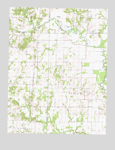
Shields, IL USGS Topographic Map
Click on map above to begin viewing in our Map Viewer.

This topographic map contains these locations and features:
Feature Name Type Latitude Longitude GNIS ID View Map
Atteberry CemeteryCemeteryN38.4084°W88.6450°403705View Map
Bradford CemeteryCemeteryN38.4464°W88.6756°415644View Map
Brush CreekStreamN38.4623°W88.6334°405026View Map
Coil Oil FieldOilfieldN38.4281°W88.6862°424763View Map
Coil West Oil FieldOilfieldN38.4264°W88.7120°424764View Map
Concord School (historical)SchoolN38.4906°W88.6409°1705869View Map
Crask CemeteryCemeteryN38.4178°W88.6653°406746View Map
Dobbs CemeteryCemeteryN38.4317°W88.6714°407265View Map
Eagle School (historical)SchoolN38.4017°W88.6853°1705871View Map
Ellis School (historical)SchoolN38.3878°W88.6437°1705872View Map
Elm CreekStreamN38.3914°W88.6970°407915View Map
Farrington School (historical)SchoolN38.4078°W88.7467°1705853View Map
Garrison BridgeBridgeN38.4803°W88.6839°424910View Map
Garrison School (historical)SchoolN38.4609°W88.6801°1705873View Map
Garrison TempleChurchN38.4425°W88.6881°408917View Map
Garrison Temple CemeteryCemeteryN38.4423°W88.6875°1953050View Map
Gettins BridgeBridgeN38.4395°W88.6264°424915View Map
Greathouse FordCrossingN38.4578°W88.6303°422753View Map
Greenwalt CemeteryCemeteryN38.4420°W88.7189°409449View Map
Gregory BranchStreamN38.3773°W88.6626°409479View Map
Hickory Hill CemeteryCemeteryN38.4975°W88.7431°410165View Map
Hickory Hill Church (historical)ChurchN38.4989°W88.7498°1705862View Map
Hickory Hill School (historical)SchoolN38.4900°W88.7481°1705863View Map
Hickory Hill TownhallBuildingN38.4209°W88.6539°1823868View Map
Horseshoe SloughLakeN38.4824°W88.6784°410584View Map
Jacob Chapel CemeteryCemeteryN38.4973°W88.6509°411020View Map
Jacobs Chapel (historical)ChurchN38.4973°W88.6509°1705876View Map
KeenesvillePopulated PlaceN38.4023°W88.6481°422861View Map
Lick BranchStreamN38.4784°W88.7181°412044View Map
Little Potatoe HillSummitN38.4917°W88.6895°412393View Map
Logansville Post Office (historical)Post OfficeN38.4239°W88.7167°1815693View Map
Lowery CemeteryCemeteryN38.4570°W88.7128°1815694View Map
McConnaughhay CemeteryCemeteryN38.4614°W88.7273°413217View Map
Mifflin CemeteryCemeteryN38.3959°W88.6998°413527View Map
Miller Shrub Swamp Nature PreserveParkN38.4839°W88.7148°1994351View Map
Mills School (historical)SchoolN38.4314°W88.6803°1705881View Map
Mount Zion CemeteryCemeteryN38.4084°W88.7251°1815704View Map
Mount Zion ChurchChurchN38.4087°W88.7251°414125View Map
Mud BridgeBridgeN38.4878°W88.6992°425228View Map
New Bradford School (historical)SchoolN38.4334°W88.7139°1705855View Map
New Hartford School (historical)SchoolN38.4937°W88.6692°1705882View Map
New Home ChurchChurchN38.4564°W88.7131°414408View Map
North Lilly School (historical)SchoolN38.4203°W88.6556°1823893View Map
O'Daniel Lodge LakeReservoirN38.3950°W88.7317°1692159View Map
O'Daniel Lodge LakeReservoirN38.3950°W88.7201°1692162View Map
O'Daniel Lodge Lake Dam Number 1DamN38.3950°W88.7317°1692158View Map
O'Daniel Lodge Lake Dam Number 2DamN38.3950°W88.7201°1692161View Map
Oak Dale CemeteryCemeteryN38.3798°W88.7426°1815705View Map
Oakdale ChurchChurchN38.3803°W88.7431°414871View Map
Orchardville Oil FieldOilfieldN38.4948°W88.6703°425288View Map
Paddy CreekStreamN38.4456°W88.6295°415291View Map
Park School (historical)SchoolN38.4575°W88.6523°1705886View Map
Possum CreekStreamN38.4253°W88.6345°416060View Map
Potatoe HillSummitN38.4864°W88.6887°416071View Map
Puncheon CreekStreamN38.3762°W88.6826°416290View Map
Rapp School (historical)SchoolN38.4020°W88.7184°1705858View Map
ShieldsPopulated PlaceN38.4678°W88.7134°418387View Map
South Lilly School (historical)SchoolN38.4098°W88.6484°1705894View Map
StrattonPopulated PlaceN38.4456°W88.7134°423211View Map
Ten Post Oak Baptist ChurchChurchN38.4209°W88.6506°419587View Map
Ten Post Oak CemeteryCemeteryN38.4212°W88.6500°1953075View Map
Township of Hickory HillCivilN38.4250°W88.6441°429133View Map
Turner CreekStreamN38.4753°W88.6584°419951View Map
Tyler CemeteryCemeteryN38.4034°W88.6562°419999View Map
Wells ChapelChurchN38.4609°W88.7470°420738View Map
Wells Chapel CemeteryCemeteryN38.4609°W88.7464°1815721View Map
Zion ChurchChurchN38.4014°W88.6853°421646View Map

Note: Coordinates in the location and feature list above are referenced to NAD83 datum.


Copyright (C) 2008-2025 Ryan Niemi / Sunset Dynamics ... All Rights Reserved