TopoQuest Logo
Do you find TopoQuest useful?
Help keep TopoQuest running and adding new maps/features by donating!
Bitcoin:  19c7KJd3qBynnjoSw5npx9KScwjBe4ifkT
Litecoin:  LXs6TkuXGGXo1vDsWCkWVdjQX94eUKd6ui
Home View Maps Find Maps Find Places Resources & Links


Orchardville, Illinois Topographic Map

USGS Map Title: Orchardville, IL
USGS Map MRC: 38088E6
DRG (GeoTIFF) Download: o38088e6.tif


Neighboring USGS Topographic Map Quads:


  Omega, IL  
38088F7
 

  Xenia, IL  
38088F6
 

  Xenia NE, IL  
38088F5
 

  Iuka, IL  
38088E7
 

  Orchardville, IL  
38088E6
 

  Johnsonville, IL  
38088E5
 

  Harmony, IL  
38088D7
 

  Shields, IL  
38088D6
 

  Crisp, IL  
38088D5


Map MRC Location:

N39°
W89°
N39°
W88°
H8 H7 H6 H5 H4 H3 H2 H1
G8 G7 G6 G5 G4 G3 G2 G1
F8 F7 F6 F5 F4 F3 F2 F1
E8 E7 E6 E5 E4 E3 E2 E1
D8 D7 D6 D5 D4 D3 D2 D1
C8 C7 C6 C5 C4 C3 C2 C1
B8 B7 B6 B5 B4 B3 B2 B1
A8 A7 A6 A5 A4 A3 A2 A1
N38°
W89°
N38°
W88°

Orchardville, IL USGS 1:24K Topographic Map Preview:
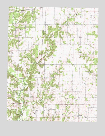
Orchardville, IL USGS Topographic Map
Click on map above to begin viewing in our Map Viewer.

This topographic map contains these locations and features:
Feature Name Type Latitude Longitude GNIS ID View Map
Banner School (historical)SchoolN38.5481°W88.6406°1725096View Map
Burrough School (historical)SchoolN38.5478°W88.7126°1737030View Map
Burroughs CemeteryCemeteryN38.5498°W88.7131°405271View Map
Butterfly School (historical)SchoolN38.5189°W88.6781°1725101View Map
Chapman School (historical)SchoolN38.5478°W88.6723°1725104View Map
Christian Home CemeteryCemeteryN38.5259°W88.7170°1821386View Map
Christian Home ChurchChurchN38.5262°W88.7178°406096View Map
Cisne CemeteryCemeteryN38.5512°W88.6295°406130View Map
CornishLocaleN38.5595°W88.7048°1725106View Map
Fields CemeteryCemeteryN38.5331°W88.7412°408361View Map
Gum Branch School (historical)SchoolN38.5734°W88.6401°1725112View Map
Harmon CemeteryCemeteryN38.5442°W88.6984°409795View Map
HelmPopulated PlaceN38.5112°W88.7087°422796View Map
Henson CemeteryCemeteryN38.5542°W88.6389°410083View Map
Hickory Flat School (historical)SchoolN38.5848°W88.6767°1725116View Map
Holiday School (historical)SchoolN38.5770°W88.7267°1737059View Map
Iuka Oil FieldOilfieldN38.6173°W88.7387°425052View Map
Lee CemeteryCemeteryN38.5237°W88.6367°1725120View Map
Middleton BranchStreamN38.6025°W88.7462°413511View Map
Mount Pleasant CemeteryCemeteryN38.5262°W88.6353°1953072View Map
Mount Pleasant ChurchChurchN38.5264°W88.6345°414055View Map
New Liberty CemeteryCemeteryN38.5620°W88.6992°1821428View Map
New Liberty ChurchChurchN38.5623°W88.6995°414441View Map
Nickolson CreekStreamN38.5456°W88.7287°414516View Map
OrchardvillePopulated PlaceN38.5064°W88.6503°415163View Map
Orchardville Fire Protection DistrictBuildingN38.5072°W88.6502°2682583View Map
Paintrock CreekStreamN38.5073°W88.7292°415301View Map
Pleasant Hill ChurchChurchN38.5131°W88.6881°415831View Map
Poplar CreekStreamN38.5125°W88.7284°416029View Map
Poplar Creek ChurchChurchN38.5192°W88.6917°416031View Map
Powers ChurchChurchN38.5925°W88.6503°416092View Map
Township of Garden HillCivilN38.5849°W88.6417°429039View Map
Township of OrchardCivilN38.5194°W88.6422°429501View Map
Union School (historical)SchoolN38.5192°W88.7495°1737108View Map
Vaughn ChurchChurchN38.5053°W88.6417°420241View Map
Vest School (historical)SchoolN38.5262°W88.6506°1725138View Map
Vickrey School (historical)SchoolN38.6139°W88.6789°1747757View Map
Young School (historical)SchoolN38.6056°W88.7181°1737116View Map

Note: Coordinates in the location and feature list above are referenced to NAD83 datum.


Copyright (C) 2008-2024 Ryan Niemi / Sunset Dynamics ... All Rights Reserved