TopoQuest Logo
Do you find TopoQuest useful?
Help keep TopoQuest running and adding new maps/features by donating!
Bitcoin:  19c7KJd3qBynnjoSw5npx9KScwjBe4ifkT
Litecoin:  LXs6TkuXGGXo1vDsWCkWVdjQX94eUKd6ui
Home View Maps Find Maps Find Places Resources & Links


Shipman, Illinois Topographic Map

USGS Map Title: Shipman, IL
USGS Map MRC: 39090A1
DRG (GeoTIFF) Download: o39090a1.tif


Neighboring USGS Topographic Map Quads:


  Medora, IL  
39090B2
 

  Summerville, IL  
39090B1
 

  Plainview, IL  
39089B8
 

  Brighton, IL  
39090A2
 

  Shipman, IL  
39090A1
 

  Bunker Hill, IL  
39089A8
 

  Alton, IL  
38090H2
 

  Bethalto, IL  
38090H1
 

  Prairietown, IL  
38089H8


Map MRC Location:

N40°
W91°
N40°
W90°
H8 H7 H6 H5 H4 H3 H2 H1
G8 G7 G6 G5 G4 G3 G2 G1
F8 F7 F6 F5 F4 F3 F2 F1
E8 E7 E6 E5 E4 E3 E2 E1
D8 D7 D6 D5 D4 D3 D2 D1
C8 C7 C6 C5 C4 C3 C2 C1
B8 B7 B6 B5 B4 B3 B2 B1
A8 A7 A6 A5 A4 A3 A2 A1
N39°
W91°
N39°
W90°

Shipman, IL USGS 1:24K Topographic Map Preview:
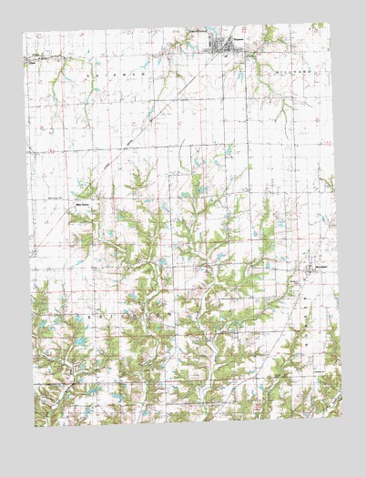
Shipman, IL USGS Topographic Map
Click on map above to begin viewing in our Map Viewer.

This topographic map contains these locations and features:
Feature Name Type Latitude Longitude GNIS ID View Map
Area Ambulance ServiceBuildingN39.1164°W90.0398°2673985View Map
Benner School (historical)SchoolN39.0206°W90.0104°404174View Map
Bruggman School (historical)SchoolN39.0131°W90.0546°405000View Map
Evergreen LakeReservoirN39.0266°W90.1055°1691933View Map
Evergreen Lake DamDamN39.0267°W90.1068°1691932View Map
Illinois No Name Number 2042 DamDamN39.0500°W90.0718°1692346View Map
Illinois No Name Number 2042 ReservoirReservoirN39.0510°W90.0711°1692347View Map
Ingersoll School (historical)SchoolN39.0714°W90.0446°410894View Map
Jonesboro School (historical)SchoolN39.0381°W90.0998°411230View Map
Locust Grove School (historical)SchoolN39.1162°W90.0154°412489View Map
Loux School (historical)SchoolN39.0137°W90.0915°412688View Map
Maple Grove School (historical)SchoolN39.0906°W90.1237°412929View Map
Miles StationPopulated PlaceN39.0695°W90.1073°424162View Map
Miles Station CemeteryCemeteryN39.0720°W90.1101°1764654View Map
Mount Zion ChurchChurchN39.1159°W90.1196°1764666View Map
PiasaPopulated PlaceN39.1159°W90.1237°415623View Map
Piasa Post OfficePost OfficeN39.1166°W90.1217°1821351View Map
Prairie Dell School (historical)SchoolN39.1020°W90.0776°416135View Map
Puregenis Pork FarmLocaleN39.0042°W90.0200°2650303View Map
Saint Denis CemeteryCemeteryN39.1162°W90.0354°1764693View Map
ShipmanPopulated PlaceN39.1175°W90.0443°418433View Map
Shipman CemeteryCemeteryN39.1214°W90.0443°2003338View Map
Shipman Elementary SchoolSchoolN39.1156°W90.0426°1821362View Map
Shipman Post OfficePost OfficeN39.1175°W90.0437°2788391View Map
Shipman ReservoirReservoirN39.1243°W90.0482°1692327View Map
Shipman Volunteer Fire DepartmentBuildingN39.1163°W90.0398°2640881View Map
Sterling School (historical)SchoolN39.0417°W90.0576°419105View Map
Stewart CemeteryCemeteryN39.0025°W90.1115°2003351View Map
Town of ShipmanCivilN39.1203°W90.0452°2397657View Map
Township of BrightonCivilN39.0430°W90.0902°428709View Map
WoodburnPopulated PlaceN39.0475°W90.0120°421419View Map
Woodburn CemeteryCemeteryN39.0431°W90.0151°1764729View Map
Woodburn ChurchChurchN39.0142°W90.0107°421420View Map
Woods CemeteryCemeteryN39.0134°W90.0282°1764730View Map

Note: Coordinates in the location and feature list above are referenced to NAD83 datum.


Copyright (C) 2008-2025 Ryan Niemi / Sunset Dynamics ... All Rights Reserved