TopoQuest Logo
Do you find TopoQuest useful?
Help keep TopoQuest running and adding new maps/features by donating!
Bitcoin:  19c7KJd3qBynnjoSw5npx9KScwjBe4ifkT
Litecoin:  LXs6TkuXGGXo1vDsWCkWVdjQX94eUKd6ui
Home View Maps Find Maps Find Places Resources & Links


Bunker Hill, Illinois Topographic Map

USGS Map Title: Bunker Hill, IL
USGS Map MRC: 39089A8
DRG (GeoTIFF) Download: o39089a8.tif


Neighboring USGS Topographic Map Quads:


  Summerville, IL  
39090B1
 

  Plainview, IL  
39089B8
 

  Gillespie North, IL  
39089B7
 

  Shipman, IL  
39090A1
 

  Bunker Hill, IL  
39089A8
 

  Gillespie South, IL  
39089A7
 

  Bethalto, IL  
38090H1
 

  Prairietown, IL  
38089H8
 

  Worden, IL  
38089H7


Map MRC Location:

N40°
W90°
N40°
W89°
H8 H7 H6 H5 H4 H3 H2 H1
G8 G7 G6 G5 G4 G3 G2 G1
F8 F7 F6 F5 F4 F3 F2 F1
E8 E7 E6 E5 E4 E3 E2 E1
D8 D7 D6 D5 D4 D3 D2 D1
C8 C7 C6 C5 C4 C3 C2 C1
B8 B7 B6 B5 B4 B3 B2 B1
A8 A7 A6 A5 A4 A3 A2 A1
N39°
W90°
N39°
W89°

Bunker Hill, IL USGS 1:24K Topographic Map Preview:
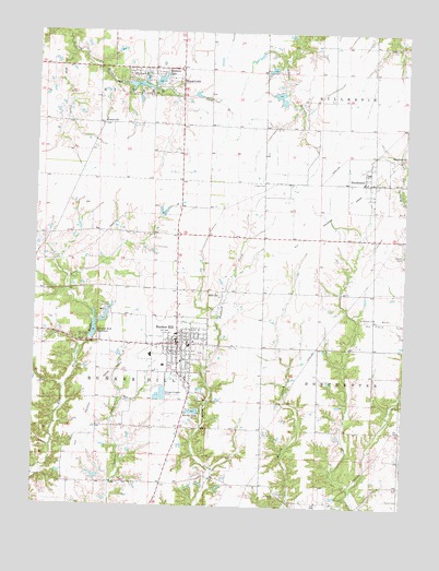
Bunker Hill, IL USGS Topographic Map
Click on map above to begin viewing in our Map Viewer.

This topographic map contains these locations and features:
Feature Name Type Latitude Longitude GNIS ID View Map
Adams School (historical)SchoolN39.1223°W89.9043°1764573View Map
Barths LakeReservoirN39.0250°W89.9460°403940View Map
Barths Lake DamDamN39.0248°W89.9443°1692278View Map
BaylestownPopulated PlaceN39.0914°W89.8795°422443View Map
Bunker HillPopulated PlaceN39.0428°W89.9518°405195View Map
Bunker Hill City CemeteryCemeteryN39.0406°W89.9434°1993420View Map
Bunker Hill Fire Protection DistrictBuildingN39.0431°W89.9522°2640268View Map
Bunker Hill High SchoolSchoolN39.0398°W89.9607°1821327View Map
Bunker Hill Old Lake DamDamN39.0434°W89.9801°1691936View Map
Bunker Hill Police StationBuildingN39.0352°W89.9498°2759015View Map
Bunker Hill Post OfficePost OfficeN39.0440°W89.9509°2788544View Map
Bunker Hill ReservoirReservoirN39.0461°W89.9803°405199View Map
Bunker Hill Reservoir Number 2ReservoirN39.0491°W89.9765°1692335View Map
Bunker Hill Reservoir Number 2 DamDamN39.0484°W89.9784°1692334View Map
Burton School (historical)SchoolN39.0042°W89.9232°1764591View Map
CentervillePopulated PlaceN39.1009°W89.9782°422536View Map
Centerville CemeteryCemeteryN39.1006°W89.9776°1992539View Map
Centerville School (historical)SchoolN39.1014°W89.9776°1764594View Map
City of Bunker HillCivilN39.0416°W89.9512°2393463View Map
Clark Family CemeteryCemeteryN39.1212°W89.8812°406175View Map
Corrington Chapel School (historical)SchoolN39.1148°W89.9420°1764602View Map
DorchesterPopulated PlaceN39.0856°W89.8876°407318View Map
Elm CreekStreamN39.1195°W89.9882°407916View Map
Hood School (historical)SchoolN39.0856°W89.9507°1764633View Map
Luken CemeteryCemeteryN39.0848°W89.9232°412742View Map
Luken School (historical)SchoolN39.0712°W89.9079°1764646View Map
Meissner Elementary SchoolSchoolN39.0425°W89.9476°1821349View Map
Meshach LakeReservoirN39.1120°W89.9586°413449View Map
MillvillePopulated PlaceN39.0570°W89.9370°413626View Map
Mize CemeteryCemeteryN39.0025°W89.8759°409736View Map
Ness School (historical)SchoolN39.0425°W89.9043°1764668View Map
Pleasant Hill School (historical)SchoolN39.0206°W89.9593°1764677View Map
Royal LakeReservoirN39.1095°W89.9770°1692343View Map
Royal Lake Resort Dam Number 1DamN39.1114°W89.9609°1692342View Map
Royal LakesPopulated PlaceN39.1103°W89.9615°417017View Map
Saint Marys Catholic CemeteryCemeteryN39.0034°W89.9173°417556View Map
Shad LakeReservoirN39.1108°W89.9661°418249View Map
Shad Lake DamDamN39.1112°W89.9701°1692344View Map
ShadrachReservoirN39.1129°W89.9636°418254View Map
Smalleytown School (historical)SchoolN39.0725°W89.9784°1764702View Map
Staunton West Oil FieldOilfieldN39.0514°W89.8829°425521View Map
Township of Bunker HillCivilN39.0426°W89.9789°428734View Map
Unit 7 Fire Protection District Station 4BuildingN39.0886°W89.8877°2640715View Map
Village of DorchesterCivilN39.0859°W89.8878°2398740View Map
Village of Royal LakesCivilN39.1117°W89.9607°2399138View Map
Weidner AirportAirportN39.0858°W89.9545°427090View Map

Note: Coordinates in the location and feature list above are referenced to NAD83 datum.


Copyright (C) 2008-2024 Ryan Niemi / Sunset Dynamics ... All Rights Reserved