TopoQuest Logo
Do you find TopoQuest useful?
Help keep TopoQuest running and adding new maps/features by donating!
Bitcoin:  19c7KJd3qBynnjoSw5npx9KScwjBe4ifkT
Litecoin:  LXs6TkuXGGXo1vDsWCkWVdjQX94eUKd6ui
Home View Maps Find Maps Find Places Resources & Links


Shired Island, Florida Topographic Map

USGS Map Title: Shired Island, FL
USGS Map MRC: 29083D2
DRG (GeoTIFF) Download: o29083d2.tif


Neighboring USGS Topographic Map Quads:


  Steinhatchee SE, FL  
29083E3
 

  Cross City SW, FL  
29083E2
 

  Eugene, FL  
29083E1
 

  Horseshoe Beach, FL  
29083D3
 

  Shired Island, FL  
29083D2
 

  Vista, FL  
29083D1


  Suwannee, FL  
29083C2
 

  East Pass, FL  
29083C1


Map MRC Location:

N30°
W84°
N30°
W83°
H8 H7 H6 H5 H4 H3 H2 H1
G8 G7 G6 G5 G4 G3 G2 G1
F8 F7 F6 F5 F4 F3 F2 F1
E8 E7 E6 E5 E4 E3 E2 E1
D8 D7 D6 D5 D4 D3 D2 D1
C8 C7 C6 C5 C4 C3 C2 C1
B8 B7 B6 B5 B4 B3 B2 B1
A8 A7 A6 A5 A4 A3 A2 A1
N29°
W84°
N29°
W83°

Shired Island, FL USGS 1:24K Topographic Map Preview:
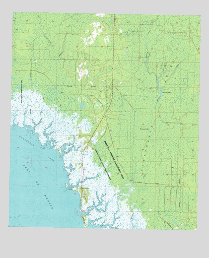
Shired Island, FL USGS Topographic Map
Click on map above to begin viewing in our Map Viewer.

This topographic map contains these locations and features:
Feature Name Type Latitude Longitude GNIS ID View Map
Amason CreekStreamN29.4163°W83.2157°277831View Map
Big Pine IslandIslandN29.3802°W83.1993°278724View Map
Butler CreekStreamN29.4333°W83.2371°279738View Map
California CreekStreamN29.4250°W83.1560°279834View Map
California LakeLakeN29.4516°W83.1510°279836View Map
California SwampSwampN29.4302°W83.1507°279839View Map
Fishbone BeachLocaleN29.4147°W83.2143°300242View Map
Fishbone CreekStreamN29.4163°W83.2157°282496View Map
Fishbone CreekStreamN29.4636°W83.1535°282497View Map
Horseshoe CoveBayN29.4213°W83.2321°284302View Map
Jim Lee CreekStreamN29.4305°W83.2349°284802View Map
Johnson CreekStreamN29.3838°W83.2024°284867View Map
Lilly CreekStreamN29.4669°W83.2326°285516View Map
Pocoson SwampSwampN29.4500°W83.2224°298055View Map
Seven BrothersBarN29.3975°W83.2393°297376View Map
Seven SistersBarN29.3805°W83.2457°297377View Map
Shired CreekStreamN29.3994°W83.2107°291062View Map
Shired IslandPopulated PlaceN29.3972°W83.2010°291063View Map
Thompson LakeLakeN29.4343°W83.1580°292225View Map

Note: Coordinates in the location and feature list above are referenced to NAD83 datum.


Copyright (C) 2008-2025 Ryan Niemi / Sunset Dynamics ... All Rights Reserved