TopoQuest Logo
Do you find TopoQuest useful?
Help keep TopoQuest running and adding new maps/features by donating!
Bitcoin:  19c7KJd3qBynnjoSw5npx9KScwjBe4ifkT
Litecoin:  LXs6TkuXGGXo1vDsWCkWVdjQX94eUKd6ui
Home View Maps Find Maps Find Places Resources & Links


Shoestring Ridge, Oregon Topographic Map

USGS Map Title: Shoestring Ridge, OR
USGS Map MRC: 45120B4
DRG (GeoTIFF) Download: o45120b4.tif


Neighboring USGS Topographic Map Quads:


  Indian Cove, OR  
45120C5
 

  Indian Spring, OR  
45120C4
 

  Igo Butte, OR  
45120C3
 

  Horseshoe Bend, OR  
45120B5
 

  Shoestring Ridge, OR  
45120B4
 

  Schott Canyon, OR  
45120B3
 

  Bath Canyon, OR  
45120A5
 

  Chimney Springs, OR  
45120A4
 

  Buckhorn Canyon, OR  
45120A3


Map MRC Location:

N46°
W121°
N46°
W120°
H8 H7 H6 H5 H4 H3 H2 H1
G8 G7 G6 G5 G4 G3 G2 G1
F8 F7 F6 F5 F4 F3 F2 F1
E8 E7 E6 E5 E4 E3 E2 E1
D8 D7 D6 D5 D4 D3 D2 D1
C8 C7 C6 C5 C4 C3 C2 C1
B8 B7 B6 B5 B4 B3 B2 B1
A8 A7 A6 A5 A4 A3 A2 A1
N45°
W121°
N45°
W120°

Shoestring Ridge, OR USGS 1:24K Topographic Map Preview:
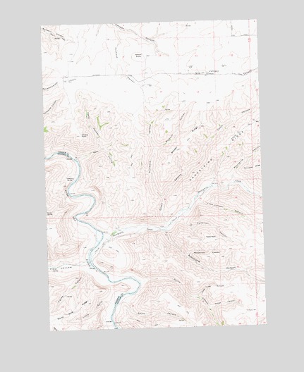
Shoestring Ridge, OR USGS Topographic Map
Click on map above to begin viewing in our Map Viewer.

This topographic map contains these locations and features:
Feature Name Type Latitude Longitude GNIS ID View Map
Armstrong CanyonValleyN45.1640°W120.4328°1117043View Map
Beef HollowValleyN45.1949°W120.4820°1117477View Map
Cason CanyonValleyN45.1668°W120.4323°1118658View Map
Crazy HollowValleyN45.1993°W120.4692°1119526View Map
Cushman CanyonValleyN45.2476°W120.4573°1119647View Map
Devils CanyonValleyN45.1435°W120.4475°1119896View Map
Fones CanyonValleyN45.1324°W120.4075°1120867View Map
Little GulchValleyN45.1354°W120.4648°1145178View Map
Lone Juniper CanyonValleyN45.1774°W120.4134°1123374View Map
Meldrum CanyonValleyN45.1985°W120.4356°1124048View Map
Nelson ButteSummitN45.2362°W120.4453°1136568View Map
Patterson CanyonValleyN45.1696°W120.4250°1125228View Map
Pemberton CanyonValleyN45.1549°W120.4198°1136620View Map
Pine HollowValleyN45.1521°W120.4787°1125406View Map
Pine Tree CanyonValleyN45.1376°W120.4156°1125413View Map
Porcupine CanyonValleyN45.1849°W120.3925°1125561View Map
Rattray RanchLocaleN45.1640°W120.4637°1638465View Map
Richmond CanyonValleyN45.1785°W120.4342°1125986View Map
Schilling SpringSpringN45.1870°W120.4887°1126642View Map
Shoestring RidgeRidgeN45.2037°W120.3878°1126905View Map
Smith CanyonValleyN45.1374°W120.4567°1127104View Map
Studer RidgeRidgeN45.2010°W120.4192°1127671View Map
Table RockSummitN45.1610°W120.4070°1136813View Map
Thirtymile CreekStreamN45.1624°W120.4687°1151072View Map
Whistle PointSummitN45.2043°W120.4800°1128963View Map
Zigzag CanyonValleyN45.1490°W120.4789°1129411View Map

Note: Coordinates in the location and feature list above are referenced to NAD83 datum.


Copyright (C) 2008-2025 Ryan Niemi / Sunset Dynamics ... All Rights Reserved