TopoQuest Logo
Do you find TopoQuest useful?
Help keep TopoQuest running and adding new maps/features by donating!
Bitcoin:  19c7KJd3qBynnjoSw5npx9KScwjBe4ifkT
Litecoin:  LXs6TkuXGGXo1vDsWCkWVdjQX94eUKd6ui
Home View Maps Find Maps Find Places Resources & Links


Shooting Creek, North Carolina Topographic Map

USGS Map Title: Shooting Creek, NC
USGS Map MRC: 35083A6
DRG (GeoTIFF) Download: o35083a6.tif


Neighboring USGS Topographic Map Quads:


  Andrews, NC  
35083B7
 

  Topton, NC  
35083B6
 

  Wayah Bald, NC  
35083B5
 

  Hayesville, NC  
35083A7
 

  Shooting Creek, NC  
35083A6
 

  Rainbow Springs, NC  
35083A5
 

  Hiawassee, GA  
34083H7
 

  Macedonia, GA  
34083H6
 

  Hightower Bald, GA  
34083H5


Map MRC Location:

N36°
W84°
N36°
W83°
H8 H7 H6 H5 H4 H3 H2 H1
G8 G7 G6 G5 G4 G3 G2 G1
F8 F7 F6 F5 F4 F3 F2 F1
E8 E7 E6 E5 E4 E3 E2 E1
D8 D7 D6 D5 D4 D3 D2 D1
C8 C7 C6 C5 C4 C3 C2 C1
B8 B7 B6 B5 B4 B3 B2 B1
A8 A7 A6 A5 A4 A3 A2 A1
N35°
W84°
N35°
W83°

Shooting Creek, NC USGS 1:24K Topographic Map Preview:
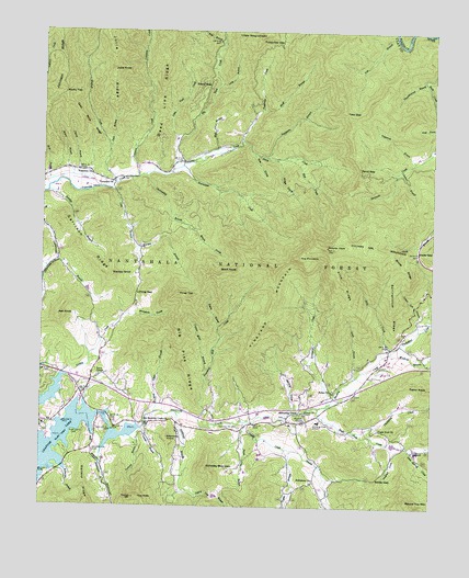
Shooting Creek, NC USGS Topographic Map
Click on map above to begin viewing in our Map Viewer.

This topographic map contains these locations and features:
Feature Name Type Latitude Longitude GNIS ID View Map
Arch RidgeRidgeN35.0601°W83.6546°1008764View Map
Ash KnobSummitN35.0498°W83.7449°1018861View Map
Bethabara ChurchChurchN35.0070°W83.6624°1009204View Map
Bethel ChurchChurchN35.0304°W83.6571°1009213View Map
Big Pine RidgeRidgeN35.0401°W83.7057°1009351View Map
Big Tuni CreekStreamN35.0884°W83.7085°1009389View Map
Birch CoveValleyN35.0726°W83.7006°1009410View Map
Birch KnobSummitN35.0618°W83.6885°1019185View Map
Bluff BranchStreamN35.1043°W83.6799°1009503View Map
Boteler PeakSummitN35.0684°W83.6588°1015469View Map
Bruce RidgeRidgeN35.0634°W83.6349°1009673View Map
Burch Cove BranchStreamN35.0195°W83.6849°1009816View Map
Chairmaker BranchStreamN35.0873°W83.7174°1010152View Map
Cherry Cove BranchStreamN35.0029°W83.7002°1010207View Map
Cherry Cove BranchStreamN35.0001°W83.6902°327430View Map
Chestnut BranchStreamN35.0890°W83.6357°1010223View Map
Church BranchStreamN35.0854°W83.7479°1010280View Map
Clay County Fire and Rescue Station 2BuildingN35.0294°W83.7359°2639516View Map
Clay County Fire and Rescue Station 4BuildingN35.0881°W83.7389°2639517View Map
Cold BranchStreamN35.0831°W83.7279°1010372View Map
Compass CreekStreamN35.0865°W83.7193°1010429View Map
Copper Mine BranchStreamN35.0356°W83.6974°1010479View Map
Dark CoveValleyN35.0473°W83.6933°1010655View Map
Dave Barrett CreekStreamN35.0154°W83.6324°1010663View Map
Davenport BranchStreamN35.0004°W83.6549°327599View Map
Dead Line RidgeRidgeN35.1226°W83.7099°1010711View Map
Eagle Fork ChurchChurchN35.0206°W83.6413°1010962View Map
Eagle Fork CreekStreamN35.0259°W83.6607°1020065View Map
ElfPopulated PlaceN35.0215°W83.7479°1020118View Map
Fishprong BranchStreamN35.0906°W83.6304°1011236View Map
Galloway Hill CemeteryCemeteryN35.0206°W83.6866°1011429View Map
Galloway MountainSummitN35.0098°W83.6966°1020392View Map
Garland RidgeRidgeN35.0051°W83.7354°1011438View Map
Garrison RidgeRidgeN35.0668°W83.7371°1011449View Map
Giesky CreekStreamN35.0226°W83.6852°1011488View Map
Glade GapGapN35.0670°W83.6293°1011509View Map
Gold Mine RidgeRidgeN35.1026°W83.7382°1011552View Map
Hogsed CoveValleyN35.0148°W83.6368°1012116View Map
Hothouse BranchStreamN35.0245°W83.7066°1012226View Map
Hurricane CreekStreamN35.0893°W83.7054°1012300View Map
Jackie CoveValleyN35.0260°W83.6690°1012396View Map
Joe CoveValleyN35.0925°W83.6824°1012487View Map
Johnson RidgeRidgeN35.1162°W83.7432°1012537View Map
Julie BranchStreamN35.0940°W83.7288°1012574View Map
Julie KnobSummitN35.1151°W83.7279°1021002View Map
Julie RidgeRidgeN35.1179°W83.7277°1012577View Map
Kitchens KnobSummitN35.0179°W83.7091°1017360View Map
Ledford CreekStreamN35.0145°W83.6310°1012791View Map
Licklog GapGapN35.0562°W83.7199°1012859View Map
Little Clay KnobSummitN35.1240°W83.6802°1021222View Map
Little Tuni CreekStreamN35.0945°W83.7077°1013039View Map
Locust Log BranchStreamN35.0462°W83.6291°1013066View Map
Long BranchStreamN35.1109°W83.6941°1013095View Map
Lynch BranchStreamN35.0340°W83.6493°1013268View Map
Marshall ChapelChurchN35.0226°W83.6652°1013330View Map
Matlock CreekStreamN35.0854°W83.7260°1013371View Map
Milksick CoveValleyN35.0501°W83.7215°1013531View Map
Mill CreekStreamN35.0404°W83.6382°1013545View Map
Mill CreekStreamN35.0915°W83.6732°1013547View Map
Mission Hill ChurchChurchN35.0243°W83.6646°1013631View Map
Moore BranchStreamN35.0868°W83.7407°1013675View Map
Morgan BranchStreamN35.0676°W83.7202°1013691View Map
Moss BranchStreamN35.0848°W83.7499°1013718View Map
Mull BranchStreamN35.0940°W83.6941°1013835View Map
Muskrat BranchStreamN35.0404°W83.6382°1013858View Map
Nattie BranchStreamN35.0151°W83.6718°1013881View Map
Neal Cabe DamDamN35.0868°W83.7482°1016974View Map
Neal Cabe LakeReservoirN35.0881°W83.7482°1016973View Map
Needmore BranchStreamN35.0134°W83.7304°1013896View Map
Old Shooting Creek ChurchChurchN35.0218°W83.7166°1014104View Map
Passmore BranchStreamN35.0915°W83.6782°1014244View Map
Penland BranchStreamN35.0179°W83.7210°1014313View Map
Perry CreekStreamN35.0959°W83.6868°1014340View Map
Perry GapGapN35.0890°W83.6488°1014342View Map
Piney TopSummitN35.0556°W83.7066°1021976View Map
Pounding Mill CreekStreamN35.0212°W83.6949°1014626View Map
Rocking Chair BranchStreamN35.0243°W83.7135°1015014View Map
Rocky TopSummitN35.1090°W83.7432°1022375View Map
Round Top MountainSummitN35.0009°W83.6318°1022428View Map
Salley GapGapN35.0079°W83.6413°1015179View Map
Sapsucker BranchStreamN35.0643°W83.7449°1015254View Map
Shooting CreekPopulated PlaceN35.0256°W83.6668°1022612View Map
Shooting CreekStreamN35.0207°W83.7171°1015468View Map
Shooting Creek SchoolSchoolN35.0226°W83.6610°1015470View Map
Shooting Creek Volunteer Fire DepartmentBuildingN35.0235°W83.6609°2638977View Map
Springhouse RidgeRidgeN35.0520°W83.6379°1015750View Map
Stamey KnobSummitN35.0604°W83.7285°1022771View Map
Steve BranchStreamN35.1220°W83.6924°1015820View Map
Steve GapGapN35.1109°W83.6971°1015821View Map
Stillhouse BranchStreamN35.0101°W83.7427°1015838View Map
Sunday BranchStreamN35.0823°W83.7479°1015950View Map
Tate BranchStreamN35.1237°W83.6382°1016034View Map
Tate GapGapN35.1034°W83.6532°1016035View Map
Taylor KnobSummitN35.0320°W83.6257°1022894View Map
The FleaSummitN35.0023°W83.7199°1011278View Map
The PinnacleSummitN35.0631°W83.6752°1016898View Map
Thompson CreekStreamN35.0406°W83.6382°1016119View Map
Thumping CreekStreamN35.0195°W83.6499°1016140View Map
Thunderstruck BranchStreamN35.1120°W83.6279°1016142View Map
Township of Shooting CreekCivilN35.0414°W83.6257°1026557View Map
Township of TusquitteeCivilN35.1071°W83.7450°1026559View Map
Tusquitee ChurchChurchN35.0881°W83.7388°1016293View Map
Tusquitee ChurchChurchN35.0854°W83.7277°1016294View Map
Tusquitee GapGapN35.1229°W83.6743°1016296View Map
Tusquittee LandingAirportN35.0862°W83.7386°2679192View Map
Union ChapelChurchN35.0340°W83.7313°1016315View Map
Vineyard CreekStreamN35.0270°W83.6582°1016376View Map
Vineyard MountainSummitN35.0629°W83.6754°1023083View Map
Virge CoveValleyN35.0906°W83.6744°1016379View Map
Wilson Shepard DamDamN35.0034°W83.6949°1016929View Map
Wilson Shepard LakeReservoirN35.0028°W83.6935°1016928View Map

Note: Coordinates in the location and feature list above are referenced to NAD83 datum.


Copyright (C) 2008-2024 Ryan Niemi / Sunset Dynamics ... All Rights Reserved