TopoQuest Logo
Do you find TopoQuest useful?
Help keep TopoQuest running and adding new maps/features by donating!
Bitcoin:  19c7KJd3qBynnjoSw5npx9KScwjBe4ifkT
Litecoin:  LXs6TkuXGGXo1vDsWCkWVdjQX94eUKd6ui
Home View Maps Find Maps Find Places Resources & Links


Andrews, North Carolina Topographic Map

USGS Map Title: Andrews, NC
USGS Map MRC: 35083B7
DRG (GeoTIFF) Download: o35083b7.tif


Neighboring USGS Topographic Map Quads:


  Santeetlah Creek, NC  
35083C8
 

  Robbinsville, NC  
35083C7
 

  Hewitt, NC  
35083C6
 

  Marble, NC  
35083B8
 

  Andrews, NC  
35083B7
 

  Topton, NC  
35083B6
 

  Peachtree, NC  
35083A8
 

  Hayesville, NC  
35083A7
 

  Shooting Creek, NC  
35083A6


Map MRC Location:

N36°
W84°
N36°
W83°
H8 H7 H6 H5 H4 H3 H2 H1
G8 G7 G6 G5 G4 G3 G2 G1
F8 F7 F6 F5 F4 F3 F2 F1
E8 E7 E6 E5 E4 E3 E2 E1
D8 D7 D6 D5 D4 D3 D2 D1
C8 C7 C6 C5 C4 C3 C2 C1
B8 B7 B6 B5 B4 B3 B2 B1
A8 A7 A6 A5 A4 A3 A2 A1
N35°
W84°
N35°
W83°

Andrews, NC USGS 1:24K Topographic Map Preview:
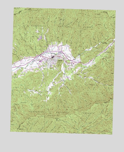
Andrews, NC USGS Topographic Map
Click on map above to begin viewing in our Map Viewer.

This topographic map contains these locations and features:
Feature Name Type Latitude Longitude GNIS ID View Map
Aaron CreekStreamN35.1695°W83.8657°1008645View Map
Alfred CreekStreamN35.1695°W83.8574°1008671View Map
Allmon BranchStreamN35.2026°W83.8699°1008698View Map
AndrewsPopulated PlaceN35.2018°W83.8241°1018822View Map
Andrews Elementary SchoolSchoolN35.1984°W83.8255°1017567View Map
Andrews Fire DepartmentBuildingN35.1991°W83.8239°2639047View Map
Andrews High SchoolSchoolN35.1926°W83.8268°1017568View Map
Andrews PlazaLocaleN35.2001°W83.8346°1017761View Map
Andrews Police DepartmentBuildingN35.2020°W83.8235°2769793View Map
Andrews Post OfficePost OfficeN35.2011°W83.8267°2766573View Map
Andrews Rescue SquadBuildingN35.1986°W83.8236°2720573View Map
Ash CoveValleyN35.2318°W83.7829°1008790View Map
Ash Cove CreekStreamN35.2229°W83.7941°1008791View Map
Bald Springs BranchStreamN35.1254°W83.7968°1008882View Map
Beach BranchStreamN35.2206°W83.8596°1008968View Map
Beal KnobSummitN35.1551°W83.7655°1018994View Map
Beal RidgeRidgeN35.1481°W83.7707°1008973View Map
Bear BranchStreamN35.1784°W83.7727°1008980View Map
Beaver CreekStreamN35.2059°W83.8341°1009072View Map
Beaver Creek ChurchChurchN35.2162°W83.8327°1009073View Map
Big CoveValleyN35.2295°W83.8387°1009286View Map
Big Cove BranchStreamN35.2184°W83.8421°1009295View Map
Big Peachtree BaldSummitN35.1281°W83.8643°1009347View Map
Big StampSummitN35.1387°W83.8174°1009386View Map
Bob BranchStreamN35.2065°W83.8291°1009516View Map
Bolden BranchStreamN35.1806°W83.7866°1009531View Map
Britton CreekStreamN35.2051°W83.8318°1009619View Map
Brokeleg BranchStreamN35.2295°W83.7927°1009628View Map
Brown CreekStreamN35.1901°W83.8574°1009653View Map
Brushy RidgeRidgeN35.1415°W83.7918°1009696View Map
Bryson BranchStreamN35.1923°W83.8724°1009714View Map
BuffaloPopulated PlaceN35.2037°W83.7927°1019389View Map
Burnt Shanty BranchStreamN35.2051°W83.7924°1009851View Map
Cherokee County Emergency Medical Services Station 2BuildingN35.2011°W83.8389°2720355View Map
Chestnut FlatsFlatN35.1526°W83.8491°1010244View Map
Coefield BranchStreamN35.1634°W83.8168°1010358View Map
Coefield CreekStreamN35.2004°W83.7610°983336View Map
Coldspring BranchStreamN35.1281°W83.7910°1010393View Map
Collett Camp BranchStreamN35.1348°W83.7813°1010413View Map
Collett CreekStreamN35.1829°W83.8093°1010414View Map
Collett RidgeRidgeN35.1673°W83.7849°1010415View Map
Colvard CreekStreamN35.1601°W83.8382°1010421View Map
Crawford BranchStreamN35.1823°W83.8085°1010569View Map
Culbert BranchStreamN35.1743°W83.7618°1010606View Map
Dan Holland CreekStreamN35.2054°W83.8343°1010641View Map
Defeat KnobSummitN35.1565°W83.7696°1019943View Map
Doctor BranchStreamN35.2156°W83.7705°1010846View Map
Fine Comb BranchStreamN35.2179°W83.7649°1011209View Map
Fires Creek Wildlife Management AreaParkN35.1329°W83.8052°1011218View Map
Flat BranchStreamN35.1620°W83.7902°1011241View Map
Flat BranchStreamN35.2098°W83.7835°1011243View Map
Freeman BranchStreamN35.2284°W83.8324°1011386View Map
Georgia State Prison CampLocaleN35.2051°W83.8168°1018107View Map
Gipp CreekStreamN35.2040°W83.7938°1011500View Map
Granny Squirrel BranchStreamN35.2168°W83.7557°1011605View Map
Granny Squirrel GapGapN35.2065°W83.7624°1011606View Map
Gumflats CreekStreamN35.1651°W83.8424°1011768View Map
HardinPopulated PlaceN35.2262°W83.8443°1020617View Map
Harris CreekStreamN35.2173°W83.7546°1011876View Map
High PeakSummitN35.2354°W83.7718°1020748View Map
Hogpen BranchStreamN35.1676°W83.8741°1012109View Map
Hogpen GapGapN35.1526°W83.8699°1012114View Map
Ingram BranchStreamN35.1945°W83.7893°1012358View Map
Janaluska SchoolSchoolN35.1856°W83.7966°1018228View Map
John West CoveValleyN35.1948°W83.7747°1012507View Map
Johnson BaldSummitN35.1262°W83.7527°1012518View Map
Jones BranchStreamN35.1959°W83.8585°1012543View Map
Junaluska CreekStreamN35.2051°W83.8102°1012585View Map
Jutts GapGapN35.2431°W83.7532°1012592View Map
Kennedy CreekStreamN35.2006°W83.7738°1012611View Map
Kennedy FallsFallsN35.2006°W83.7649°1012612View Map
Kennedy TopSummitN35.1854°W83.7516°1021029View Map
Leatherwood MountainSummitN35.1962°W83.8171°1012773View Map
Left Fork Webb CreekStreamN35.2170°W83.8605°1012810View Map
Little BaldSummitN35.2459°W83.7735°1021161View Map
Little PeakSummitN35.2237°W83.7852°1018226View Map
Long BranchStreamN35.1254°W83.7924°1013145View Map
Mary BranchStreamN35.2109°W83.8082°1013348View Map
Matherson CreekStreamN35.2023°W83.7641°1013366View Map
Mc Clellan CreekStreamN35.1895°W83.8130°1013384View Map
Melton CreekStreamN35.2173°W83.7657°1013468View Map
Messer BranchStreamN35.1301°W83.8488°1013474View Map
Mike BranchStreamN35.2093°W83.8671°1013527View Map
Mill BranchStreamN35.2073°W83.7874°1013537View Map
Moody BranchStreamN35.2104°W83.8530°1013661View Map
Moody StampGapN35.2434°W83.8749°1013668View Map
Nancy GapGapN35.1551°W83.8599°1013864View Map
Nick BranchStreamN35.1987°W83.7593°1013959View Map
Old Billy TopSummitN35.2481°W83.8560°1014090View Map
Patterson BranchStreamN35.1737°W83.7555°1014254View Map
Phillips CreekStreamN35.1893°W83.8130°1014370View Map
Phillips RidgeRidgeN35.1345°W83.8416°1014374View Map
Pile CreekStreamN35.2079°W83.8149°1014396View Map
Polecat BranchStreamN35.1615°W83.8166°1014556View Map
Polecat BranchStreamN35.1748°W83.7627°1014557View Map
Potrock BranchStreamN35.1409°W83.7543°1014616View Map
Puncheon BranchStreamN35.2129°W83.7735°1014667View Map
Radder CreekStreamN35.2026°W83.7638°1014708View Map
Rail CoveValleyN35.1855°W83.7890°1014714View Map
Rail Cove BranchStreamN35.1923°W83.7893°1014715View Map
Rattlesnake KnobSummitN35.1737°W83.7771°1014753View Map
RhodoPopulated PlaceN35.2176°W83.7521°1022238View Map
Rhodo SchoolSchoolN35.2148°W83.7543°1018225View Map
Ricket BranchStreamN35.1898°W83.8674°1014880View Map
Right Fork Bear BranchStreamN35.1754°W83.7724°1014894View Map
Right Fork Webb CreekStreamN35.2173°W83.8605°1014901View Map
Rockhouse RidgeRidgeN35.1331°W83.8252°1015013View Map
Rogues BranchStreamN35.1318°W83.8482°1015071View Map
Sandy GapGapN35.2218°W83.8518°1015236View Map
Sassafras KnobSummitN35.1606°W83.7527°1022505View Map
Sassafras RidgeRidgeN35.1523°W83.7571°1015280View Map
Shinbone RidgeRidgeN35.1429°W83.7568°1015436View Map
Shop BranchStreamN35.1929°W83.7855°1015473View Map
Short BranchStreamN35.1459°W83.7641°1015481View Map
Snowbird MountainsRidgeN35.2437°W83.8699°1015652View Map
Snyder CreekStreamN35.1751°W83.8107°1015656View Map
Spread Eagle BranchStreamN35.2320°W83.8135°1015737View Map
Stewart BranchStreamN35.2076°W83.8132°1015827View Map
Stewart RidgeRidgeN35.2362°W83.7982°1015830View Map
Stillhouse BranchStreamN35.2120°W83.7777°1015843View Map
Strange BranchStreamN35.2204°W83.8405°1015880View Map
Sunk BranchStreamN35.2298°W83.8543°1015953View Map
Tatham Cabin BranchStreamN35.1298°W83.7946°1016037View Map
Tatham CreekStreamN35.2062°W83.8160°1016038View Map
Tom Thumb CreekStreamN35.2148°W83.7721°1016184View Map
Town BranchStreamN35.2034°W83.8366°1016198View Map
Town of AndrewsCivilN35.1995°W83.8256°2405151View Map
Township of ValleytownCivilN35.1957°W83.8354°1026549View Map
Trail BranchStreamN35.1648°W83.8157°1016212View Map
Truett BranchStreamN35.2048°W83.8693°1016241View Map
Turkeypen BranchStreamN35.2320°W83.8138°1016281View Map
Turnpike CreekStreamN35.2204°W83.7513°1016287View Map
Tusquitee MountainsRidgeN35.1298°W83.7549°1016297View Map
Underwood BranchStreamN35.2018°W83.8435°1016312View Map
Valley River CemeteryCemeteryN35.1920°W83.8371°1016353View Map
Valley River ChurchChurchN35.1906°W83.8368°1016354View Map
Valley River MountainsRidgeN35.1418°W83.8441°1016355View Map
ValleytownPopulated PlaceN35.1943°W83.8066°1023066View Map
Valleytown CemeteryCemeteryN35.1995°W83.8082°1016358View Map
Valleytown Volunteer Fire DepartmentBuildingN35.1967°W83.8005°2638156View Map
Weaver BranchStreamN35.1806°W83.7763°1016484View Map
Webb CreekStreamN35.2004°W83.8435°1016490View Map
Western Carolina Regional AirportAirportN35.1964°W83.8639°1016908View Map
Whitaker BranchStreamN35.1918°W83.8552°1016575View Map
Whiteoak KnobSummitN35.1481°W83.7941°1023218View Map
Will King GapGapN35.1387°W83.8538°1016689View Map
Worm CreekStreamN35.1995°W83.7982°1016842View Map

Note: Coordinates in the location and feature list above are referenced to NAD83 datum.


Copyright (C) 2008-2024 Ryan Niemi / Sunset Dynamics ... All Rights Reserved