TopoQuest Logo
Do you find TopoQuest useful?
Help keep TopoQuest running and adding new maps/features by donating!
Bitcoin:  19c7KJd3qBynnjoSw5npx9KScwjBe4ifkT
Litecoin:  LXs6TkuXGGXo1vDsWCkWVdjQX94eUKd6ui
Home View Maps Find Maps Find Places Resources & Links


Shottsville, Alabama Topographic Map

USGS Map Title: Shottsville, AL
USGS Map MRC: 34088C2
DRG (GeoTIFF) Download: o34088c2.tif


Neighboring USGS Topographic Map Quads:


  Fulton NE, MS  
34088D3
 

  Red Bay, AL  
34088D2
 

  Halltown, AL  
34088D1
 

  Fulton SE, MS  
34088C3
 

  Shottsville, AL  
34088C2
 

  Vina, AL  
34088C1
 

  Tremont, MS  
34088B3
 

  Bexar, AL  
34088B2
 

  Weston, AL  
34088B1


Map MRC Location:

N35°
W89°
N35°
W88°
H8 H7 H6 H5 H4 H3 H2 H1
G8 G7 G6 G5 G4 G3 G2 G1
F8 F7 F6 F5 F4 F3 F2 F1
E8 E7 E6 E5 E4 E3 E2 E1
D8 D7 D6 D5 D4 D3 D2 D1
C8 C7 C6 C5 C4 C3 C2 C1
B8 B7 B6 B5 B4 B3 B2 B1
A8 A7 A6 A5 A4 A3 A2 A1
N34°
W89°
N34°
W88°

Shottsville, AL USGS 1:24K Topographic Map Preview:
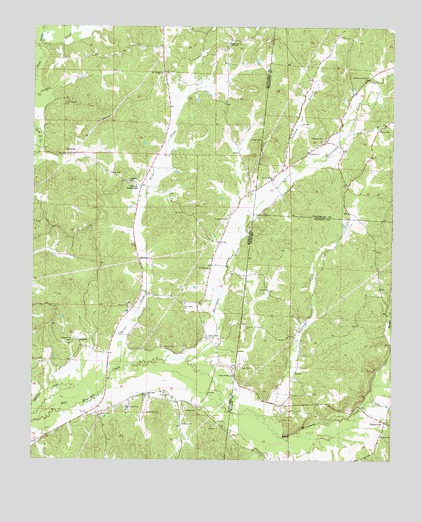
Shottsville, AL USGS Topographic Map
Click on map above to begin viewing in our Map Viewer.

This topographic map contains these locations and features:
Feature Name Type Latitude Longitude GNIS ID View Map
Banner - Bounds Volunteer Fire Department Bounds StationBuildingN34.3292°W88.2133°2666087View Map
Bear BranchStreamN34.3437°W88.1437°113642View Map
Bethany ChurchChurchN34.2848°W88.2362°666871View Map
Bounds CrossroadsPopulated PlaceN34.3293°W88.2123°691721View Map
Briar CreekStreamN34.2754°W88.2209°148949View Map
Briar CreekStreamN34.2754°W88.2209°667550View Map
C W Murphy Pond DamDamN34.2918°W88.2317°682558View Map
Chasteene CemeteryCemeteryN34.3193°W88.1831°668352View Map
Chubby CreekStreamN34.3695°W88.2464°668439View Map
Collier Lake DamDamN34.3684°W88.1984°682610View Map
Donham CemeteryCemeteryN34.2898°W88.1300°137960View Map
EastmanPopulated PlaceN34.3384°W88.2362°691835View Map
Ebeneezer CemeteryCemeteryN34.3420°W88.1492°136159View Map
Ebenezer ChurchChurchN34.3432°W88.1495°117833View Map
Hopewell CemeteryCemeteryN34.3304°W88.2170°671411View Map
Hurricane CreekStreamN34.2784°W88.1959°120594View Map
Hurricane Creek ChurchChurchN34.3609°W88.1337°151837View Map
Little CreekStreamN34.2670°W88.1314°121772View Map
Lone Star ChurchChurchN34.2687°W88.2109°672788View Map
McConegal CreekStreamN34.2629°W88.1698°152267View Map
Mount Carmel ChurchChurchN34.3618°W88.2059°673966View Map
Mount Olive ChurchChurchN34.3057°W88.1884°674161View Map
Mount Zion CemeteryCemeteryN34.3709°W88.1809°706257View Map
Mount Zion ChurchChurchN34.3704°W88.1817°674400View Map
North Fork Hurricane CreekStreamN34.3609°W88.1273°123998View Map
OaklandPopulated PlaceN34.2829°W88.2325°675115View Map
Oakland CemeteryCemeteryN34.2845°W88.2361°706260View Map
Pates Temple CemeteryCemeteryN34.3529°W88.2398°675491View Map
Pearly Gates ChurchChurchN34.2745°W88.1803°675549View Map
Providence CemeteryCemeteryN34.2954°W88.1973°706265View Map
Providence ChurchChurchN34.2943°W88.1975°676394View Map
Rara Avis (historical)LocaleN34.3423°W88.1806°706266View Map
Ridge CemeteryCemeteryN34.3426°W88.1709°676653View Map
Shady Valley ChurchChurchN34.2857°W88.1892°677603View Map
Shekel (historical)LocaleN34.2779°W88.2000°706272View Map
ShottsvillePopulated PlaceN34.2609°W88.1273°126823View Map
Spearman CemeteryCemeteryN34.2640°W88.2109°678042View Map
Tuckahoe BranchStreamN34.3329°W88.1606°128099View Map
Yale (historical)LocaleN34.3168°W88.2292°706283View Map
Yale College (historical)SchoolN34.3170°W88.2292°706284View Map

Note: Coordinates in the location and feature list above are referenced to NAD83 datum.


Copyright (C) 2008-2025 Ryan Niemi / Sunset Dynamics ... All Rights Reserved