TopoQuest Logo
Do you find TopoQuest useful?
Help keep TopoQuest running and adding new maps/features by donating!
Bitcoin:  19c7KJd3qBynnjoSw5npx9KScwjBe4ifkT
Litecoin:  LXs6TkuXGGXo1vDsWCkWVdjQX94eUKd6ui
Home View Maps Find Maps Find Places Resources & Links


Shushan, New York Topographic Map

USGS Map Title: Shushan, NY
USGS Map MRC: 43073A3
DRG (GeoTIFF) Download: o43073a3.tif


Neighboring USGS Topographic Map Quads:


  Cossayuna, NY  
43073B4
 

  Salem, NY  
43073B3
 

  West Rupert, VT  
43073B2
 

  Cambridge, NY  
43073A4
 

  Shushan, NY  
43073A3
 

  Arlington, VT  
43073A2
 

  Eagle Bridge, NY  
42073H4
 

  Hoosick Falls, NY  
42073H3
 

  Bennington, VT  
42073H2


Map MRC Location:

N44°
W74°
N44°
W73°
H8 H7 H6 H5 H4 H3 H2 H1
G8 G7 G6 G5 G4 G3 G2 G1
F8 F7 F6 F5 F4 F3 F2 F1
E8 E7 E6 E5 E4 E3 E2 E1
D8 D7 D6 D5 D4 D3 D2 D1
C8 C7 C6 C5 C4 C3 C2 C1
B8 B7 B6 B5 B4 B3 B2 B1
A8 A7 A6 A5 A4 A3 A2 A1
N43°
W74°
N43°
W73°

Shushan, NY USGS 1:24K Topographic Map Preview:
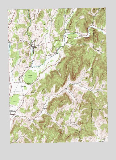
Shushan, NY USGS Topographic Map
Click on map above to begin viewing in our Map Viewer.

This topographic map contains these locations and features:
Feature Name Type Latitude Longitude GNIS ID View Map
AnaquassacookPopulated PlaceN43.0748°W73.3123°942451View Map
Ash GrovePopulated PlaceN43.0320°W73.3312°972180View Map
Barber HillsSummitN43.0165°W73.3307°942983View Map
Battenkill Riversports and CampgroundLocaleN43.0726°W73.3308°2599520View Map
Black Hole HollowValleyN43.0551°W73.2946°944135View Map
Black Hole HollowValleyN43.0487°W73.2723°1456447View Map
Cambridge Valley Rescue SquadBuildingN43.0250°W73.3725°2720153View Map
Camden CemeteryCemeteryN43.1205°W73.2930°945513View Map
Camden CreekStreamN43.1009°W73.2890°1456083View Map
Camden CreekStreamN43.1009°W73.2993°945514View Map
Camden RidgeRidgeN43.1106°W73.2932°945515View Map
Camden ValleyValleyN43.1034°W73.2979°1456084View Map
Camden ValleyValleyN43.1034°W73.2993°945516View Map
Chapin FieldAirportN43.0537°W73.3617°977938View Map
Chestnut WoodsWoodsN43.0117°W73.2851°946565View Map
Chunks BrookStreamN43.1070°W73.2668°946664View Map
Clark PondLakeN43.1151°W73.3735°946777View Map
Dugway MountainSummitN43.1126°W73.2746°948774View Map
EaglevillePopulated PlaceN43.0845°W73.3129°948951View Map
Eagleville Covered BridgeBridgeN43.0833°W73.3136°2097325View Map
Eldridge SwampSwampN43.0626°W73.3471°949464View Map
Flying Pigs FarmLocaleN43.0856°W73.3475°2542383View Map
Goose Egg RidgeRidgeN43.0701°W73.2865°951358View Map
Guber Farm CemeteryCemeteryN43.0490°W73.2590°1920273View Map
Hemlock Grove FarmLocaleN43.0947°W73.3486°2559414View Map
Juniper Swamp BrookStreamN43.1129°W73.3451°954359View Map
Lake LauderdaleLakeN43.0898°W73.3740°955076View Map
Lake Lauderdale CampgroundLocaleN43.0949°W73.3675°2599521View Map
Lake Lauderdale County ParkParkN43.0867°W73.3717°2499811View Map
Laws RidgeRidgeN43.1170°W73.2534°1458176View Map
Le Barron - Harrington Farm CemeteryCemeteryN43.0456°W73.2653°1920303View Map
McKie HollowValleyN43.0482°W73.3027°956803View Map
Murray HollowValleyN43.0931°W73.3007°1461197View Map
Murray HollowValleyN43.0926°W73.3001°958199View Map
Old Shushan and Eagleville CemeteryCemeteryN43.0819°W73.3242°943991View Map
Peaked RockSummitN43.0701°W73.2998°960048View Map
Pumpkin HookPopulated PlaceN43.0181°W73.2971°972977View Map
Pumpkin Hook CreekStreamN43.0254°W73.3354°961975View Map
Ravenwood EstatesPopulated PlaceN43.0333°W73.3725°2500221View Map
Rhoda Blowers CemeteryCemeteryN43.0540°W73.2530°1920400View Map
School Number 11 (historical)SchoolN43.0542°W73.2890°974997View Map
School Number 6 (historical)SchoolN43.0612°W73.3743°975498View Map
School Number 6 (historical)SchoolN43.1054°W73.3023°975499View Map
School Number 7 (historical)SchoolN43.0448°W73.3562°975557View Map
School Number 9 (historical)SchoolN43.0942°W73.3737°975651View Map
ShushanPopulated PlaceN43.0904°W73.3429°965195View Map
Shushan Covered BridgeBridgeN43.0911°W73.3453°2612458View Map
Snake RidgeRidgeN43.0601°W73.3190°965566View Map
Steele BrookStreamN43.0779°W73.3273°966324View Map
SugarloafSummitN43.0506°W73.2951°966720View Map
The NotchGapN43.0079°W73.3087°967305View Map
The PlainsPopulated PlaceN43.0529°W73.3584°967323View Map
Town of White CreekCivilN43.0003°W73.3278°979635View Map
Two TopsSummitN43.0384°W73.3073°968084View Map
West Camden CreekStreamN43.1073°W73.3015°969158View Map
Windy River FarmLocaleN43.0772°W73.3403°2559426View Map

Note: Coordinates in the location and feature list above are referenced to NAD83 datum.


Copyright (C) 2008-2025 Ryan Niemi / Sunset Dynamics ... All Rights Reserved