TopoQuest Logo
Do you find TopoQuest useful?
Help keep TopoQuest running and adding new maps/features by donating!
Bitcoin:  19c7KJd3qBynnjoSw5npx9KScwjBe4ifkT
Litecoin:  LXs6TkuXGGXo1vDsWCkWVdjQX94eUKd6ui
Home View Maps Find Maps Find Places Resources & Links


Sidon, Arkansas Topographic Map

USGS Map Title: Sidon, AR
USGS Map MRC: 35091C8
DRG (GeoTIFF) Download: o35091c8.tif


Neighboring USGS Topographic Map Quads:


  Heber Springs, AR  
35092D1
 

  West Pangburn, AR  
35091D8
 

  Pangburn, AR  
35091D7
 

  Rose Bud, AR  
35092C1
 

  Sidon, AR  
35091C8
 

  Letona, AR  
35091C7
 

  Mount Vernon, AR  
35092B1
 

  Floyd, AR  
35091B8
 

  Garner, AR  
35091B7


Map MRC Location:

N36°
W92°
N36°
W91°
H8 H7 H6 H5 H4 H3 H2 H1
G8 G7 G6 G5 G4 G3 G2 G1
F8 F7 F6 F5 F4 F3 F2 F1
E8 E7 E6 E5 E4 E3 E2 E1
D8 D7 D6 D5 D4 D3 D2 D1
C8 C7 C6 C5 C4 C3 C2 C1
B8 B7 B6 B5 B4 B3 B2 B1
A8 A7 A6 A5 A4 A3 A2 A1
N35°
W92°
N35°
W91°

Sidon, AR USGS 1:24K Topographic Map Preview:
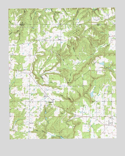
Sidon, AR USGS Topographic Map
Click on map above to begin viewing in our Map Viewer.

This topographic map contains these locations and features:
Feature Name Type Latitude Longitude GNIS ID View Map
Ball HollowValleyN35.3559°W91.9013°46056View Map
Bennett HollowValleyN35.3165°W91.9274°46385View Map
Bethel ChurchChurchN35.2606°W91.9768°46452View Map
Brown's AirportAirportN35.2911°W91.8898°2650781View Map
Cedar BranchStreamN35.3459°W91.8801°47570View Map
Center HillPopulated PlaceN35.2626°W91.8840°76567View Map
Center Hill ChurchChurchN35.2695°W91.8807°47636View Map
Center Hill Volunteer Fire DepartmentBuildingN35.2631°W91.8822°2116247View Map
Georgia RidgeRidgeN35.3137°W91.9121°49381View Map
Gravel HillPopulated PlaceN35.2620°W91.9774°81863View Map
Gray HollowValleyN35.3195°W91.9357°49610View Map
Hanes HollowValleyN35.3548°W91.9857°49818View Map
Hog Foot CreekStreamN35.2695°W91.9043°65081View Map
Hudspeth HollowValleyN35.3548°W91.9857°50391View Map
Hyde BranchStreamN35.3720°W91.9590°50476View Map
JoyPopulated PlaceN35.2876°W91.9504°50752View Map
Joy Volunteer Fire DepartmentBuildingN35.3023°W91.9663°2116658View Map
Lookout MountainSummitN35.3523°W91.9199°58086View Map
Low GapGapN35.2937°W91.9118°51487View Map
McKinney HillSummitN35.2626°W91.9243°58154View Map
Mill BranchStreamN35.2559°W91.9549°51972View Map
Morgan BranchStreamN35.2848°W91.8993°52185View Map
Mount Hebron Baptist ChurchChurchN35.2906°W91.9576°77715View Map
Murdough HollowValleyN35.3104°W91.9640°52551View Map
Myers LakeReservoirN35.2752°W91.9578°80118View Map
Myers Lake DamDamN35.2734°W91.9585°80117View Map
Newton HollowValleyN35.2851°W91.9243°52765View Map
Pleasant Ridge CemeteryCemeteryN35.3037°W91.9324°53589View Map
Potato HillSummitN35.2859°W91.9043°58417View Map
Schoolhouse HollowValleyN35.3226°W91.9188°54625View Map
SidonPopulated PlaceN35.3445°W91.9393°54841View Map
Sidon Baptist ChurchChurchN35.3442°W91.9413°65115View Map
Sidon CemeteryCemeteryN35.3451°W91.9576°54842View Map
Sidon Post Office (historical)Post OfficeN35.3442°W91.9390°84979View Map
Spout Springs HollowValleyN35.3709°W91.9468°55074View Map
Sweet Springs AirportAirportN35.3123°W91.8764°2770246View Map
Sweet Springs ChurchChurchN35.3151°W91.8976°55398View Map
Township of CadronCivilN35.3372°W91.9549°69817View Map
Township of Des ArcCivilN35.2688°W91.8989°69827View Map
Township of JoyCivilN35.2966°W91.9631°69841View Map
Walker HollowValleyN35.2559°W91.9565°55967View Map

Note: Coordinates in the location and feature list above are referenced to NAD83 datum.


Copyright (C) 2008-2025 Ryan Niemi / Sunset Dynamics ... All Rights Reserved