TopoQuest Logo
Do you find TopoQuest useful?
Help keep TopoQuest running and adding new maps/features by donating!
Bitcoin:  19c7KJd3qBynnjoSw5npx9KScwjBe4ifkT
Litecoin:  LXs6TkuXGGXo1vDsWCkWVdjQX94eUKd6ui
Home View Maps Find Maps Find Places Resources & Links


Sidwalter Buttes, Oregon Topographic Map

USGS Map Title: Sidwalter Buttes, OR
USGS Map MRC: 44121H5
DRG (GeoTIFF) Download: o44121h5.tif


Neighboring USGS Topographic Map Quads:


  Mount Wilson, OR  
45121A6
 

  Beaver Butte, OR  
45121A5
 

  Foreman Point, OR  
45121A4
 

  Fort Butte, OR  
44121H6
 

  Sidwalter Buttes, OR  
44121H5
 

  Hehe Butte, OR  
44121H4
 

  Boulder Lake, OR  
44121G6
 

  Sawmill Butte, OR  
44121G5
 

  Potters Ponds, OR  
44121G4


Map MRC Location:

N45°
W122°
N45°
W121°
H8 H7 H6 H5 H4 H3 H2 H1
G8 G7 G6 G5 G4 G3 G2 G1
F8 F7 F6 F5 F4 F3 F2 F1
E8 E7 E6 E5 E4 E3 E2 E1
D8 D7 D6 D5 D4 D3 D2 D1
C8 C7 C6 C5 C4 C3 C2 C1
B8 B7 B6 B5 B4 B3 B2 B1
A8 A7 A6 A5 A4 A3 A2 A1
N44°
W122°
N44°
W121°

Sidwalter Buttes, OR USGS 1:24K Topographic Map Preview:
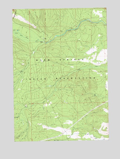
Sidwalter Buttes, OR USGS Topographic Map
Click on map above to begin viewing in our Map Viewer.

This topographic map contains these locations and features:
Feature Name Type Latitude Longitude GNIS ID View Map
Big SpringSpringN44.9716°W121.5842°1117675View Map
Cedar CreekStreamN44.9054°W121.6145°1139514View Map
Nellie SpringSpringN44.9165°W121.5195°1124645View Map
North Fork Cedar CreekStreamN44.9057°W121.6145°1146924View Map
Schoolie PastureFlatN44.9721°W121.5870°1126667View Map
Schoolie Pasture Ranger StationBuildingN44.9679°W121.5887°1129600View Map
Sidwalter ButtesSummitN44.9263°W121.5395°1136754View Map
South Fork Warm Springs RiverStreamN44.9676°W121.5853°1150040View Map
Warm SpringsSpringN44.9815°W121.6234°1129601View Map
Warm Springs MeadowsSwampN44.9746°W121.6159°1151902View Map

Note: Coordinates in the location and feature list above are referenced to NAD83 datum.


Copyright (C) 2008-2024 Ryan Niemi / Sunset Dynamics ... All Rights Reserved