TopoQuest Logo
Do you find TopoQuest useful?
Help keep TopoQuest running and adding new maps/features by donating!
Bitcoin:  19c7KJd3qBynnjoSw5npx9KScwjBe4ifkT
Litecoin:  LXs6TkuXGGXo1vDsWCkWVdjQX94eUKd6ui
Home View Maps Find Maps Find Places Resources & Links


Foreman Point, Oregon Topographic Map

USGS Map Title: Foreman Point, OR
USGS Map MRC: 45121A4
DRG (GeoTIFF) Download: o45121a4.tif


Neighboring USGS Topographic Map Quads:


  Post Point, OR  
45121B5
 

  Rock Creek Reservoir, OR  
45121B4
 

  Wamic, OR  
45121B3
 

  Beaver Butte, OR  
45121A5
 

  Foreman Point, OR  
45121A4
 

  Wapinitia, OR  
45121A3
 

  Sidwalter Buttes, OR  
44121H5
 

  Hehe Butte, OR  
44121H4
 

  Simnasho, OR  
44121H3


Map MRC Location:

N46°
W122°
N46°
W121°
H8 H7 H6 H5 H4 H3 H2 H1
G8 G7 G6 G5 G4 G3 G2 G1
F8 F7 F6 F5 F4 F3 F2 F1
E8 E7 E6 E5 E4 E3 E2 E1
D8 D7 D6 D5 D4 D3 D2 D1
C8 C7 C6 C5 C4 C3 C2 C1
B8 B7 B6 B5 B4 B3 B2 B1
A8 A7 A6 A5 A4 A3 A2 A1
N45°
W122°
N45°
W121°

Foreman Point, OR USGS 1:24K Topographic Map Preview:
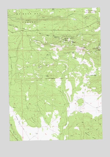
Foreman Point, OR USGS Topographic Map
Click on map above to begin viewing in our Map Viewer.

This topographic map contains these locations and features:
Feature Name Type Latitude Longitude GNIS ID View Map
Bald Peter Pasture SpringSpringN45.0603°W121.3823°1137462View Map
Boundary Log Scaling StationLocaleN45.1043°W121.4642°1167212View Map
Byzandine GulchValleyN45.1009°W121.3784°1139094View Map
Coyote SpringSpringN45.0609°W121.4502°1140342View Map
Daniel SpringSpringN45.0825°W121.4152°1140617View Map
Deer SpringSpringN45.0811°W121.4466°1140866View Map
Evick SpringSpringN45.1247°W121.4400°1141936View Map
Foreman PointSummitN45.0873°W121.4012°1142296View Map
Government SpringSpringN45.0825°W121.4177°1142887View Map
Grandview (historical)LocaleN45.0765°W121.4623°1129618View Map
Kelly SpringSpringN45.0854°W121.3817°1144531View Map
Laughlin HillsSummitN45.0882°W121.4067°1144861View Map
Log SpringSpringN45.0266°W121.4059°1145334View Map
McCubbins Gulch Recreation SiteLocaleN45.1154°W121.4831°1159329View Map
Quartz ButteSummitN45.0688°W121.4566°1148080View Map
Rainbow QuarryMineN45.0615°W121.3945°1125786View Map
Rainbow RockSummitN45.0619°W121.3952°1153707View Map
Rock Creek Recreation SiteLocaleN45.0540°W121.3817°1156711View Map
Simnasho ButteSummitN45.0036°W121.3881°1149525View Map
Sunflower FlatFlatN45.0746°W121.4034°1150663View Map

Note: Coordinates in the location and feature list above are referenced to NAD83 datum.


Copyright (C) 2008-2025 Ryan Niemi / Sunset Dynamics ... All Rights Reserved